I will conclude this blog with a music video I made to celebrate my completion of the Triple Crown of Hiking. Enjoy:
After a bit of cleanup, this blog will be archived under a subdomain and future hikes and journeys will appear in new, fresh blogs. Thanks for following me!
I packed up and got out of the campground by 7am. The road the trail followed turned onto the old highway, a paved road slowly being eaten by trees, at Rabbit Ears Trailhead. Just down the road I could see the rock formation in question. I was told by a race volunteer the day before that the rocks were crumbling away rapidly and will not be much to look at in only a few years. You can see a picture of their current state below.
Moments after rugs picture was taken, a small black bear darted across the road, stopped briefly in the middle to glance at me, then ran off into the woods on the other side. That was my first bear sighted while hiking, and it happened way too fast to get a picture.
I passed a group of bow hunters just beyond the end of the pavement. One asked if I’d already caught them (the elk) and tied them up for them. A dirt road continued down from there to a random place on the new highway.
I walked south on this road for maybe half a mile with my thumb out trying to get to a sunny spot where I wouldn’t be freezing. Only a few minutes after I got there, a CUV pulled off ahead of me and a young woman jumped out to start repacking her things.
Ryn was headed from Denver to Salt Lake City taking CO 40 the whole way, the scenic route because she wasn’t in a hurry. The car was absolutely brimming with stuff. A lot of camping gear. Mattress and bedding. There was barely enough room for my pack atop it all.
She got me to town before 9 and dropped me at The Shack Cafe, where there was plenty of room at the bar. I got myself a traditional Eggs Benedict with hash browns and two slices of French toast on the side. I added entire pats of butter to each triangle of French toast just for the extra fat.
I spent a few minutes after breakfast looking around for a place to stay, but everything in town–hotels, campgrounds, BnBs, AirBnBs–that could be booked at a reasonable rate was full up. Typical Saturday night in Steamboat? Or something to do with the race? Anyway, eventually I got in touch with an angel family living outside of town and arranged a stay in their camper trailer, with a ride out to their house after 3:15 when Joe got off work.
Next stop was a walk to the post office to pick up my package before it closed. No problem. Next door was the Old Town Hot Springs. I paid $25 for a day pass and $5 to rent a towel. Then I stayed there until noon. I couldn’t fit my pack in a locker, so I put all my valuables inside one and left my pack on a counter. I spent most of an hour in the shower–there wasn’t much pressure but it’s not often I get to take a hot shower that isn’t on a timer these days–and then most of another hour sitting in the hot spring-fed pools outside.
When I returned to the locker room, I was disturbed to find the locker I distinctly remember leaving closed and locked standing wide open. It must have been staff with a key. I can’t prove that I had locked it, so I didn’t complain, and anyway, nothing was missing or moved. On the whole, my first onsen visit episode this season was a success, and I hope it won’t be the last.
I caught the free bus down to the Safeway next to do my resupply. $118 for a week’s worth of food, including that night’s dinner and the next morning’s breakfast. It took less than an hour to do the shopping, but as much time again to pack it all up in a way I could carry. I ended up with a small pack on my chest and a bag of potato chips in my hand as I walked away. The bus was just leaving as I left, so I figured I would need to walk back into town. Another bus wouldn’t be around for 20 more minutes, and I was short on time. After checking the bus schedule, I learned that the next bus was only 4 minutes away and the previous bus had just been running late. The next bus was a little late too, arriving 9 minutes later, but it still got me into town faster than I could’ve on foot.
My next stop was BAP, Inc., the Big Agnes Factory Outlet. I couldn’t get my tent repaired, as previously mentioned, but I could get a new stuff sack for it and some other necessities. It only took a few minutes.
Then I went to Mountain Tap Brewery to try a few local brews while waiting for Jeff to come through and give me a ride back. I also bought a beer for the Buddy Board. For the next six months, anyone who arrives at the brewery with a 30+ pound backpack can claim that beer.
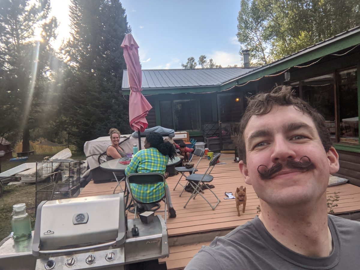
Jeff picked me up just before 4 and took me out of town to the Ross homestead, a place of many vehicles, dogs, chickens, friends, family, and a great camper trailer. I got a load of laundry done and also got a chicken taco for dinner! And gave an improptu geography lesson to Indie, their youngest. I also talked with Joe about his hard day at work in the city busses and how the two fanciest busses had computer issues that had to be coordinated with the proprietary software vendors in California leading to some busses being late… mystery solved.
Then I retired to the trailer for the night to eat hot pockets, drink root beer, and watch YouTube until I passed out. It rained several times throughout the night but I was high and dry. I ended up taking the worst mattress with the depression under my butt because it was closest to a power outlet. Priorities. Anyway, big props to the Ross family for the magic.
Trail miles: 2.5
Ryn
Sara and Tamika (Indie is trying to hide)
Midnight
Millie?
This is a neighbor dog that was just visiting. No collar or name tag.
With all the sound and light and the slightly canted tentsite, it was easy to wake up when everyone around was getting ready to leave. Sunday morning in an RV park: guaranteed mass exodus.
But I had been up until midnight. I didn’t want to get up yet. I couldn’t get back to sleep, so I ended up lying about in the tent chatting online for a couple of hours. Just long enough for the grocery store next door to open.
When I did finally leave the tent, I took my phone to the laundry to charge and then hit up the grocery for breakfast. Coffee, energy drink, choccy milk, Gatorade, two breakfast sandwiches and a burrito. I carried it all back to the laundry and ate it all (except the Gatorade which I saved for a couple of hours and slowly sipped for a few hours) while watching three consecutive episodes of Craig of the Creek on the TV in there. You have to pack all the pleasures of civilization in while you have the chance.
After a morning bathroom break, I spent an hour or so in my tent sewing up rips in my shirt and shorts (including that hole in my pocket I’ve been putting off fixing for several weeks since I acquired a replacement needle). Then it was time to pack up. Most of the campground had emptied out already. So I took my pack over to the one nearby picnic table that had direct sunlight to dry. That became my central packing point. I rolled out my mattress on it. Everything got moved there. And by the time I was packed up, everything was mostly dry just in time for the trees to steal the sunlight.
I finished packing shortly after the Bear Trap Cafe opened again. Time for one more big meal before hitting the trail. And their good wifi helped me get all my posts uploaded shortly after I finished my meal (of fish tacos, a Cuban sandwich, and tots).
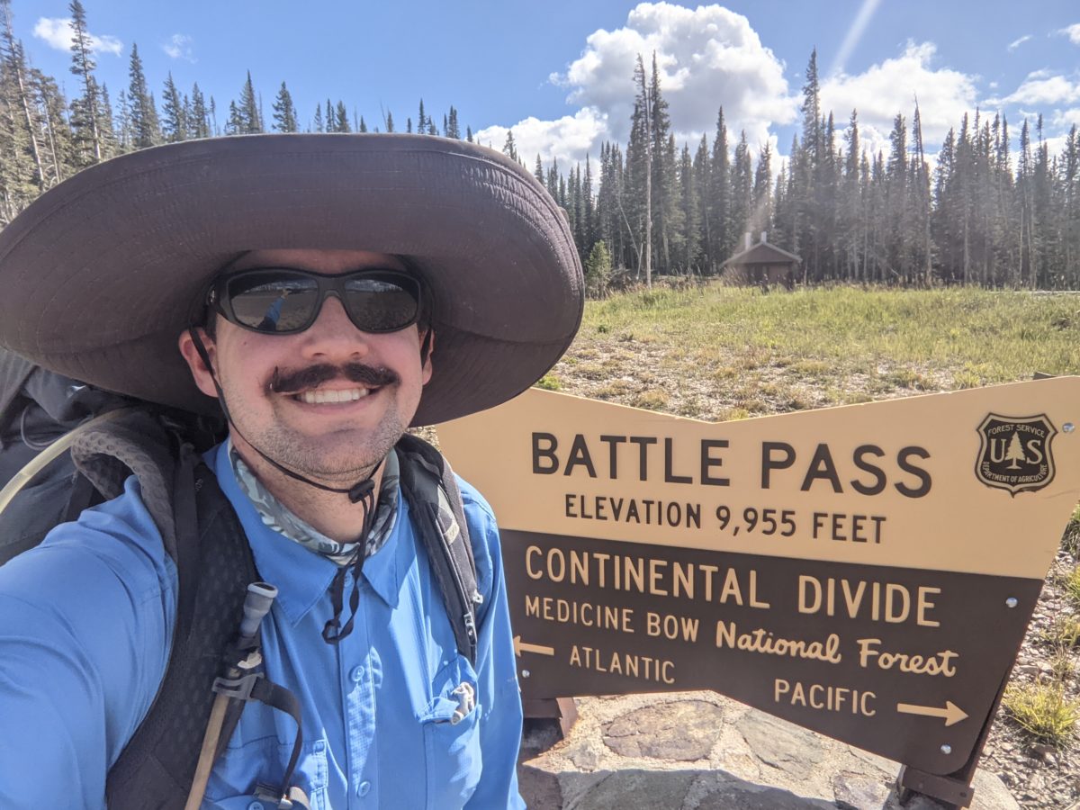
As soon as I left, I walked to the end of the road to the highway and started walking toward Encampment sticking my thumb out at each passing truck. The highway went two miles through Encampment before heading up the 12 miles back to Battle Pass, and I preferred not having to walk all the way to the other side of town to get a hitch. I got pretty lucky despite the sparse traffic. A truck came up to me just as I had crossed the Encampment city limits. Lauren said she would give me a lift to the pass as soon as she went to pick up a bed for her friend’s disabled child. So I just offered to help her move and load the bed and she agreed.
So here’s all the details: I’m the second person this woman (who is my age) has ever given a lift to, she’s not going anywhere near the pass otherwise, her husband’s far away jumping fires, and she’s taken out this old former fire truck and never drives that gets horrible gas mileage just to move this bed for her friend’s child, and decides based entirely on my hat and mustache that she is willing to drive this truck miles out of her way for me. Honestly, helping her with the bed was the least I could do. So we find the house with the bed frame ready to go, and the brother of the guy who is giving it away helps us too by fetching out the box spring and mattress and wrangling an overly excited dog into the house. We Tetris all the bed parts into the bed of the truck and run a chain across it. And then, with all that in the back, she drives me to the pass. It’s like 2:30 pm when she leaves me.
At this point, I remember that I didn’t download any maps for the alternate trails around the Morgan Creek Fire closure. The trailhead has excellent 4G service (much better internet than anywhere in Riverside by far), so I end up hanging around for another hour at the trailhead just downloading what I need to continue. Luckily, I was able to multipurpose the wait thanks to the privy in the middle of the parking area, saving some time down the trail.
It was a little after 4 when I finally started hiking. The trail was similar to what it had been in the last hours of the previous day, rocky road into rocky trail through forest. Eventually, it become more of a dirt and mud and grass trail through boggy meadows crossed by multiple muddy streams. I crossed some on logs where I could tell the mud would be up to my ankle if they weren’t there.
After a mile of this, I found a nice rock in the shade to stop for supper. There was a nonstop cold wind that cooled my pot too quickly and made the pasta in my rice a little too gummy. It also made me shiver a bit. I was happy to get back on the trail.
No sooner had I than I spotted two hikers behind me. I assumed Jennifer and Deluxe. I used them as motivation to keep moving even when the trail got rocky, steep, and passed through blowdowns. The trail came over a series of rocky hilltops where it was easy to lose as the sun was setting, and then joined a ridgeline with a long view. It was dark enough I was ready to stop, and I found a perfect flat spot just off the trail. No sooner had I started unpacking than the pair came up behind me and passed. It was actually Cliff Richards and Lost Keys, finally caught up.
I had no idea what the other sobos around me had planned with regard to the closure, which started only a day’s walk from here. If they went a different way, they were likely to beat me to Steamboat, and then who knows who I would be hiking with. That’s motivation to get an early start right there.
I woke up at 5, but forced myself to try to catch a few more winks, then got up a little after 6. I put my shoes on, grabbed my phone, and walked back to the Running Bear Pancake House.
Again, I got a table immediately, this time because it was much less busy than usual. The waitress indicated it was more like an October level of busyness. Anyway, it took me a long time to when my way through that huge Spanish omelet and a cinnamon roll and I drank a lot of coffee along the way, then took some to go.
Back in the room, I had to solve an issue with the blog to get the last few posts uploaded, then I plugged my phone in and took a shower.
I got ready to hike and then wasted a little time leaving. I drank one of the three remaining ciders and packed up the other two. At ten after ten, I decided I couldn’t waste any more time letting my phone charge up completely, so I got the road.
I took the highway west to the edge of town, about a twenty minute walk. Then I stuck my thumb out towards Targhee Pass. It was about a 15 or 20 minute hitch. Not bad! Almost as easy to get into and out of West Yellowstone as Augusta. The driver was a kid, Caleb, on break from college, visiting his girlfriend and out camping near the pass, doing a little bit of day hiking. Seemed pretty cool. Dropped me right at the trailhead. It was about 11:30.
I switched to hike mode and went as fast as I could. The first two miles passed in a heartbeat. Then I crossed a number of creeks, but I had some water and wasn’t worried. I passed up a side trail to an overlook. No time for sightseeing. A group of horse tourists passed me by. A couple of miles later, they passed me again in the other direction, having turned around at the overlook. They asked if I had seen the mama grizzly and cub they had stopped a quarter mile after passing me the first time. I guess they must have scared her off.
At the overlook, a couple of trail bikers wanted to chat. They asked me about water on the next section since they weren’t aware of any water on trail until Reas Pass in 11 miles. I checked and saw that there was a nice source just off trail in a mile and then nothing until Reas Pass like they said. I thanked them for bringing it to my attention, as I surely would have gotten low on water if I had passed up that next source.
In a mile, I turned out into a grassy meadow with water flowing through it and a good view of an energetic bulldozer doing who knows what on the other side of the road that passed through it. I took a break for a half-hour or so while filtering water.
I stopped again around 2:30 for lunch. I had a nice spot with a decent view just beside the trail at the top of a hill. I also had packed out some tinned lemon pepper trout with the lemons and peppercorns in the tin. A nice variation on the usual wrap.
Then, wanting to get as many miles as possible before dark, I buckled down and did the next 6+ miles without stopping. After 4 miles, I turned onto a dirt road that soon crossed the border into Idaho, taking me out of Montana for the last time. I was not alone on this road. I was passed by a speedy dirt-bike and saw an abandoned pickup parked just off the road too. I arrived at the Reas Pass turn-off around 6:45, and there were already a lot of people there, all nobos. The ones already cooking dinner were Caveman, Taco, Junk Cart, and Roadrunner, but more arrived after I had joined them. Unfortunately, I neglected to take any pictures of them. I was too focused on cooking dinner and drinking a can of cider while maintaining conversation with them.
They informed me that it was 0.4 miles to the water source here and it was the last for 27 miles to Summit Lake. I checked, and it looked like there was water in a small pond right next to the trail in only ten miles, so I skipped the 0.8 mile diversion, not wanting to carry that extra weight up the hill anyway.
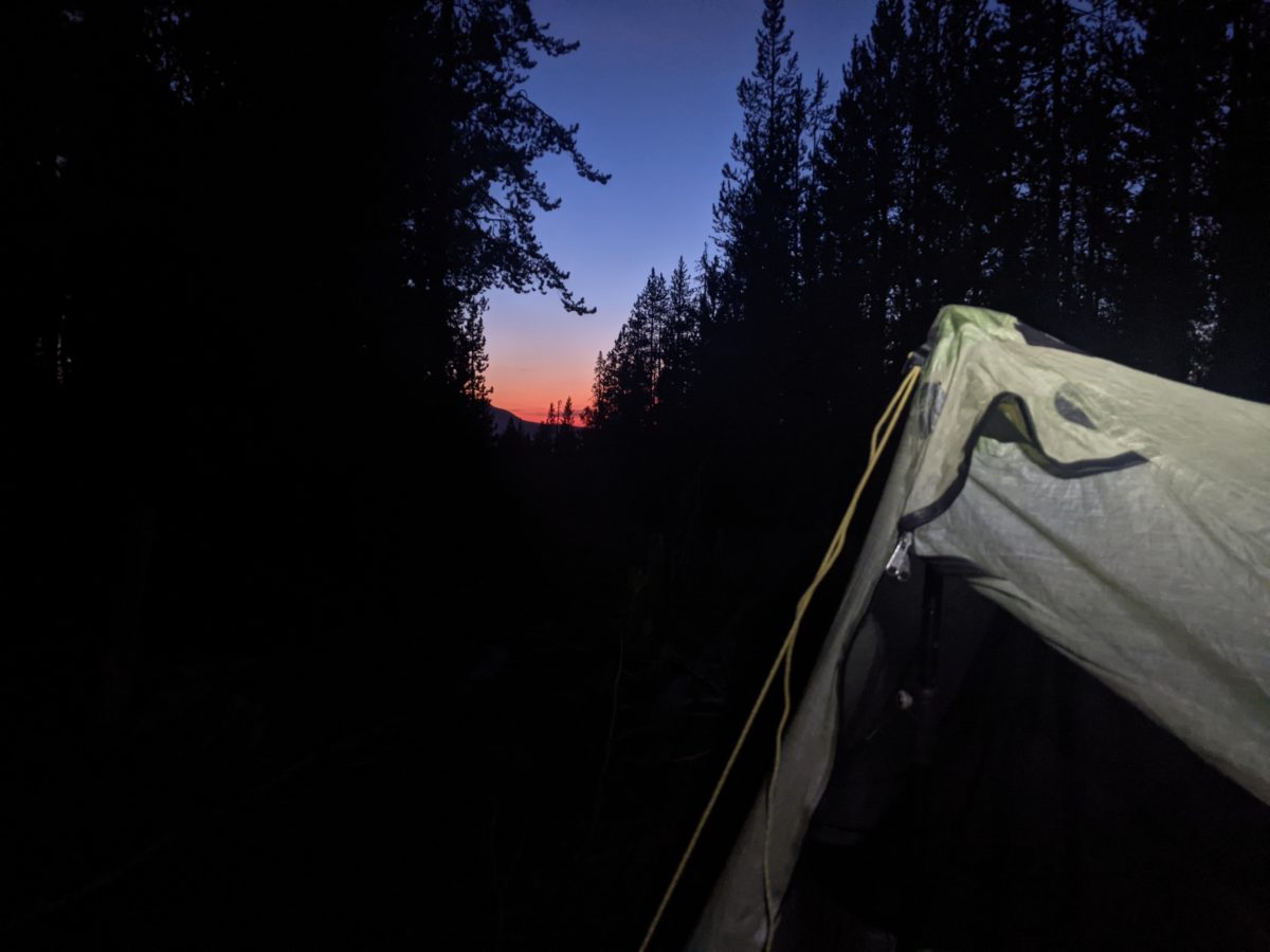
A few of the new arrivals headed toward the water source and never returned, having found suitable camping somewhere along the road. I followed Goddess and a few other up the road they had just come down, and they peeled off down a side track to camp immediately. I kept going up the hill until 9pm, stopping beside the road just as the sun was setting. Late to bed is the price I pay for taking too long getting out of town.
It was a struggle to set up my tent in the very soft and crumbly dirt beside the road, and eventually, after replanting pulled-up stakes and standing everything up three times, three of out four stakes had one or more rocks weighing them down. The struggles of a non-freestanding tent again.
Anyway, I gave up catching up on blogging and knocked off to sleep around 10:30.
I set the alarm for four AM for the second day in a row and got up by it. This time I had the coffee maker already prepped and just had to press the button. I was ready to walk out the door by 4:45.
The drive up to Chief Mountain was very eventful. First, we saw a mama grizzly with cub walking down the side of the road, though it was dark and my picture taken backwards after passing her abs backing up came out blurry.
Immediately after, we saw a black bear on the other side of the road entirely nonplussed by all the attention it was getting from passersby.
We missed the turn for Chief Mountain and had to go back. My bad.
We were stopped by a lady moose in the middle of the road (that, facing us dead on, looked much like a tall, skinny man standing there upon first sight) who kept moving to block us until she ran off. We passed a small-antlered buck a moment later and then nearly ran into a swooping owl.
Finally, we arrived at the Chief Mountain trailhead for a photo session. I got as close to the border as I legally could and got some sign pictures and some trail pictures. I finally hiked out for good around 6:30.
Immediately, I came upon a bird running up the trail. It may have been a ptarmigan or a grouse. Right behind it fifty yards later I came upon a small herd of moose who went tearing out across the river as soon as they saw me.
The rest of the day, I encountered nothing but squirrels and ground squirrels. Maybe it was because I was playing podcasts out loud and clacking my poles together to ensure any bears could hear me coming.
I stopped twice along the way. The first time was fairly early on for a snack because my bagel and yogurt breakfast faded quickly. At this point, I applied tons of insect repellent to my legs because the flies and mosquitos were so thick, a total nightmare. They seemed to come with the territory: a wildflower-filled meadow all down the river valley. I had a horsefly bite my calf right through my calf sleeve. I swatted it instantly. It went down. I stepped on it. I won that exchange.
When I successfully arrived at Gable Creek, six miles in, by 9:30, I committed to reaching Elizabeth Lake by 11 for another snack break. And I achieved that. I knocked down the first nine miles in 4.5 hours, even with breaks included.
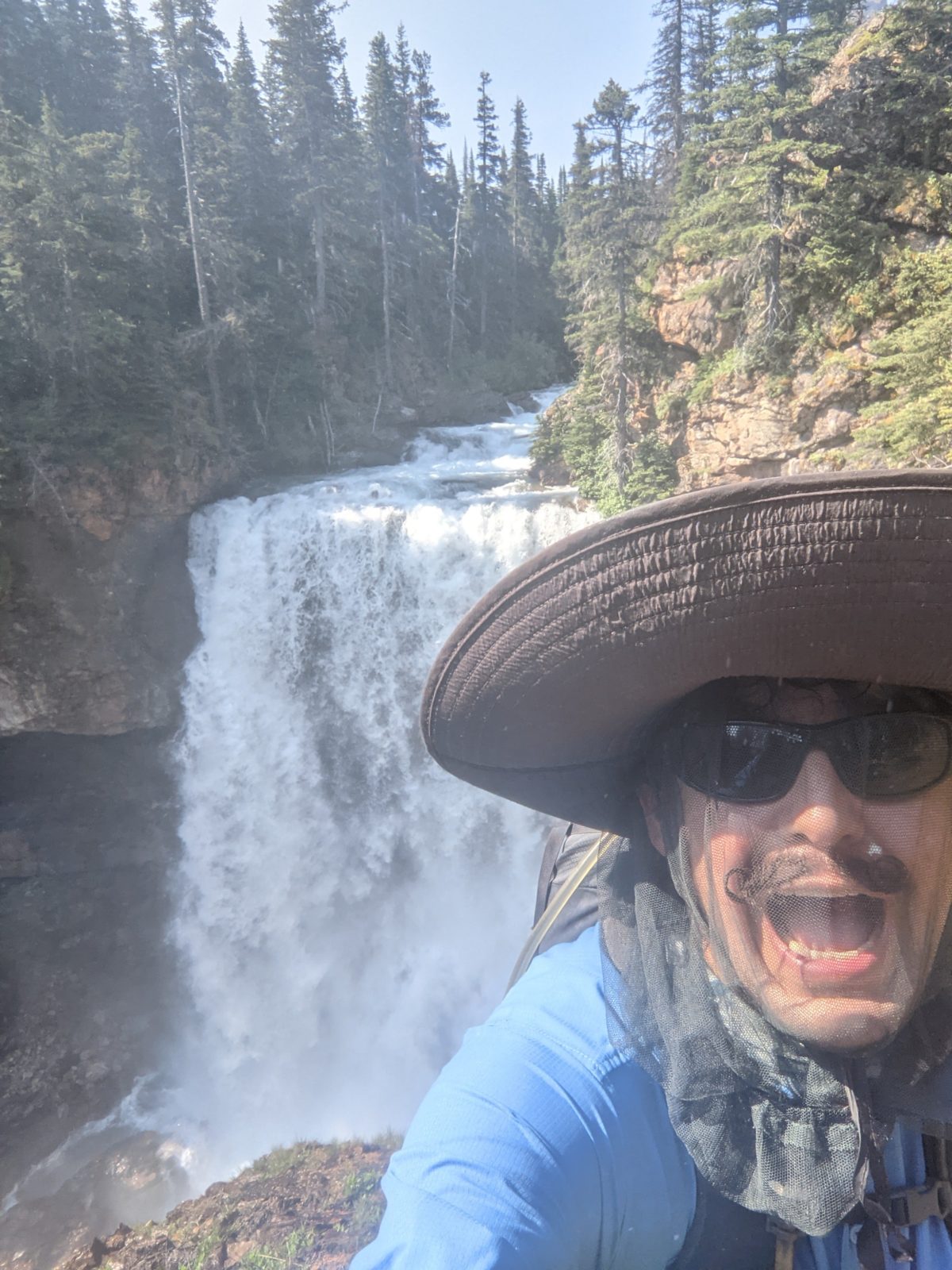
Leaving Elizabeth Lake, the trail begins a 4.4 mile climb up to Red Gap Pass. The average slope of the climb was exactly 600 feet per mile–enough to really feel your muscles straining by the end. Once it gets out of the trees, the views are just amazing. It took me four hours to climb those 2640 feet, so I took another snack break in the shadow of a tall red rock. (Come in under the shadow of this red rock…) Then I had a mere 5.5 mile descent to the valley floor and across it to Poia Lake and my designated campsite on the far side.
The man whose permit I was attached to, Boy MacGyver, was already there, as were a group of three others who actually lived just outside the park and had arranged a trip for a large group to come backpack and fish. Most of the group had canceled, freeing up several campsites for such as me. We chatted about the day’s activities and experiences as I cooked and ate.
Just as I was finishing up my dessert, another couple showed up, Jolly and Emma. Since Boy MacGyver had filled his entire campsite already, I pitched my tent with them after they ate. Jolly is about to start selling a line of button-down sun hood shirts for hikers and is reading testing one of the manufacturer samples as he hikes. Emma is testing the model for ladies. I am very impressed with the design and could see it selling very well.
Anyway, it was a pretty good first day for hiking the CDT in Glacier. I got all the way to my campsite in just 12 hours. It wasn’t ever too hot: cloudy in the morning, windy in the pass and by the lake. And I got to bed before sunset.
The next two days will basically be days of rest and fun. No big miles. There will be plenty of time for that at the other end of the week. At the very least, I’m looking for a week of beautiful scenery.
I slept in a little bit, spent a little time on the phone finishing up a podcast out loud while packing in the tent. I paused it when I heard two women walking by talking about tequila mixed drinks. I was closer to the trail than I thought, though they gave no sign of noticing my tent when passing, low as it was behind some bushes.
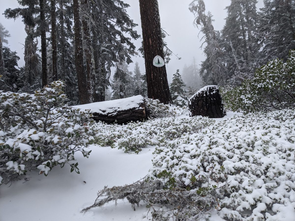
This is a simple one. I woke up with snow everywhere, including on top of the tent. But it was otherwise a nice, shiny morning.
The trail was all covered with snow, but it was only a few inches deep at worst. It was very dry powdery snow because it was too cold for it to melt on top and get hard. But it was still awkward to walk on. I tried putting on my microspikes for better traction, but they just stuck to the snow and formed it into large, hard ice balls under my feet, so I took them off by the time of my first snack break.
I may have slept in a bit and not gotten up until sunup, but I wasn’t going to let that cut my hiking short on a day when the hike was mostly downhill.
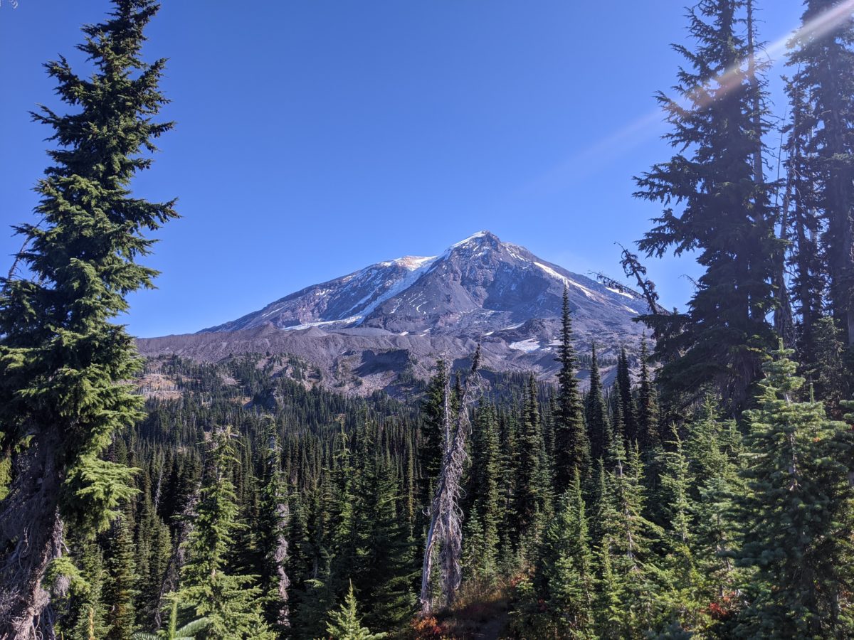
The hiking started out level around the mountain, across lava fields and rock piles, through the burnt remnants of forests, rock hopping over the milky glacial rivers.
About two hours in, I stopped for a snack in front of a small cave. It was nice to have a bit of cool air to contrast with the direct sunlight on this exposed section. I thought about crawling inside, but I could see it didn’t go anywhere.
After nine miles, the trail was about to take a sudden hook to the right and down the mountain, so I found a tiny clearing among a tiny patch of living trees and made lunch.
Then it was hours of descent, straight down the side of the mountain, all exposed by fires of years past. There were views, sure, but it wasn’t particularly interesting terrain.
Some four miles later, I was nearly at the bottom of the descent. I passed an elk hunter climbing up the hill to his fresh kill just a couple miles in, ready to butcher and haul the second quarter to his truck. He was the first and only successful hunter I met.
Finally, after passing a quiet hipster with a camera and just before crossing FS 23, the road to Trout Lake, I stopped at the White Salmon River, more of a small creek, for another snack break.
But I wasn’t done for the day. I crossed the road and started another climb. It was fairly steep at first. On the way up, I passed a message. Someone had written “BEE” in pinecones right across the trail. Confused, I looked around but didn’t see any beehives or hear any buzzing. So I kept climbing. The trail got steeper. Huffing a bit, I stopped for a moment to stretch. Bees started pouring out of the ground right next to the trail. I canceled my break instantly and started running up the hill. Just before it leveled out again, I stepped over another pinecone message. “BEE” again, but written the other way so nobos could read it.
I sure climbed that hill fast.
At the top, I crossed a small open meadow with a number of good campsites. But I wasn’t done yet. By not collecting any water, I had committed myself to camping next to the next creek. And why not? There was still plenty of daylight to be had.
After a long level section, the trail hooked and climbed up over a saddle, then began another long winding descent, reminiscent of the one that had started the afternoon, but this time under cover of trees.
Finally, just as the last available light was disappearing, I crossed a creek and found myself at a large campsite with plenty of places to sit. I dropped my bag and went to fetch some water from the next creek (Trout Lake Creek) , then set about making supper by headlamp light.
It felt like the hiking would never end, but I had gotten enough done to be satisfied with my day. More importantly, I was exactly keeping to the camping schedule that I had reported on the self-issue permit coming into the wilderness.
I’ll be straight. We spent the vast majority of these days in our hotel room.
But there were nonetheless some errands to run and a few fun meals to be had.
Thursday began with a breakfast of cold pizza, candy, and Coke. Then it was off to Wal-Mart in National City to buy supplies. Which was miserable. Poorly stocked. Poorly organized. Crowded. Loud. Rude people blocking the aisles. But they had nearly everything I needed to pick up.
Except for a fuel canister. Which mean a mile down the road to another Wal-Mart. One that was the opposite in every way. Well-stocked. Organized. Less crowded. Polite people. I wish we had known to go there in the first place.
Then it was time for lunch and a touristy visit to Coronado Island. Mexican food at Miguel’s Cucina. Because it’s San Diego. You have to get Mexican.
Then we went back to the hotel, so I could pick up some boxes from the post office next door and a package from the front desk containing all my section maps for the trail.
After a brief break in the hotel room, we decided to spend the evening out by visiting a brewery. The Gaslamp Quarter was surprisingly happening despite the various current events conspiring to shut the city down. It’s probably for the best that this place wasn’t open:
But Knotty Brewing was open and a great time. Two flights of craft beer and a chicken sandwich dinner passed the next two hours in a flash while the neighborhood joggers and dogs paraded around us.
We also hit up a Ralph’s around the corner for some breakfast food and snacks, then back to the hotel to start putting map/guide/water report packages together, and a little bit of TV in bed to finish out the night.
Today didn’t involve nearly as much driving or traveling far at all. We started off the day by grabbing take-out breakfast from the Panera across the street and eating in the hotel room. Then, I spent the rest of the morning finishing putting together all the map packets for my bounce box and a food package for my first resupply. By early afternoon, I was ready to return to the post office to ship them.
But we were also ready for lunch, so we just continued out into the neighborhood to visit another brewpub: The Local Eatery of Resident Brewing. Nachos, beer cheese pretzels, Cuban sandwich and fries, and two amazing IPAs. My mom said the first was the best beer she ever tasted. (All Together IPA for future reference.)
Back to the hotel. After a short digestion break on the bed, I repacked my pack for tomorrow. Then, we went down to the pool area to sit on lounge chairs and chill as twilight disappeared. I had my laptop and downloaded 20 audiobooks from the library and a couple dozen podcasts for my mp3 player to listen to while walking. That’s how I always roll as you might know by now.
And now it’s blogging while a Julia Roberts movie from the 90’s plays on Lifetime. The big show starts tomorrow. The nervousness is all gone now–but I still hope I’m not forgetting something. Something always gets forgotten.
Next update to follow within two weeks. Best I can do.
I’ll be straight with you about this. The name, tagline, color scheme, icon, and background image for this blog come from an anime. Go ahead and call me a total weeb if you like, but I’m going to tell you what it has to do with this trip anyway.
The anime is called Laid-Back Camp, and it’s about a bunch of girls that go camping. It focuses on food, fun, gear, exploration, and beautiful scenery. The theme song, Shiny Days, is a straight-up ripoff of the Jackson Five’s oeuvre, as YouTuber TripleQ has demonstrated with this mashup:
Shiny Jacksons by TripleKyun
The song ends with San Diego from South Park…but my journey begins here in San Diego.
I got my gear packed just a few hours before it was time to go to the airport. Here it is spread out on the garage floor:
You might notice some new items here that weren’t on my AT hike. In particular, I have a new ultralight tent,
From Tarptent
a new ultralight shovel, a new ultralight pillow, a new ultralight sleeping pad, and a new bear canister.
I took most of this new gear to northeast Georgia to do an in-and-out 25 mile section of the Bartram Trail over the first weekend of May. Although there was a decent amount of rain the first afternoon, the rest of the weekend was beautiful, and I only saw a handful of people for obvious reasons–except an enormous family completely taking over Warwoman Dell. I had a heck of a time getting through the crowd while maintaining social distance, and couldn’t even get close to the waterfall. I also severely blistered my left foot in a boot I didn’t realize was so ill-fitting. Anyway, here are the pictures from that trip:
So that’s what spring looks like in the temperate zone. Look back at this post once I start uploading pictures from the Socal desert for a stark contrast.
Modifications made and packing complete, it was time to catch a flight. The Atlanta airport was surprisingly easy to navigate in spite of, or perhaps because of, coronavirus adjustments. We were the only people in our Plane Train car.
The Delta lounge was open with more limited food availability. And it was full. The flight was an easy four hours,
but we arrived to find San Diego basically completely shut down. The Gaslamp Quarter is half boarded up to ward off riots. There’s nothing riotous happening, but it still manages to feel like we’re halfway to the zombie apocalypse.
2020 man. This is the perfect time to go get lost in the wilderness away from all this crap. Or it would be if it weren’t for the tremors under Yellowstone….
So what’s left? Wal-Mart trip. Package sending. And a drive to Agua Dulce to start. I should be on the trail by Saturday at the latest. Let’s do this.