Categories
CDT CO Section 1

Day 132: Dumont Campground

Got out of camp by 7:05, 15 minutes faster than my usual. It was cool, but not that cold relative to the hour, the date, and the elevation.

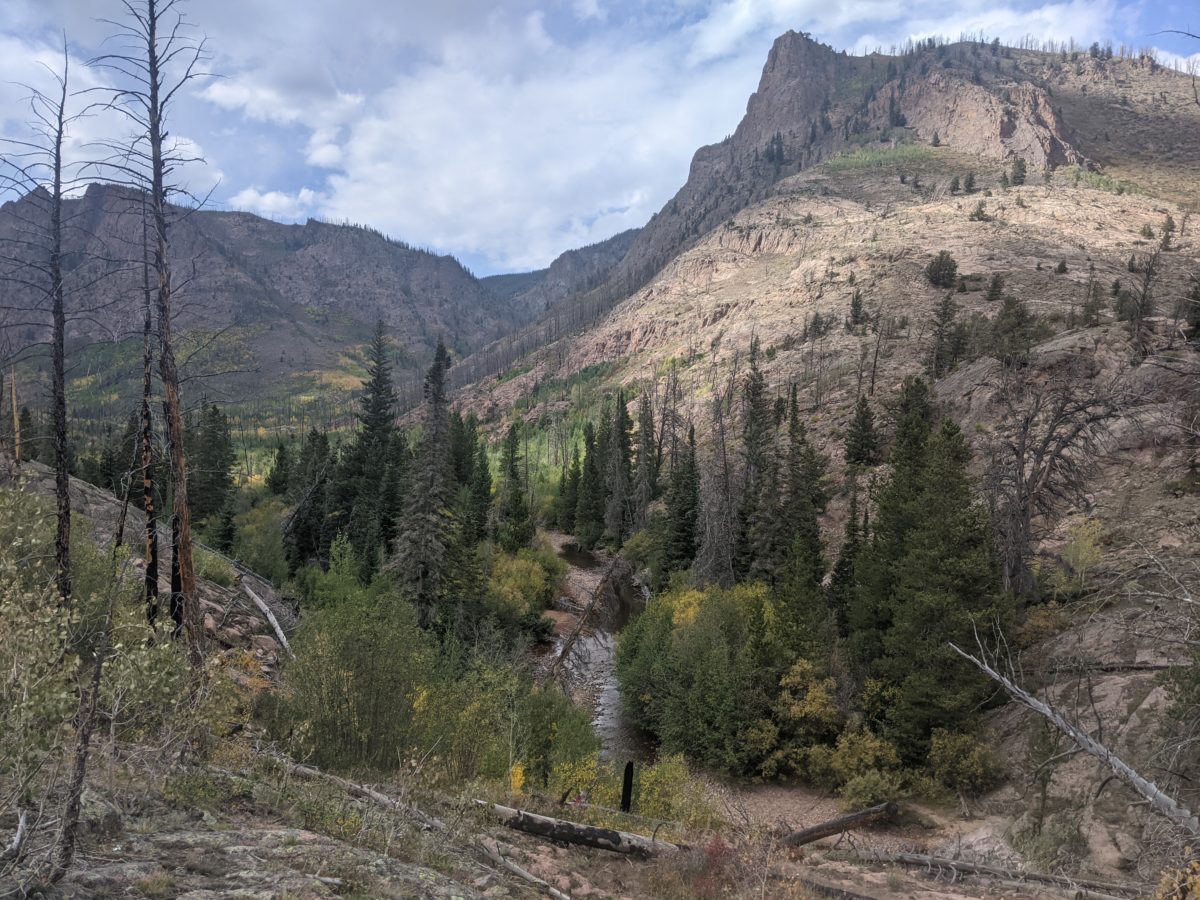
Speaking of elevation, right off the bat I had a steep climb up to Upper Slide Lake, and then an even steeper climb up the hill behind it. I hit 11000 feet of elevation within the first fifteen minutes of hiking, and an hour and change later, having finally climbed up to the CDT just south of the fire closure boundary and climbed yet further to the high point for the day, I had passed 11,500 feet in elevation. There was a lot of stopping to huff and puff and let my legs stop burning over those 3 miles. If it hadn’t been so steep and rocky…

But once I was up there on the divide, I was wishing I could have hiked the actual CDT through the Zirkels. There were no trees up there, and there were views for miles. I bet it went on like that for many more miles north from there, but I was headed south and predominantly downhill. I did take a nice snack break at that high point and discovered it had good cell service. I started texting some numbers I had found to see if I could get a ride into town out of Buffalo Pass that very day. It was only 9 miles ahead. But I only got “no” when I got an answer at all.

Skipping ahead, I made it to Buffalo Pass by lunchtime. It wasn’t all downhill. There were a few steep climbs. But other than the views near the beginning, there was nothing notable about that descent.

I hailed a man driving a truck who was only going a mile down. I asked about charging my phone. He sent me up the road to the other trailhead I would be going past anyway, saying there were folks up there that probably had a way. So I went up the hill to the Powerline Trailhead.

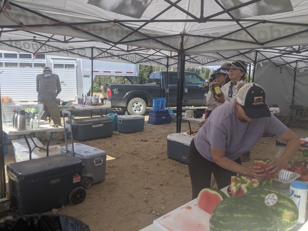
There were a couple of big tents there and a colorful assortment of bags spread out on tarps. The tent and the truck backed up to it was filled with all sorts of food. It was an aside station for an ultramarathon you see, the Run Rabbit Run 50 & 100 mile race, which lasted from that morning at 8 until the following evening at 8. The volunteers here were expecting their first runners to arrive in an hour, and they were basically already set up.

And they did gave a nice power bank I could plug into while I had my lunch. It was fun chatting with the volunteers about the event and hiking the trail. I got to dump my trash in their trash can and even fill my water bag from their tanks, a major time saver. They even gave me a piece of watermelon.

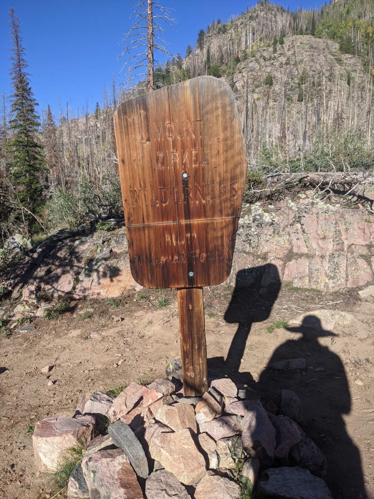
I also heard that hitching to and from that pass was usually really easy, but the only reason I wanted to go from there was to get my tent repaired at the Big Agnes store. Steamboat Springs is the headquarters for Big Agnes (it’s named for a mountain in the Zirkels just west of Mt. Zirkel itself and the second highest peak in the wilderness) and their store there does gear and tent repairs. But I was able to call the store from there, and they only repair Big Agnes tents, so I decided to keep hiking.

Then runners started coming in. I tried to stand just out of the way as they started getting to work. But I still felt like I was intruding, so I waited for my phone to hit 60% and hiked up the hill.

The trail south from there was festooned with markings and signs for the runners. It was also briefly an ATV track, and at one point I had to keep pulling over as five in a row came past. But luckily, the 1 mile climb at the start was the last steep climb of the day. It was all alternately level or downhill from there, so my pace skyrocketed.

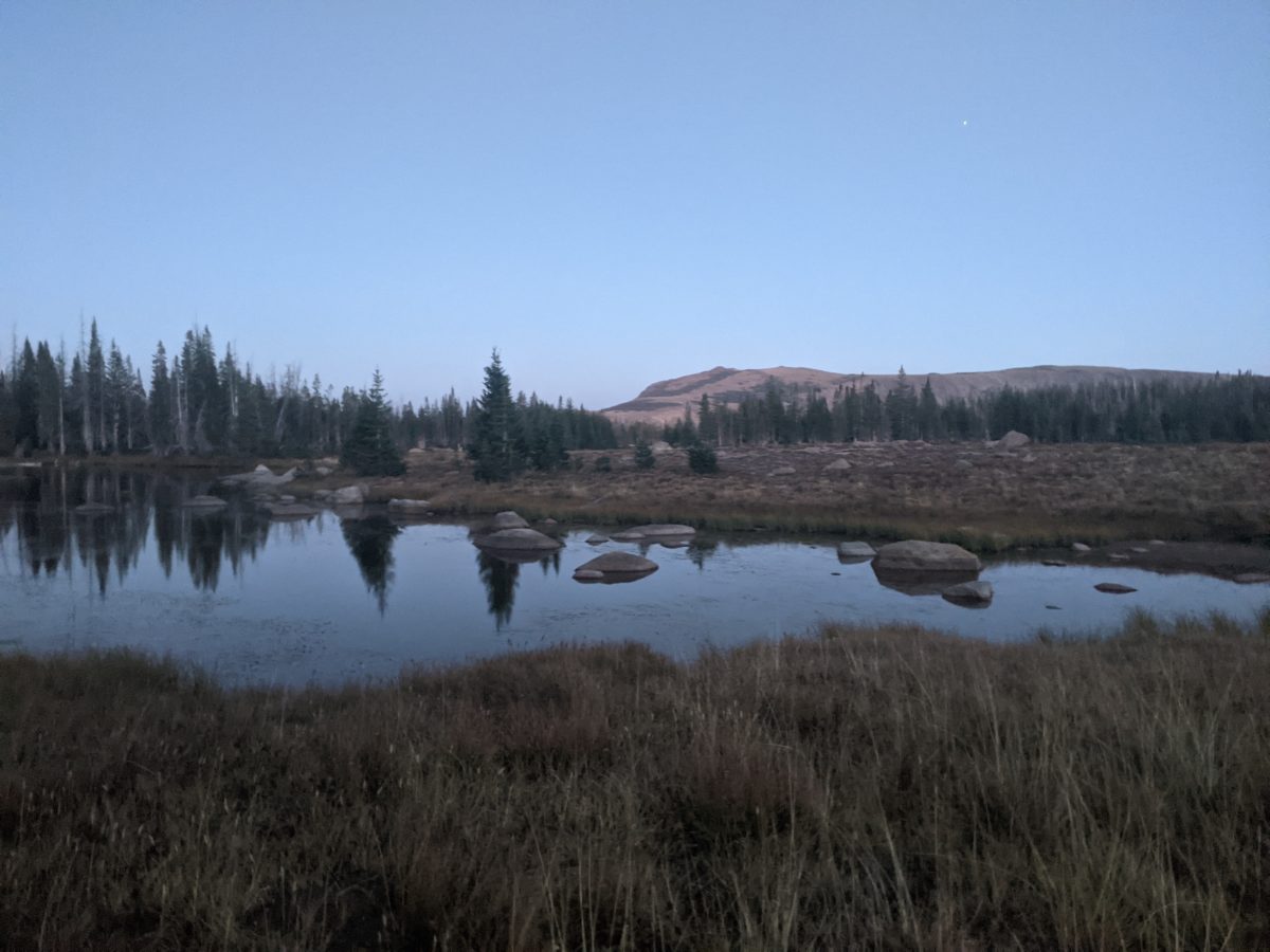
I took one snack break at 4:40, hiked past some lakes, and then dinner at 7 in a campsite near another lake. I switched to headlamp mode, put on my down puffy jacket, and started hiking again just after 7:30.

I soon passed through the Base Camp Trailhead and saw what was surely another aid station being set up, though I don’t think any runners would be reaching it until the next day because it’s only on the 50 mile course. Maybe. I’m just guessing based on the color coding of the trail markings. I didn’t stop. I just went on down the hill listening to podcasts (which I could do now that my phone had more charge) and cruised into Dumont Lake Campground around 9:30.

I found an unused campsite and threw up my tent in it. Sure, it’s a fee campground and I didn’t pay, but they should be grateful to have the honor of my august personage occupying a 20 square foot area in their campground for 8 hours. Anyway, sleep by 11 or so.

Trail miles: 24.4 (actually hiked 27.5)

Distance to Steamboat Springs: 2 miles

Categories
CDT CO Section 1

Day 131: Slide Lake

Getting the miles in is all about time management. Sure, you have to have gather the motivation to start hiking early and keep up a good pace while you’re walking by staying fueled and hydrated. Taking breaks can even help with this pace. But whenever you’re not hiking, you ought to be getting multiple chores done at once. For example, nowadays my gravity filter has gotten so slow it takes over an hour to filter two liters. So I need to be filtering any time I’m stopped for more than a few minutes. I can blog while my meal cooks while my water filters. I can eat while Nuun tablets dissolve. I need to cut time spent not hiking down to the minimum while getting done what needs to get done.

I really felt the need to get that hiking work done as efficiently as possible. With only two full days of food in my can, snacks dwindling, mobile battery nearly empty, and out half a charge on my phone, I wanted to get into town ASAP. On top of that, if I couldn’t get into town before noon on Saturday to get my package at the post office, I’d have to zero or bounce it again. And who knew if I would end up needing that extra ice traction it contained before I could catch up to it again?

I woke up thinking I had overslept, but despite the light, it wasn’t even midnight yet. I thought maybe my headlamp had turned on in the night, but the light was just the moon getting low enough to peek under my tent flap and give everything a blue electronic glow.

After a couple of hours, I passed a lone cow who that bolted deep into the woods before descending to the edge of a meadow containing the rest of the herd. At this point, the ATV track doglegged back up the hill while the Grizzly-Helena Trail turned off into the meadow and became a single-track horse-and-footpath. It was a much more comfortable walk.

I woke up again at the usual time and hiked out again at the usual time. The trail was similar to how it had been for a few miles: rocky ATV trail, frequent water crossings, lots of ups and downs (only occasionally steep), passing little lily pad duck ponds along the way. At one point on one of the climbs, I stood and slammed the crown of my head into a blowdown that crossed the trail at exactly head height where I couldn’t see it through the brim of my hat. It’s either risk your neck occasionally hurting all day from such an impact or have a face constantly peeling from sun exposure.

Later in the morning, I came to a creek crossing and took a long break. I didn’t want it to be a long break, but I had things to do that couldn’t be ignored. The whole time, though, water was filtering. I took a liter of the filtered water and made a vitamin drink with it before I hiked on and dumped the unfiltered water on the ground. There was a surfeit of water all over the trail, so never any need to take any unfiltered water when I was ready to hike out again.

I stopped again after hiking down into the majestic Red Canyon, finding a spot in the shade of a steep rock wall right next to the Roaring Fork. I ate lunch while filtering more water, again dumping the unfiltered remainder before hiking out.

Although I had initially calculated that I could make it to the junction with the Rainbow Lakes trail by 5, then after lunch modified that to 5:30, the trail ended up taking a very disregarded route than was on the old map I was using (and not for the first time since I left the CDT). I pulled some water out of the creek just before climbing the last hill to the ridge where it was and arrived around 6pm. I stopped and made dinner, filtering water as I did. I dumped the unfiltered water, put on my headlamp, and started hiking speedily up the ridge toward the divide as the sun disappeared. I figured I could reach Upper Slide Lake some five miles away by 10pm if I pushed.

I had climbed all the way up to Rainbow Lake by 8:30. I think it would’ve been cool to see in the day. It was Big enough it took over 15 minutes to hike from one end to the other at full speed. I expect it looked similar to lower Green River Lake.

At the top end of the lake, I began climbing the steep hill next to the falls on the creek (Norris Creek) that fed the lake. I also would like to have seen those cascades in the sun, but they were quite nice to hear and peaceful in the moonlight. Before climbing that steep hill, I pulled some more water out of the creek, but that was a mistake. It turned out I would cross that same creek an hour later, and I wouldn’t have had to lug that weight up the hill if I’d waited.

The third and final hour of hiking after dinner was the hardest. That super energy was gone and there were a lot of steep, rocky climbs. I had to pause frequently to let my legs recover. Also, I had made it up to well above 10.5k feet in elevation. When I found a nice field to camp in with a relatively flat and rock-free spot, it was 10pm and I was maybe a quarter mile shy of Upper Slide Lake. The elevation was about 10,740 feet.

After setting up my tent and climbing in to get a few winks, I discovered there was a rock bulging out of the ground directly beneath my tailbone. It was too late to move the tent and impossible to move the rock, so I put a few more bags into my mattress and dealt with it. I slept pretty well.

Trail miles: 5.1 (actually hiked 21.5)

Distance to Steamboat Springs: 28 miles

Categories
CDT CO Section 1

Day 130: Grizzly-Helena Trail east of Blue Lake

My morning went basically the same as the previous. Up and out of camp by 7:20 or so. Another sunny clear day.

The trail down from Seven Lakes was much clearer of blowdowns than the pervious section. It got steep and rocky in places, but it also admitted several nice views. I also passed the Big Creek Falls, which weren’t beautiful, but it’s been a while since I passed a waterfall.

When I finally got to Upper Big Creek Lake, the trail kind of evaporated among blowdowns again. I ended up hiking through a wet meadow, briefly finding the trail again, taking a snack break, then joining a wrong trail, crossing the creek that connects the lakes, taking a turn down a clear, maintained trail that just dead-ended at the upper lake, backtracking to find that the trail on the map was lost in a field overgrown by bushes, wending my way through a wet meadow again, following critter tracks between the bushes, finding a trail again, climbing a steep hill to the foundation of a collapsed house overlooking the lower lake, finding a trail that got eaten by blowdowns again, walking along the rocky shore of the lake past a few cabins that seemed to be well-used until that was blocked, then finding the overgrown blowdown-covered trail again until it cleared up somewhat and eventually reached a road. It was a bit of a mess. It took a while.

But just up the road was Big Creek Campground, and that had toilets and dumpsters, so I was able to lighten my load and lighten my load. It also had picnic tables of which one I commandeered to make and eat lunch. Finally, I grabbed some water from the outlet river and hiked south on the road.

After a few miles on the road it ended, and the Grizzly-Helena ATV track began. I was feeling a bit lightheaded by the time I started down the freshly built boardwalk bridge. As soon as I got back into some trees again, I stopped for a snack and filtered some water to immediately drink a liter.

The track was frequently swamped with water. Deep fords are no problem for the bow hunters riding in on ATVs and fat tire bikes. One such hunter even offered me a ride across when I stopped him to ask which way to go at a fork in the road (except that I had already crossed and wasn’t going that way). Those frequent fords would be ankle-deep for me if I didn’t find a way around. Fortunately, even the widest ones had been bridged nearby by logs or strategically placed trees. Also, because the wilderness boundary was drawn to be just slightly west of the road (so that the road would be outside the wilderness and motor vehicles could use it), there was no issue with regular maintenance of the road via chainsaw. As such, I never had to worry about blowdowns.

A few miles later, I stopped for supper and filtered the rest of the water. I was passed several times by traffic on the road, including a whole troop of hunters on fat tire bikes. Just beyond where I stopped, the trail snaked between a number of lily pad ponds as it climbed into the hills. I found the bicycle troop prepping in front of a gorgeous sunset view.

I kept hiking up and up and up as the sun disappeared and even into the night. Every time I came close to a creek, I found a hunting camp. Several tents and an ATV parked nearby. One was even running a generator. Some of these hunters were practically glamping.

I climbed higher and higher onto the slopes leading up to the Fryingpan Basin below Mt. Zirkel. The occasional hilltop would reveal distant city lights beyond the hills in the valley below (and their attendant strong cell service I took advantage of to nab some missing map tiles and new podcasts). Eventually, late into the 8 o’clock hour, I found a broad, flat campsite that was somehow completely unoccupied. So I took it. Close to 9 seemed like a good time to stop hiking from here forward as I never seemed to be able to wake up before 5 these days, and the days were not particularly hot anymore. Sleep came shortly after 10.

Trail miles: 14.8 (but actually hiked 16.9)

Distance to Steamboat Springs: ~54 miles

Categories
CDT CO Section 1

Day 129: Seven Lakes

I woke up a little before five and was on the trail a little after seven, which is shortly after sunrise. When I emerged from my tent, a couple of does were passing through, apparently spooked at first but otherwise not too bothered by my presence.

The first 8+ miles of trail was an ATV track that followed the Continental Divide exactly. It was dirt and big rocks and steep hills up and down and being not infrequently passed by hunters on ATVs or passing parked ATVs. One was parked with a Tupperware full of lunch just sitting out on the front seat for any passing critter to nab if it wanted.

It was just about lunchtime when I reached the Manzanares Cutoff, where I left the CDT for the east side of the Zirkels, a wilderness area no longer affected by the Morgan Creek Fire closure. My aim was to reach the Big Creek campground near the Big Creek lakes. But I stopped halfway down the hill to the valley to eat lunch.

Resuming, at the bottom of the hill, I had to go cross-country a bit to cut across to the trail I wanted where the cutoff had been overgrown. But I eventually connected back up with a clear trail following a tributary of the West Fork. Then the trail disappeared, but I followed where it was supposed to be until it appeared again. Then it was easy to follow all the way down to the Main Fork trail.

It was during this last climb down that the deadfalls over the trail started to get denser. A few started requiring significant workarounds.

Other than a brief confusion involving which direction I needed to turn onto the West Fork trail, it was a lot clearer and the blowdowns were not too dense and easy to avoid. It was just follow the stream up the hill to the lake it flowed out of and then up the hill beyond that to climb over into the valley of the Main Fork to join the Main Fork trail.

This one was even easier to follow than the last, and I could basically zone out for the mile or so I was on it. There were a couple of crossings of the river, but nothing that mandated getting my feet. After my afternoon snack break and the second crossing, I turned off onto the Big Creek Trail.

This was a bit of a nightmare. Right off the bat, I was climbing a steep hill with blowdowns over the trail extremely frequently, some of them requiring long detours or some gymnastics to avoid. Then, about a mile in, the clear trail just disappeared among a hillside of blowdowns. I tried to follow the route on the GPS, but the trail that had been there could not be seen. So, I just started working my way across the blowdowns and climbing higher as I did to try to stay near where the trail was supposed to be. An hour later, I hadn’t even gotten a mile and it was time to stop for dinner. It was clear that Big Creek campground was not going to happen at this point.

I stopped for supper at a random point on the hillside where there was a huge boulder with a rivulet of water running around it. This particular hill was just covered up with springs for some reason, and there were an overabundance of these little streams. In fact, I passed one just after dinner with such good flow I decided to collect from it, having used the last of my water for dinner.

At this point, I saw the light (of the half moon rising, probably) and decided to stop trying to follow the official trail route. I just got as high as I could, up toward the rocky, boulder-strewn cliffs where fewer trees grew and so there were fewer blowdowns. This greatly speeded my progress and I had rejoined the actual trail within a half-hour. It had been climbing too, had caught up to my altitude, and continued climbing. There were still blowdowns across it, but now I was moving quickly and it was getting dark, so I guess I started getting reckless. As always happens on these blowdown-heavy days, I finally scraped and bloodied my knee stepping over a log, but of course it happened at the very end after I’d gotten through all the hard stuff unscathed.

It was only a few more minutes before I arrived at Seven Lakes with not even enough twilight to pitch a tent by. I did it by headlamp light. And I was not the only one there. I saw m more headlamps at another camp a hundred yards away. I heard their voices as I went to bed. I assumed they were hunters as I definitely heard elk bellows in the area. It seemed like a nice place for elk to hang out.

Anyway, the point is that I went almost 7 miles less than I wanted to, partly because I set an unrealistic goal and partly because of all the blowdowns I didn’t realize would get so bad so late in the day. I had enough lunches and dinners for five more days, roughly, but maybe snacks for four at most. I needed the rest of the alternate route to be a much easier time. I didn’t regret going the way I did. It was beautiful and fun. But time and speed would always be important factors.

Trail miles: 14.7 (17.3 actual miles hiked)

Distance to Steamboat Springs: ~71 miles

Categories
CDT CO Section 1 CDT WY Section 6

Day 128: Near the CO/WY Border

When I woke up at 3:50am, I could see the flashing of distant lightning and eventually the sound of distant thunder. It was clear a storm would arrive by the time I could get packed up, so I decided to sleep in until it had passed.

It took most of an hour for the rain to start, and I got in a little more uncomfortable sleep. But little did I know that that first storm would be followed by 5 more in sequence, with never more than a half-hour respite in the rain or hail between them. I did as much packing and prep as I could do from under cover of my rainfly, including wiping up all the water that had gotten inside during the storms. Then I just watched some videos I had downloaded to pass the time.

Finally, during the 9 o’clock hour, there was a long enough cessation of rain to get the tent down and everything packed without getting soaked. No sooner had I gotten my rain gear on and started hiking, a little after 10, than it started hailing again. With the cold wind blowing over those rocky hilltops, I very quickly lost feeling in my fingers and had to pull them into my Packa sleeves. It barely helped.

A mile down the trail, the hail had stopped, the rain lightened. I passed Cliff and Lost sitting beside the trail looking a little bit soaked and muddy. They indicated they were planning to do the road walk detour to Steamboat Springs to try and get to Mt. Elbert (some 365 miles sobo from there) before the snows came. I wouldn’t be seeing them in the Zirkels. At my pace, I don’t have much hope that Elbert will be safe to climb by the time I would pass it.

Anyway, they must have chased me over the rocky hilltops with indistinct trail for the next couple of miles as the sun finally came out and warmed up the day enough that I could feel my fingers again because as soon as I stopped to take my Packa off and put my hat on, they passed me never to be seen again. I wasn’t even trying to catch them. As I had lost most of the morning to waiting out the endless rain, I had given up hope of doing much more than getting into Colorado this day.

I took a nice break on a rock shaped like a chair a mile or so later. A couple of hours after that, I took my normal lunch break on top of a hill scattered with uncountable blowdowns. After losing the trail for a quarter mile following a missed turn and backtracking, I took my regular dinner two hours after that on the edge of a very boggy meadow.

I carried some water out of a nice stream there and climbed up to another meadow, where I scared off a dozen elk at very close range when I popped around a corner and they spotted me last second. They disappeared into the forest at light speed, but looked very elegant doing it. A while later, a half hour after sunset, I crossed the border into Colorado. There are five states on the CDT, and I had now hiked it in all of them. Bingo!

A third of a mile down the hill from there, I finally found a levelish spot with few enough rocks and tufts of high grass to pitch a tent on, and did just that in the dark. Shortly after getting everything that needed to be dry under the tent, the last rain of the day came through, a very light and pleasant affair accompanied by some strong, cold winds.

Colorado would seem to be a place with a lot of trees, a lot of blowdowns, high elevation (as I hadn’t been below 9000 feet all day just getting into it), cold winds, and temperamental weather. But the forecast for the next day indicated it would be sunny, clear, and ideal for making a few more miles.

Trail miles: 13.4

Distance to Steamboat Springs: ~88 miles