I woke with the birds at 5:30 and felt fully-rested this time. Even with moving slowly and taking some time to sew up a hole in my glove, I was still moving up the trail by 7:15.
After a half mile, I was at the junction at the top of the canyon–and there was no cache. I guess the cache had actually been placed down at Dutchman Spring this year. Rather than backtrack a mile for water, I decided to hike on to the next cow pond some five miles further on, described by some as “highly suspect pond water” and by those who tried it as “filters clear with no unusual taste.”
It was a familiar stretch of burned out hillside. I didn’t remember it going into the section, but I recognized it once I was there. What I didn’t recognize from last year was the chill torrent of wind. Sure, there had been breezes, but I had had to put on my puffy coat to pack up in the morning, and when I reached the cow pond just before noon and sat down in the shade for lunch, I had to put it back on again. It was like a summer day with a winter wind. A perfect balance when hiking, but far too cold when stopped.
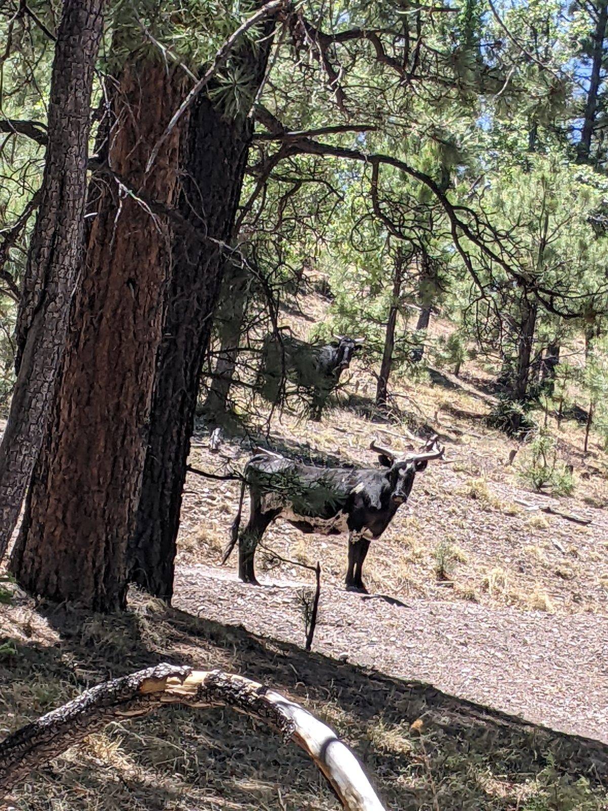
Brown pond water does not flow quickly through a microfilter. I sat there looming in the minds of the cows who also wanted a drink for two hours. Shaking up the reservoir to let more water through the filter also let more water through the leak. When the water level in reservoir fell at all, only a third of it or less was reaching my bag. Eventually, I decided to give up and try the pond at the top of Govina Canyon 2 miles ahead.
The last time I hiked this section, I stayed on the red line, which required an intense effortful climb up onto a ridge line. This time I went down. It was just old forest roads and poorly worn trails following Govina Canyon down and back up on the other side, taking 5 miles to cut off 6.5 miles of the CDT. It wasn’t the best maintained trail, but it was in the shade, and that intense cold wind did reach most of it, so it was pleasant enough.
There was another cow pond right near the beginning of the alternate, and the water came out slightly more clear than the previous pond. But it was still very slow to filter. I again got in the way of the cows who wanted to get to the water without passing near me for nearly two hours. And again, most of the water I collected went onto the ground via the leak. I can’t wait to get a replacement filter in a couple of days.
So it was already getting on into the afternoon by the time I set out to tackle the rest of the canyon in earnest. I still had another couple of miles left to reach the CDT again when I stopped to cook supper. It was the most fly-infested spot I’ve seen so far. They mostly stayed out of my food, but despite my bag shaking before packing up, I’m sure I carried more than a few flies away with me.
When I finally found my way back onto the official trail again, it was a very familiar scenario. A steep climb up Wagontongue Mountain late in the day, crossing the upper ridge and descending through the burned-out section as the sun set, and continuing down the long descent until there was barely enough light to make out the trail until I found a nice flat spot on a random ridge most of the way down to make camp. I’m pretty sure that that’s exactly how I ended my day the last time I was in this area last June. I probably took the sand pictures and camped in the same spot.
My Garmin brought tales of canceled flights and delayed pickups on the following day, so once I was in bed, I turned off airplane mode and found I had a decent cell signal. I called and made alternate plans–but that is a story for tomorrow.
Trail miles: 16.6 (only 15 walked)
Distance to Highway 12: 5 miles


