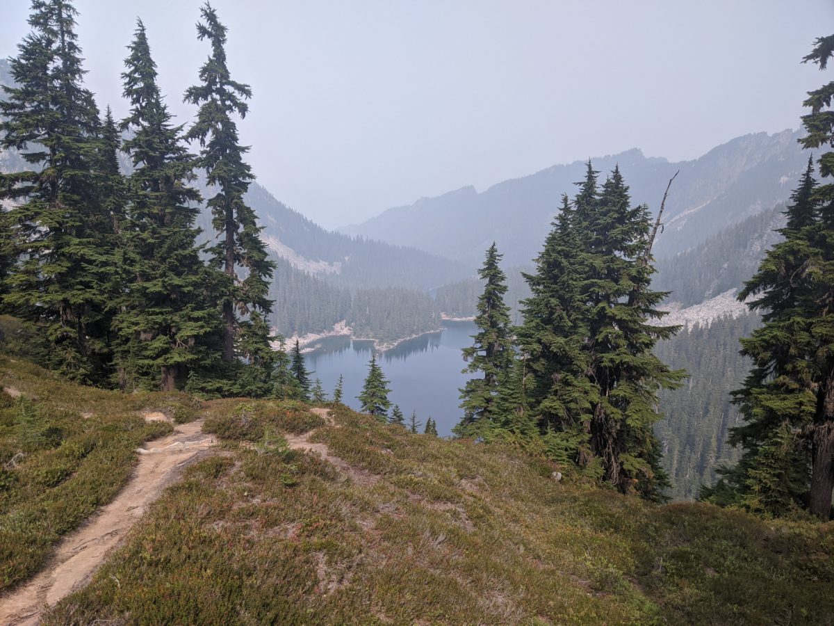
After a beautiful lakeside morning, I began a long gentle 4 mile climb to a pass, where I chatted with a couple with a good dog.
Then it was downhill for 2 miles before beginning the climb up to Piper Pass. Less than a mile into this climb, I passed Glacier Lake, where I had been considering eating lunch, but I did not make the turnoff to go down to its edge. I had eaten on the edge of a lake enough times that I wanted to eat in a spot with a view overlooking a lake. Guthook comments for the tentsite a quarter mile ahead promised views.
This is the first of the posts using the new one-day-per-post format. If you missed the previous post, all you need to know is that these are coming out once per day at 3pm eastern from now on.
First things first, I packed up my camp site. I had been up so late making sure things were in order, this didn’t take long.
Be sure to read the important note about the future of this blog at the end of this post.
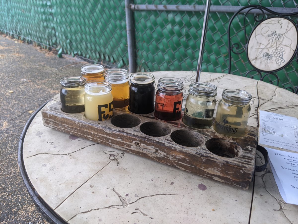
Let’s talk about food for a moment because it seems to be something that people want to know about. But I’m not going to get into how many Calories I eat per day because sometimes I eat things that I don’t even know the caloric content and I never really count calories anyway.
My last few days of hiking in California were almost completely solitary. And my trip north had me dealing exclusively with people and situations completely unrelated to hiking. But now I was setting off down a very popular stretch of trail in a time when hiking is more popular than usual: the week leading up to Labor Day. I sure wouldn’t be getting the trail to myself. But with my legs rested, my pack feeling light, and the trail pretty worn and gentle, there was a good chance I would be outpacing any short sectioners I came upon.
Note that in this section, I had to walk north to the border and then south from there. Because the Canadians have closed the border to all Americans, this backtracking is mandatory. Otherwise, I would have crossed into Canada and hitchhiked or bussed or whatever to Manning Park to go south the easy way. But since it is required for everyone this year, I get to say that the trail is 30 miles longer than usual. And to that end, I’m counting both the northbound and southbound miles north of Hart’s Pass as trail progress.
There will be no hiking in this post. Unless you count hitch-hiking. This, I won’t be tracking distances for each day. In the end of the last post, I was just picked up by a taxi headed to Mount Shasta (the town, not the mountain). Let’s get right into it.
Sometimes I find myself annoyed by what other people find mannerly.
I’m sure you have all found yourself in the position of seeing someone holding a door open for you while you’re still on the other side of the parking lot. You feel like you’re being rude if you don’t hurry up because you’re now holding them in place.
As someone who walks around town a lot, I’m often met with a car that stops just where I am planning to cross a road and waves me by. They frequently do this when they have one or more cars behind them followed by a huge gap so that if they had just kept going, I would have been able to cross anyway five seconds later and no one would have to wait for me to cross. Yet I know that were I to try to wave them by at that point, they would just double down and wave me through again as if to say “This has nothing to do with you, buddy. That guy behind me has been following too closely for miles, and you’re just an excuse for me to force him to wait.” To which I would think “Why did I have to be the scapegoat for this vendetta?” as I go ahead and cross. (I’ve learned to solve this problem constructively by simply turning my back on the driver when I see it’s about to happen. Unable to signal me to cross, the driver can no longer begin this game and is forced to do the thing that is most efficient for all involved.)
A similar thing happens out here on the trail. The footpath is only wide enough for one person to pass at a time, so whenever two people meet going opposite directions, one must yield and step off the trail. Rather than have this turn into an inefficient negotiation every time, someone somewhere long ago handed down a traditional rule: the uphill party must yield to the downhill party.
I find this rule annoying at best. It has a number of flaws:
It does not specify what should be done on level ground, thus forcing such meetings to devolve into negotiations anyway.
People going uphill tend to take more frequent breaks and often want to stop. They still can, of course, but only if they are the first to do so. Otherwise, the situation devolves into a negotiation.
Like with the door holding scenario, the climbing party will feel pressured to climb faster once the uphill party yields, but it’s harder to speed up when climbing.
Because the climbing party tends to be slower than the descending party, this criteria is designed to maximize the amount of time someone has to wait.
On the other hand, the system does have one benefit: for someone who climbs quickly and has a lot of momentum, they don’t have to lose that steam and get that rush of stiffness to the legs that comes with even the briefest of stops while climbing.
This post makes reference to California wildfires. You should know that I am no longer in California, and, in fact, flipped up to Washington when the smoke everywhere became inescapable. Unfortunately, I was unable to escape it in Washington for very long either. The whole west coast is on fire. Fortunately, there aren’t too many trail closures this far north yet. Now back to where I last left you in Quincy.
Day 1
The main goal of the morning was to get some packages sent before I had to vacate my hotel room. Since I could no longer trust the post office, I visited the paint store where UPS shipping could be bought. Over the course of the morning, I visited three times to construct three packages.
The Quintopia pint glasses and other odds and ends. (Spoiler: there was no good packing material, and the two fragile stickers on the box weren’t enough signal, so only 3 of 6 glasses survived the trip.)
Another batch of food which I bought that morning to be shipped to Old Station.
The wrong phone case to be shipped home so it could be returned to a Victra store.
Once this was done, I could stop for brunch at the cafe on that same street that had tables strewn all down the sidewalk and still get back to my room in time to move out.
I spent the next couple of hours after that on the motel front lawn making phone calls and writing a blog post using the motel wifi. I also chatted with a man who was staying in that motel in exchange for doing some housekeeping and had cleaned my room when I checked out. I gave him my last root beer and the rest of my grapes.
When these sundries had been tidied up, I went to stand on the road out of town that led back up to Bucks Summit. It was a block down from the courthouse (where today there was a Trump rally in the exact location of the previous day’s Democrat rally–a very politically diverse little town) and from the charred ruins of the brewery and the crisis intervention center that used to provide showers and laundry to hikers but had burned two weeks before.
After a bit, a guy picked me up and carried me as far as the next town, dropping me where he was turning off the road just before it went around the curve. I started to walk up the road for a better place to hitch from but was accosted by a large family hanging out in their front lawn. It was a hot day and they gave me cold seltzer. (I had neglected to fill my water bag with ice this time.) In exchange, I gave them small talk and the URL for this site.
It wasn’t too long after leaving there that I caught another ride that got me all the way to Bucks Summit. It was early afternoon, but I wasn’t the only one hitting the trail headed north that day. There was a group of young men starting a loop around the lake who followed me onto the trail (where I met a ranger who had just tidied up this section), passed me as I stopped to collect some water, and then wandered off the trail at a random place where I passed them for the last time (as they intended to take the Spanish Peak trail instead of following the PCT).
I dry-camped by myself in a small wooded site on the side of a ridge.
Total distance: 7 miles
This flower was gifted to the woman who drove me to the trailhead. I thought Daddy would like it.
Day 2
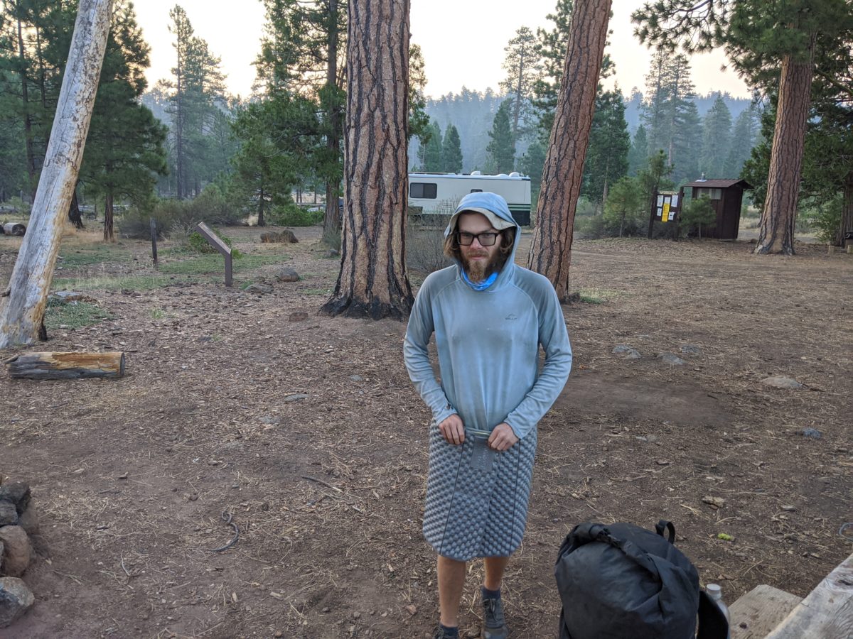
Up and going with the sun, which was easy to see from the eastern edge of the ridge I camped on. The gnats and flies were miserable just as soon as I got going, but I had to stop and repack because I had accidentally packed my head net inside my tent.
The morning was a brisk 12 miles all downhill into Belden. Very easy hiking but brutally hot and exposed. The thermometer read 101 within Belden itself, so I spent the majority of the day at the resort there.
The first few hours consisted of buying a few items I had run out of at random marked up prices, eating a Belden Burger and onion rings with a beer or two (and a root beer or two), uploading and scheduling another blog post, being annoyed by a woman who laughed just like Fran Drescher, and filling my water bag with ice. By this time, I was aware of the first nearby fire which had closed a section of trail back near Quincy-Laporte Road. I was glad I had gotten through that section ahead of it just days earlier.
Then I went down to the local beach swimming hole to cool off until the sun started to fade. It was an extremely popular spot that day, and almost everyone there was drinking but me. A great way to spend a day that hot I suppose.
I started hiking out by 6pm to start the big climb out of town before sun set (but after the heat had someone subsided). The trail started with a long overgrown brambly section that made it hard to see my feet, but it was easy climbing besides that.
It got more rocky as the twilight faded, though, and that was not a good combination. I tripped repeatedly on the toe stubbers. So I stopped to get out my headlamp. As soon as I turned it on, I turned to see an owl sitting on a bendy stalk right in front of me. I said “Who!” and the owl started visibly. It turned its head all the way around because I was clearly blinding it with the light, then took off flying silently up the trail to hide in a tree.
Another hour of climbing brought me to the Williams Cabin Site, where two tents were already filling the only visible tent sites. The folks inside were awake and said they had no idea where another place to camp was, but the Guthook app clearly said there was space for 5 tents nearby. After wandering in the woods near the trail in both directions, I eventually stumbled upon the real campsite and set up my tent. I skipped making supper because I was still plenty full from lunch.
Total distance: 18 miles
It was so cute seeing this couple climb into this tiny raft to cuddle as they floated around the river. This photo is titled “The Bridge on the River Kawaii”
Day 3
When I packed up in the morning, the other two campers had left just barely ahead of me, but moving fast enough that I couldn’t catch up to meet them. Oh well.
I stopped to soak my shirt on every stream I crossed (because it was still extremely hot), and on one of those occasions Crazy Legs came up behind me, having just started the section early that morning and being incredibly fast. He shared some pumpkin seeds and some stories. He indicated he was doing 30s no problem despite living off a pack full of Chips Ahoy® and pumpkin seeds found in hiker boxes. When asked about cat holes, he said he never had to dig them because as soon as he hit the trail his body turned into a machine that took in food and put out miles and nothing else.
He also asked to see the soles of my shoes to see if I was the source of the Nutter Butter® shoe prints. After some shoe talk, he let me try on his shoes (as he happened to be the same size and he had recommended the style highly). I decided they weren’t for me. He went ahead, never to be seen again.
I stopped for lunch in the middle of a rock fall. While I was eating, a buck landed right next to me, clattering on the rocks as if he had fallen from the sky then turned and wandered off when he saw me as if he didn’t know what he had gotten himself into. I saw him again further up the trail before he finally moved off in a direction I wasn’t going.
All along this long climb, the trail was marked by small metal placards with diamonds on them nailed to trees, and someone had taken to intermittently graffitiing encouraging messages on them. I was happy when late in the day I finally reached the one letting me know I’d finally done it.
As the sun had started to disappear, I reached a road where stood a pipe ejecting gobs of cold water into an algae-filled trough. Fittingly named Cold Spring, it had a number of tent sites behind it. It had been a very short day miles-wise, but my legs were very aware of the nearly 3000 feet in elevation gain under a pack at full leaving-town weight. The water falling from the pipe provided some wonderful white noise for a good night’s sleep.
Total distance: 12 miles
Day 4
It was only a few miles into my hike when I turned off to have a snack near the Butte County High Point. It wasn’t anything to see, but it was close to the trail so why not? It briefly rained while I was sat there, but the rest of the day was clear and hot.
I stopped for an hour or so on the exposed ridges near Eagle Rocks because they had good Verizon data service and I needed to download some more audiobooks. I also took some pictures of the distant peaks swathed in what was surely the smoke of distant wildfires. But it wasn’t at all hazy where I was.
I stopped for lunch at a dirty road crossing frequented by dune buggies fancy ORVs. Just as I finished, the skies opened up in a sudden shower and my bowels responded with a sudden urge to move, leaving me running from tree cover to tree cover looking for a suitable place to go without getting soaked. Of course it stopped raining as soon as I was done.
Some of the trail here consisted mainly of piles of pea-sized gravel on the sides of hills, and at one point, the trail crumbled underneath my right foot. There was no way to save my stride at the speed I was walking and I immediately face-planted hard. My right calf was cut wide open on a larger rock that just happened to be right there in the way.
None of the water was particularly close to the trail on this section, which pretty much stayed on the ridge. I had to go 0.3 miles down off the ridge to fetch water from Little Cub Spring, and that was the option that required the least extra walking. It did give me an opportunity to wash the blood and dirt off my calf at least and put on a better bandage.
I dry-camped in a flat nook right next to the trail near the Carter Meadows trail junction. A short day, but I would have no trouble making up the miles as my pack got lighter.
Total distance: 13 miles
Day 5
This next section led through forests owned, maintained, and logged by a lumber company. It started with a downhill jog past the PCT halfway marker (where I signed a log that had been signed by many folks I recognized, including by HeiZenBerg just the day before) to the highway leading to Chester. But I had no need to go to town at the moment.
I ended the day in a very popular camping area for hunters near Stover Spring. All the best sites had tents and campers in them but I didn’t see a single person for the entire time I was finding a spot, setting up camp, eating, going to bed. There was one doe in the area investigating the camps. I think she had been there before, knocking over all kinds of things, like my neighbor’s pop-up privy tent. I saw her panic when she nearly tied herself up in a loose end of clothesline. Very funny.
I saw a couple of trucks and people come in very late, but no one came near our spoke to me. Ah well, I was anticipating a big fun day the next day and went to sleep early.
Total distance: 17 miles
Day 6
I packed up and left that site having seen only a single human walk by. I got some water from Stover Spring and began my highly anticipated day of entertainment. The haze from the fires cast a pall on the forest but not my spirits.
Late in the morning, I stopped to wash my feet in the North Fork Feather River. Unlike the Middle Fork, the swimming options here were very slim. I found a small swimming hole but it was getting late and the haze caused by smoke from one of the wildfires was blocking that good sunshine. I would have frozen getting out.
I walked down to a nearby campground to get water, eat lunch, and dump my trash. I asked a man camping there about the fires but he didn’t know anything.
From there, it was time to head into Lassen Volcanic National Park.
Even though it was only a few miles from where I would be stopping for the day, I stopped at Boundary Spring and fetched a quart or two.
Soon, I came to the turn off for Terminal Geyser, and dropped my pack for the side trip. The Nutter Butter footprints went this way too. By this time, I suspected they belonged to HeiZenBerg because of how far they had come and I was glad he had gone on following Pants’ apparent trip-ending injury. Not that I had any reason to think he wouldn’t.
Terminal Geyser isn’t a geyser at all, but a large steam vent. The kind of place you don’t get too close to because you will definitely get scalded by the steam pouring out of the ground.
Another mile or so brought me to the edge of a boiling lake. Yellow with sulfur and marked by warning signs, it was clear this wasn’t the sort of hot spring you could soak in.
And finally, at exactly the time dinner was said to be served, I made my way up to the outdoor dining area of Drakesbad Guest Ranch. And who should I find seated there and already eating but HeiZenBerg and Pants! I joined their table to catch up.
It turned out Pants hadn’t quit after all and was just hiking on the injury, some kind of hairline fracture that wasn’t likely to get worse without announcing said worsening with a great deal of pain. In fact, they had been the occupants of the pastor of tents at Williams Cabin Site that I hadn’t been able to identify in the dark or catch up with in the morning. Pants was also confirmed to be the wearer of the literal wafflestompers, and HeiZenBerg hadn’t taken the Geyser detour at all. They had camped at Boundary Spring, and he had opted to skip it so as to make it to Drakesbad for breakfast. The two had been there, washing clothes and hanging out at the poolhouse, for the entire day.
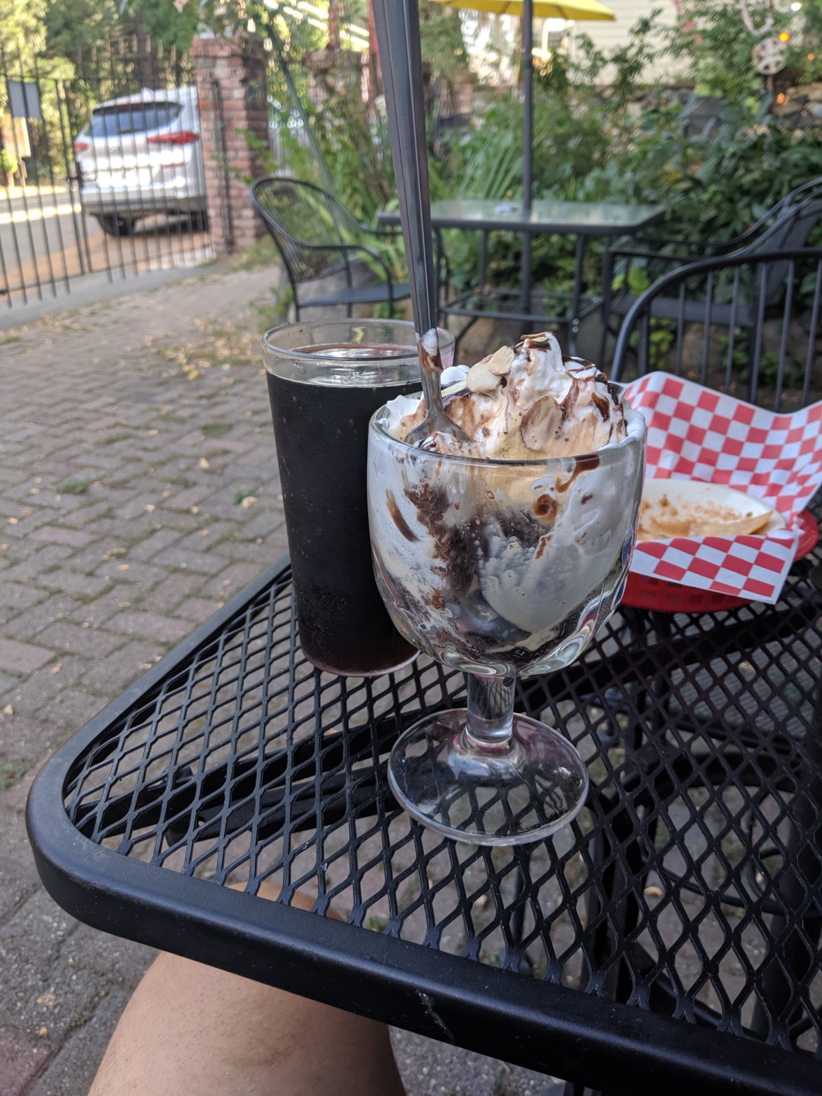
Dinner was incredible. A buffet of half a dozen meats, a dozen varieties of starch and veggie combos, as well as breads and cookies. To top it off, I could order beer, root beer, and even a root beer float for dessert! It remains my gold standard for PCT dinners to this day.
After dinner, we all walked over to Warner Valley Campground, the only place in the park we were allowed to stay without a permit, and stole a campsite for the night. Not that there was anyone besides us and a couple of other PCTers there that night. Anyone with sense would prefer a reservation at Drakesbad anyway.
Total distance: 15 miles
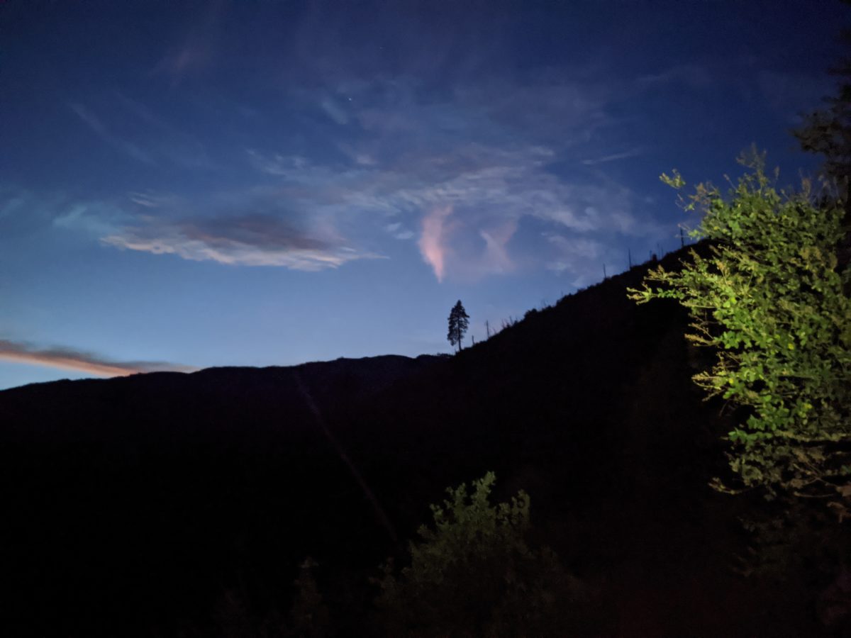
Sun through the haze at about 6pm
Day 7
After packing up camp and storing our packs in the bear box, we, of course, returned to Drakesbad for breakfast. Who could resist that temptation? After all, HeiZenBerg had started the previous morning with chocolate chip pancakes! What would they have this time?
French toast, it turns out, along with plenty of coffee, eggs that were brought out already cold, sausage, potatoes, butter, etc. I went ahead and got a root beer with breakfast too.
During breakfast, Pants and HeiZenBerg had a bit of a spat, each interpreting the other as being in a bad mood. This would lead to some awkwardness between them for the next few days, and in particular, their not talking to each other. Of course, I was not implicated in any of this and could and did freely talk with both. Often about the other and how to resolve the disruption.
Jeff and I left for the campground first and were basically ready to go by the time Adrienne got back, so we walked out together. I chased him up the one steep hill of the day, climbing out of the smoke settling in the valley. The haze was just as bad as the previous day. We stopped together to collect water after crossing the big creek on a log. I left first, but he passed me later when I stopped to soak my shirt in a stream.
At Lower Twin Lake, I stopped for lunch, sharing a lakeside with Chipmunk and Blueberry (the other two occupants of the campground the previous night). I could see HeiZenBerg doing something similar on the other side of the lake. After I finished lunch and the other two had left, I went for a quick swim in the lake to cool off. The sun was really racing through the haze and it was my last chance before a long dry stretch.
I passed Pants lunching on the other side of the river but hardly stopped to chat. I had a good 12 miles left to do and no reason to stop again until it was done.
Or so I thought. In fact, I stopped again within a mile as I entered the burned zone. It was like an apocalyptic wasteland with all the dead trees creaking in the smoky wind and the haze blocking the view beyond a thousand yards. There’s a picture of the scene below, but you wouldn’t be too far off of you’re imagining the first Silent Hill. But more importantly, the lack of tree cover meant high probability of sunburn, so I sat down on a log and covered my legs in sunscreen.
Then I got back up, and set off at top speed through the wasteland, slowing only when a snag blocked the path. I stopped once for a snack about 2 hours in when I found the only shady spot with a sitting log. But the trail was painfully flat and boring, so aside from that, I practically ran through it all.
Once outside the park boundary, the trail canted downhill and dove back into the trees. But it wasn’t any more interesting because it went right through a tree farm, also notoriously boring environments.
Finally, somewhere around 5:30, I reached the site where HeiZenBerg had set up camp right next to Hat Creek. After I had finished my nightly ritual, about an hour after arrival, Pants came wandering up too and set up her tent in the middle of a game trail above our site. I went up to talk to her before going to bed.
The next morning, I would be the first one out of camp in a perfect reversal of Williams Cabin Site’s departure scenario. It was only a few miles down to Old Station and I had a lot to look forward to there. But I’ll save all that for the next post. Over and out!
This post is only to be read by those able to solve the following basic trigonometry problem:
Q: I’m sitting on a one foot tall bear canister with my knees bent at exactly the right angle to make my lap perfectly level so I can roll up some fish inside a tortilla. If the length of my lower legs from my heels to my knees is exactly 22 inches, what kind of fish am I about to eat?
The previous section had been intended to be Echo Lake to Sierra City, the whole thing at once, but the side trip into Truckee and the whole matter of the broken phone kind of forced the section to be somewhat split. As such, this will be a shorter section/post.
Day 1
We left off in the morning with my intention to hike back to Donner Pass to get a replacement phone. I figured I could get a warranty replacement overnighted there and get a new phone for just the price of a hotel stay in Truckee.
Right off the bat, though, I already got some good luck. I chatted up Teresa and Mike as they were finishing packing up their camp. Mike was going to keep hiking through this section, but Tereza was headed back to Arizona to get some work done. She would be going right through Truckee, and her car was parked much closer than Donner Pass. So I had a ride and saved two miles of walking just by talking to everyone I passed.
She dropped me at the Verizon store (actually a Victra store), where I would end up spending most of that day. I hope I didn’t smell too bad sitting in their storefront on hold with Verizon customer service all day. Eventually, I got through and got in the offline queue to be called when a rep was available. I ran around the corner to get some taquitos for lunch and then back again to catch the call. I had gone through a whole shtick when suddenly the store’s phone started buzzing and I couldn’t hear anything the rep was saying. I asked her to call back, but the buzzing didn’t go away. There was no way to get the thing done here and I didn’t want to wait an hour in the phone queue again, so I told the store employee, “Screw it, just sell me a pixel 3a and order me a case for it to be delivered to Quincy.” I also bought a new pair of headphones while I was there.
About that time, I got some more luck. Paul came into the store and offered to wait for me to ship my old phone to the data recovery service from the FedEx store next door and then drive me back to the trail. He was retired and looking for an excuse to take his new old Jeep off-roading. He drove me all the way back to Castle Pass, way beyond where I had expected to be taken. I had to rehike at most a mile. And I was back on the trail instead of wasting the night in town spending my money on hotel rooms and town food.
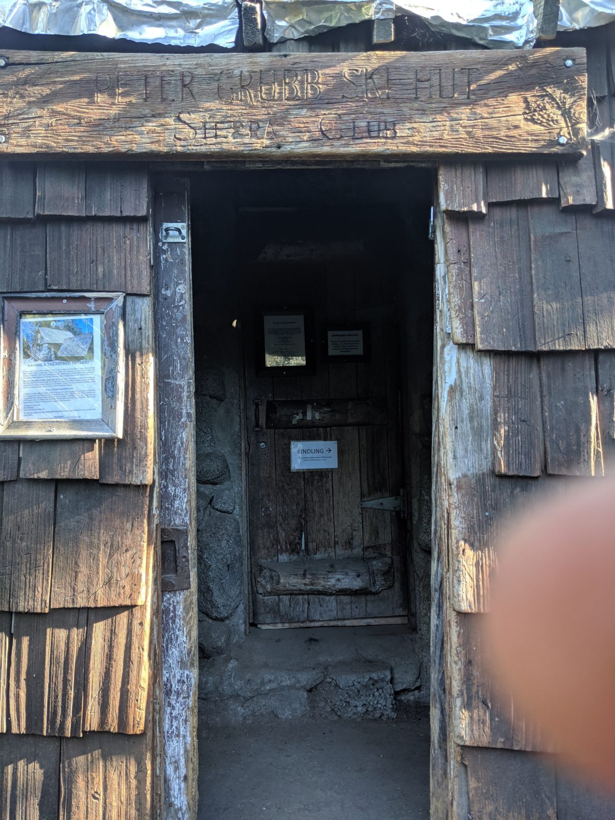
I had enough time left to use the privy at Peter Grubb Hut, get some pictures (which you’ve already seen) and hike as far as Paradise Lake before it was dark.
After going down a mile long side trail and circling the rock barrier surrounding the lake confusedly, I finally found the lake’s edge when I chatted up a man who was sitting there next to his tent. The light was nearly gone, but he was interested in chatting about everything. His son was in the tent, recovering from the ten mile hike and possible altitude sickness which had led to vomiting.
I broke off the conversation to cook and set up my tent closer to the water. In doing so, I majorly bent one of my stakes trying to hammer it into the sand.
More conversation with the man ensued by headlamp light when his son came to ready to eat something. The full moon rose over the lake and I tried to catch its reflection in the water. Unfortunately, a will-o-the-wisp ruined the shot.
Total distance: 9 miles
Trail progress: 5 miles
Day 2
I woke up at first light and was leaving camp just as my neighbors were emerging from their enormous tent. He tried to ensnare me in another conversation, but I finessed away and got back to the PCT.
I stopped at Snowbank Spring, a beautiful little trickle just beside the trail, to get some good cold water and spend a little time communing with nature as it were. I ended up having lunch there before leaving.
Spent the night at a campsite near Mule Ears Creek. A couple of college boys had spread out all over the campsite, but made room for me to put my tent. Apparently they had known each other so long that the talkative one accidentally introduced himself by the other’s name. They sequestered themselves inside their tent to play a modified version of War in which they made up lots of crazy extra rules like it was Mao crossed with Nomic. They were incredibly nerdy engineers and probably lovers too, but they had come halfway across the country to hike a short section together while school was out, so I tried not to bother them too much. Also, they seemed very COVID-shy so I tried not to get too close to them.
I also took this opportunity to record a time lapse movie of my nightly cooking and set up routine.
Total distance: 15 miles
Day 3
The day started with a trip down to the creek to fetch water. I packed and left the other two still in camp barely moving.
Halfway through the day, I turned down a paved road and took a quarter mile side trip to a lakeside campground to take advantage of the flush toilets and trash cans.
A few miles later, I spent an hour chilling beside the falls of Bear Valley Spring, getting some water and washing my feet and legs and just generally enjoying the beautiful waterfall cove. The two boys from camp caught up to me here as I was leaving. I let them have the spring to themselves.
Late in the afternoon, I turned down the side trail that led into the Wild Plum Campground. I thought I could hitch into Sierra City from there, but only three cars passed going that way, none willing to pick me up. So I walked 3 miles to the highway and another half mile into town. It was too late for the general store to be open, but one of the restaurants was open, and I got to order a nice meal in the garden. I paid way too much for an overcooked steak and watered down root beer, but at least the ice cream was good.
After calling around and finding that every single lodging establishment in the entire area was completely booked for the weekend, I walked to the community center and found that the bathroom where hikers can normally get a free shower had been locked shut for COVID-19 reasons. A man living next door informed me that it was no longer allowed to camp next to the church. So, it seemed, I would have to get back to the trail to stealth camp.
Fortunately, I was accosted by some hikers right there in front of the community center who were willing to give me a lift back to the hilltop and the trail. I found a singular stealth site just a few tenths of a mile from the road and set up.
Total distance: 16 miles
Day 4
After I packed up and made my way back to the road, I was moments too late to catch a likely ride into town. No one who passed on my two mile walk down the hill to town wanted to make it easier on me. I stopped at the coffee shop for a bagel and peppermint mocha for breakfast, then arrived at the general store just an hour after it opened. I needed to pick up two boxes there. One with my maps and one with my food.
There was only one box for me there.
After calling home for the tracking number on my food box, I learned it was still in San Francisco, having taken three weeks to complete 80% of what should have taken only a week. A chat with the postman made it clear that the current political situation has finally reached me on the trail. Trump’s attack on the post office (as the postmaster himself described it) had now become an attack on my wallet, as I was now forced to resupply at the general store, which had only some of the things I wanted at massively inflated prices.
Not that I blame Larry, the proprietor, one bit. He probably isn’t even making a profit in a year like this. He’s probably barely staying open. So I bought what I needed to get as far as Quincy and packed it all up.
It was around this time I bumped into Jeff. Yes, Jeff from Kennedy Meadows South. He had been hiking with Adrienne whom I met here for the first time. Her trail name is Pants. And she had decided to call him Heisenberg thanks to his resemblance to Brian ? though I would find out later that he preferred to spell it Hei-Zen-Berg. He was just as skinny but indicated he had stopped precipitously losing weight. I left them repacking food (which had arrived in time for them) beside the post office. They had disappeared when I passed that way again.
I got a hot pastrami sandwich from Larry’s deli inside the general store. It was great. Then, just before the store closed, I bought a box of beer and a bag of ice. I put the ice in my water bag and the rest in the box with the beer. I left my phone plugged in beside the store and walked the beer down to the local swimming hole on the Yuba River.
It had been a very hot day and I was finally getting cooled off, along with the closest thing one could get to a shower and laundry in this town. But I had been there only an hour–already done swimming and starting to put my shoes back on thankfully–when storm clouds came rolling in and dropping rain on us river visitors. I rushed back up the hill to make sure my phone (which lacked a case, you’ll recall) didn’t get wet, but the rain stayed light and didn’t last much longer than a few minutes beyond my arrival.
My phone, by the way, had turned itself off due to the intense heat of that day. Nonetheless, I spent another hour making sure I had enough books and podcasts downloaded, visited the trash can at the community center to clean up the remains of all I had bought, met a nice dog, then set off looking for a kind soul to get me back to the trail. This is where I got some good luck.
I saw a couple of guys sitting in front of the bar waiting for some beer to be brought out (as entering the bar was not allowed and the general store was closed). Said beer was too be taken to their campsite and they agreed to take me along.
Calvin and his stepdaughter’s boyfriend John were camped with several others at Upper Tamarack Lake on the far side of Sierra Buttes, which meant I could skip a notoriously nasty climb by riding along with them.
Few trucks would be able to make it up the janky dirt road to the lake. John had even had to walk a mile up it carrying a disk bag from the farthest point his car could reach (a feat which bought him a full day’s respite from Calvin’s teasing). But Calvin’s pickup made it.
After circumnavigating the lake, I identified a nice spot to put my tent, then went back for my pack. It was at this time I realized the belt I’d been using as a sternum strap since the first week had disappeared, probably fallen beside the road in Sierra City.
I talked to a family that had parked their camper within inches of the PCT and for my trouble got a nice beer and two of the ripest, sweetest plums I’ve ever tasted. They also told me they would keep a limit for my belt as they packed up in the morning.
From there, I walked my pack to the store I had found and set up my tent before returning to Calvin’s party’s campsite to repay their kindness by talking to family friends Greta about the trail since she was planning to do it herself once she had graduated from college. I ended up staying there for hours and learning a lot more about that family and in particular about Calvin’s brand of humor. (For example, his stepdaughter was half-Chinese and her boyfriend John was Mexican, so he referred to the pair as Rice and Beans.)
They kept me well supplied with beer until 11pm, when Calvin pulled a trout they had caught earlier out of the lake, cleaned it, wrapped it in foil, and grilled it over the campfire. So, just before midnight and my trip back to my tent, I was eating a mouthful of fresh trout grilled in almonds. What a day!
Guthook’s PCT Guide switches from the “Sierra” section to the “Northern California” section at Echo Lake. There’s a good reason for that. There’s a very different vibe to the trail going forward. In some ways and at some times, northern California is more similar to the desert section than the high Sierras. There is far less water on the trail but many more road crossings and hiker-oriented businesses right on the trail.
Befitting such a major transition, and to celebrate another month of hiking and completion of an entire quarter of the trail, I had long since decided to take a true zero in South Lake Tahoe, a tourist town absolutely full to the brim with guests during the time I was there.
Day 0
Part of this day was to be spent on certain errands.
The day started with a visit to the 7/11 for a coffee, a breakfast sandwich, and some fruit. Then, it was on to the grocery store by foot for an easy resupply.
The biggest and most expensive task was buying new gear. Right next to the grocery store was the only worthwhile outdoor sports store in town. There I bought a new winter sleeping bag, a new mattress pad (mine was great but it kept leaking through the valve requiring waking in the night to reinflate–how do you fix that?), better insoles, and a new compression sack for the sleeping bag.
I walked these items down the street back to my room, then picked up my old sleeping bag and mattress and walked them back up to the same shopping center to FedEx them home.
In the same area was a hardware store where I bought some velcro and some laundry detergent.
Back at my room, the next task was laundry, which I did by hand in the enormous whirlpool tub in my room, then hung all my clothes on hangers from the curtain rod above the A/C unit under the window. I also got my food situation pretty much squared away so I wouldn’t be in a rush leaving in the morning.
All this worked out, it was time to play. 8 rented a Lime scooter and took to the bike trails, zooming some 5 miles down to the South Lake Brewing Company. They serve flights on child skis with holes cut in them. I soon joined up with a small group of locals: Patrick, Cameron, Alma, Keegan, Phil, and Jommy. Patrick bought a round for everyone and offered me a ride to Echo Lake the next day. Jommy invited me to his place when they were leaving for a barbecue and backyard fire, but I declined and hopped back on my scooter for my hotel.
The scooter battery died a few blocks from where I could rent another, and I had to push it there. But I could ride the last mile, went to my room, and fell asleep after spending all night editing video.
Total trail miles: 0
Day 1
The next day, I still had some errands. I had to swap out my compression sack for a larger size at the outdoors store because the new sleeping bag wouldn’t fit in the same size bag the old one would.
After that, I had to pack up and get out of my motel room. At the last, I left my headphones on the bathroom counter. I never missed them though. They didn’t quite fit in my ears and caused severe pain when not perfectly adjusted and some scarring in my left pinna that still pains me a month later.
After a long relaxing lunch at Azul (tacos) with live music, I set out to find other outdoors stores to shop for a new pair of sun gloves since the main store had none. I bought a pair of ski glove liners that were close enough and then walked over the border into Stateline to keep looking. No luck.
I walked back over to South of North Brewing Company’s beergarden to sample their wares. For legal reasons, I had to order a hot dog I didn’t want, but then I proceeded to spend the next several hours trying all their beers, cutting the fingers off the gloves I had bought, writing a blog post, and listening to the live band.
Late in the afternoon, I decided it was time to hit the trail. I left Patrick a message, and he called me back to say he couldn’t actually give me the ride he offered. No problem. I only called to be polite anyway. Just as easy here to summon an Uber. It was probably 6pm by the time we arrived back at Echo Lake.
Then I realized I was supposed to have a permit for Desolation Wilderness. I hopped on my phone and bought one, but I wasn’t going to be able to print it. The site wouldn’t even let me download a pdf. I crossed my fingers and hoped if I met a ranger, I’d be forgiven for not having a paper copy.
The sun had set by the time I reached the far end of Echo Lake and entered the Desolation Wilderness (marking the boundary of where I was allowed to camp again. I got out my headlamp and cruised along in the dark, seeing no tentsites for another mile. I turned down the side trail for Tamarack Lake and stopped as soon as I saw a clear spot next to the trail. I threw up my tent there.
I wasn’t the only one out late that night either. Several more headlamps came floating by and an entire family came down past me looking for a place to camp. Apparently the traffic had been horrible coming up from wherever they’d driven from?
Total distance: 4 miles
Day 2
Most of this day would be spent hiking past Aloha Lake. It’s huge and the trail near it is nothing but broken rock that you cannot move very quickly over. Also, it’s swarming with people. Every quarter mile of shoreline was occupied by groups and families and crowds were flowing up and down the trail.
As soon as I came near it, I stopped to soak my shirt to ward off the heat of the day. When I went to leave, I saw a ranger coming up and arranged to get ahead of him so I didn’t have to talk to him.
I reached the end of the lake where a large rock created a small shady cave. I stopped to have lunch, wondered what time it was, and realized I had left my watch and gloves beside the lake where I’d stopped miles back. I stashed my pack under the rocks and started hiking back to get them. I hiked right past the ranger, but I was able to deflect his questions with irrelevant nonsense and since I had no pack on, he wasn’t concerned about whether I would need a permit.
Anyway, an hour and 3 miles later, I was back at my pack and starving. I took my time with lunch in the shade of that rock, collected water, and soaked my shirt again before leaving.
The trail didn’t get any less rocky before I began the climb up to Dicks Pass an hour or two later. It got worse and it was a hell of a climb too. It was the last place the trail went above 9000 feet, and just when it looks like you’re about to reach the top, the trail turns right and makes you keep climbing along a talus pile for another quarter mile. Right here is where I saw my last marmot.
Coming down the other side, I settled into a pace with another guy who was coming down and we chatted. He was only staying one night at Dicks Lake in support of his girlfriend who was beginning a circuit of the Tahoe Rim Trail. He was getting to camp first to set up their hammocks. I set up right next to them and we hung out that night and talked about her first long distance hiking trip, food, and how she would adjust to it. I shared some Christmas in a Cup with them and they shared some cookies with me.
Total distance: 12 miles
Day 3
Time to put on some speed. I was leaving camp not long after that couple was just getting up.
Past the last couple of lakes, where I soaked my shirt again, I entered a forest with a smooth dirt track trail and could really put on the speed. It was mostly downhill. I saw my first bear here. It didn’t care about me at all. I also saw my first trail crew, breaking big rocks into fist sized gravel.
I stopped for a snack next to a creek that had been reduced to stagnant pools. I needed the water. But I didn’t stay long. I really wanted to get to Richardson Lake for lunch.
And I did. There were lots of folks there. Some of them were willing to swim, as did I. The water was murky and home to some massive freshwater crawfish, but it was also perfect swimming temperature, especially on a day that hot and muggy. I didn’t want to leave.
But leave I did. I climbed up to Barker Pass before sunset, made and ate dinner there, took advantage of the unlocked pit toilet (having been informed by sobos that it was an option), strapped on my headlamp, and kept going. The sun had well set by the time I reached my intended campsite, in which the best site was already occupied. I made do with a slanted campsite up the hill behind them because I did not intend to go any further that night. I didn’t sleep well, both because of the tilt and because of the woman’s annoying laugh that continued well after I was in bed.
Total distance: 19 miles
Day 4
I woke rushing to take pictures of the sun rising over Lake Tahoe.
Then, I packed up and got out of camp before the other couple, heading down to the nearby stream to get water. They passed me while I was doing this, but I passed them within the next mile and practically ran up the next big climb with them chasing me. I wanted to get it done so that I could enjoy the ridgewalking while it stayed cool.
I also found some cell service above one of the ski mountain areas and downloaded some more podcasts. Then it was downhill into Squaw Valley and the creek where I would stop, along with some others, to eat lunch. Had a nice chat here, then began my climb out of the valley, stopping once to sit in another stream and soak my shirt–the sun continued to be relentless all day.
Eventually, I made my way to the tentsite beside Squaw Creek (just beyond the Granite Chief ski area), a nice spot with several wrapped condoms spread out on a log, just in case.
Unfortunately, while I was trying to get to sleep that night, a couple of women came hiking through (as there was another campsite not too far away) yammering at each other at the top of their lungs. It was well after 10pm, which everyone knows is quiet hours in the wilderness. No respect!
Total distance: 13 miles
Day 5
Most of the morning was spent walking along exposed ridgelines, many with good views of Big Blue. These were sometimes the tops of ski slopes, and I walked under some chair lifts. At one point, I found some cell service and stopped to download some information about where I was headed.
I was headed, in fact, to the Donner Ski Ranch for lunch. This was a very exciting goal because there would be tasty hot sandwiches, beer, device recharging, and even flush toilets. Once I made it in, I spent most of the afternoon there.
Eventually, I set out to hike the little piece between the Skranch and the interstate at Donner Pass (yes, those Donners), go through the tunnel under the highway, and swing around to visit the rest area, where the restrooms were open. That big lunch needed some room to expand into, I guess.
Then, it was a quick two mile climb up and over Castle Pass as the sun went down. One more mile and I was at Peter Grubb Hut. It has electric lighting! But I didn’t need it. I just used my headlamp.
I noticed then that my phone was rebooting. And then it just suddenly collapsed to black in an uncontrolled power off. Oh well. I wanted to turn it off anyway. I had the place to myself, but I didn’t realize it until I climbed into the attic and found no one else there. I had been trying to keep it quiet for no reason.
I made up a bed on the attic floor and went to sleep.
Total distance: 20 miles
Day 6
I tried to plug in my phone when I came down the ladder in the morning. The charging icon briefly came up, then the screen went black again. Then it would not respond to anything. A brick.
I popped outside and scared away three does near the woodpile who didn’t expect any people to be around. I went down to the creek to get some water, and met a hiker headed through.
I learned that my best bet for getting a working phone was back in Truckee, off the interstate I had crossed the day before. So I went and packed up my stuff and set off back up the trail I had come down the previous night.
That’s where we’ll stop for now. And now you know why there are no pictures and videos in the last few posts. They didn’t get backed up before the phone died. I remain confident they will soon be rescued and I will be able to update these last few posts with the illustrations they deserve. But I’m still waiting on that to happen. From here on, though, the posts will go back to having pictures in them.
To kick things off, here’s a few pictures of Peter Grubb Hut: