Sometimes I find myself annoyed by what other people find mannerly.
I’m sure you have all found yourself in the position of seeing someone holding a door open for you while you’re still on the other side of the parking lot. You feel like you’re being rude if you don’t hurry up because you’re now holding them in place.
As someone who walks around town a lot, I’m often met with a car that stops just where I am planning to cross a road and waves me by. They frequently do this when they have one or more cars behind them followed by a huge gap so that if they had just kept going, I would have been able to cross anyway five seconds later and no one would have to wait for me to cross. Yet I know that were I to try to wave them by at that point, they would just double down and wave me through again as if to say “This has nothing to do with you, buddy. That guy behind me has been following too closely for miles, and you’re just an excuse for me to force him to wait.” To which I would think “Why did I have to be the scapegoat for this vendetta?” as I go ahead and cross. (I’ve learned to solve this problem constructively by simply turning my back on the driver when I see it’s about to happen. Unable to signal me to cross, the driver can no longer begin this game and is forced to do the thing that is most efficient for all involved.)
A similar thing happens out here on the trail. The footpath is only wide enough for one person to pass at a time, so whenever two people meet going opposite directions, one must yield and step off the trail. Rather than have this turn into an inefficient negotiation every time, someone somewhere long ago handed down a traditional rule: the uphill party must yield to the downhill party.
I find this rule annoying at best. It has a number of flaws:
It does not specify what should be done on level ground, thus forcing such meetings to devolve into negotiations anyway.
People going uphill tend to take more frequent breaks and often want to stop. They still can, of course, but only if they are the first to do so. Otherwise, the situation devolves into a negotiation.
Like with the door holding scenario, the climbing party will feel pressured to climb faster once the uphill party yields, but it’s harder to speed up when climbing.
Because the climbing party tends to be slower than the descending party, this criteria is designed to maximize the amount of time someone has to wait.
On the other hand, the system does have one benefit: for someone who climbs quickly and has a lot of momentum, they don’t have to lose that steam and get that rush of stiffness to the legs that comes with even the briefest of stops while climbing.
This post makes reference to California wildfires. You should know that I am no longer in California, and, in fact, flipped up to Washington when the smoke everywhere became inescapable. Unfortunately, I was unable to escape it in Washington for very long either. The whole west coast is on fire. Fortunately, there aren’t too many trail closures this far north yet. Now back to where I last left you in Quincy.
Day 1
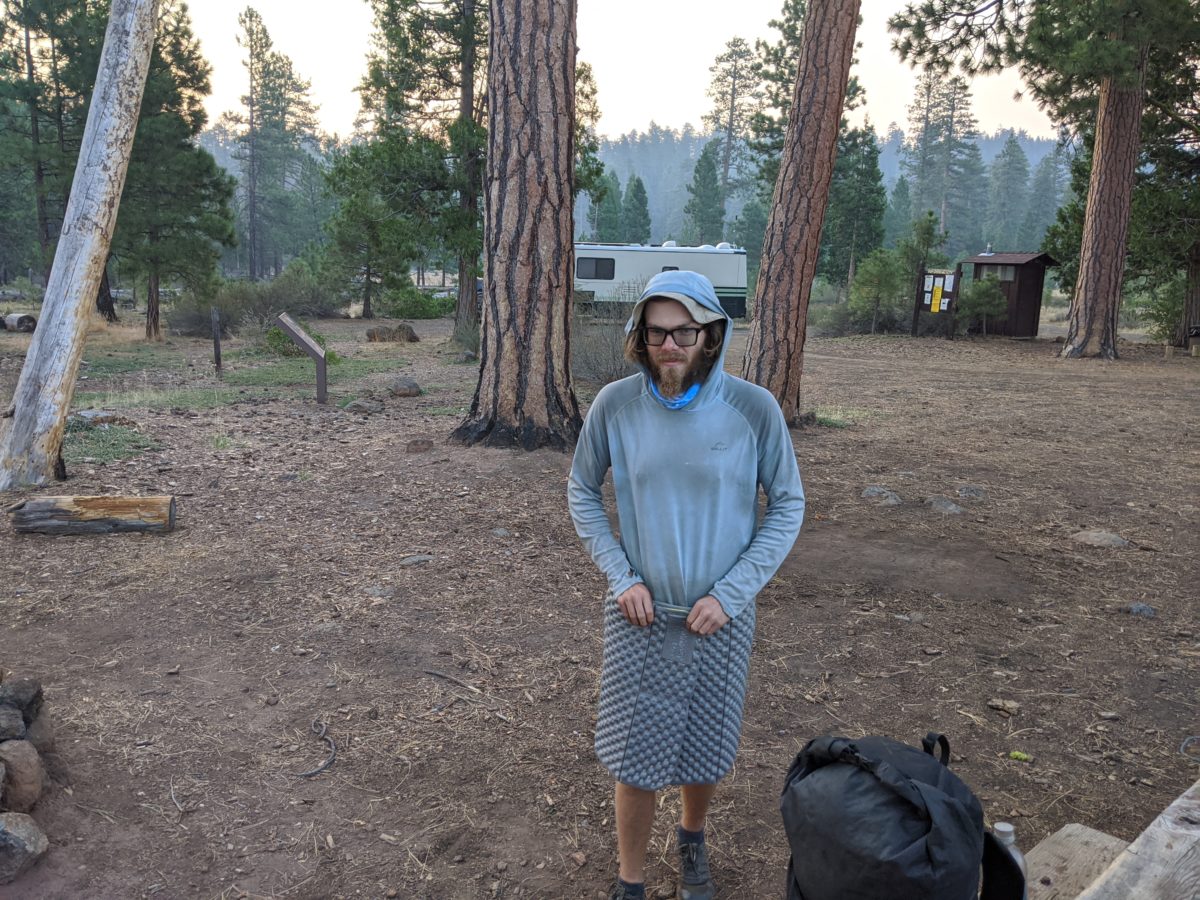
The main goal of the morning was to get some packages sent before I had to vacate my hotel room. Since I could no longer trust the post office, I visited the paint store where UPS shipping could be bought. Over the course of the morning, I visited three times to construct three packages.
The Quintopia pint glasses and other odds and ends. (Spoiler: there was no good packing material, and the two fragile stickers on the box weren’t enough signal, so only 3 of 6 glasses survived the trip.)
Another batch of food which I bought that morning to be shipped to Old Station.
The wrong phone case to be shipped home so it could be returned to a Victra store.
Once this was done, I could stop for brunch at the cafe on that same street that had tables strewn all down the sidewalk and still get back to my room in time to move out.
I spent the next couple of hours after that on the motel front lawn making phone calls and writing a blog post using the motel wifi. I also chatted with a man who was staying in that motel in exchange for doing some housekeeping and had cleaned my room when I checked out. I gave him my last root beer and the rest of my grapes.
When these sundries had been tidied up, I went to stand on the road out of town that led back up to Bucks Summit. It was a block down from the courthouse (where today there was a Trump rally in the exact location of the previous day’s Democrat rally–a very politically diverse little town) and from the charred ruins of the brewery and the crisis intervention center that used to provide showers and laundry to hikers but had burned two weeks before.
After a bit, a guy picked me up and carried me as far as the next town, dropping me where he was turning off the road just before it went around the curve. I started to walk up the road for a better place to hitch from but was accosted by a large family hanging out in their front lawn. It was a hot day and they gave me cold seltzer. (I had neglected to fill my water bag with ice this time.) In exchange, I gave them small talk and the URL for this site.
It wasn’t too long after leaving there that I caught another ride that got me all the way to Bucks Summit. It was early afternoon, but I wasn’t the only one hitting the trail headed north that day. There was a group of young men starting a loop around the lake who followed me onto the trail (where I met a ranger who had just tidied up this section), passed me as I stopped to collect some water, and then wandered off the trail at a random place where I passed them for the last time (as they intended to take the Spanish Peak trail instead of following the PCT).
I dry-camped by myself in a small wooded site on the side of a ridge.
Total distance: 7 miles
This flower was gifted to the woman who drove me to the trailhead. I thought Daddy would like it.
Day 2
Up and going with the sun, which was easy to see from the eastern edge of the ridge I camped on. The gnats and flies were miserable just as soon as I got going, but I had to stop and repack because I had accidentally packed my head net inside my tent.
The morning was a brisk 12 miles all downhill into Belden. Very easy hiking but brutally hot and exposed. The thermometer read 101 within Belden itself, so I spent the majority of the day at the resort there.
The first few hours consisted of buying a few items I had run out of at random marked up prices, eating a Belden Burger and onion rings with a beer or two (and a root beer or two), uploading and scheduling another blog post, being annoyed by a woman who laughed just like Fran Drescher, and filling my water bag with ice. By this time, I was aware of the first nearby fire which had closed a section of trail back near Quincy-Laporte Road. I was glad I had gotten through that section ahead of it just days earlier.
Then I went down to the local beach swimming hole to cool off until the sun started to fade. It was an extremely popular spot that day, and almost everyone there was drinking but me. A great way to spend a day that hot I suppose.
I started hiking out by 6pm to start the big climb out of town before sun set (but after the heat had someone subsided). The trail started with a long overgrown brambly section that made it hard to see my feet, but it was easy climbing besides that.
It got more rocky as the twilight faded, though, and that was not a good combination. I tripped repeatedly on the toe stubbers. So I stopped to get out my headlamp. As soon as I turned it on, I turned to see an owl sitting on a bendy stalk right in front of me. I said “Who!” and the owl started visibly. It turned its head all the way around because I was clearly blinding it with the light, then took off flying silently up the trail to hide in a tree.
Another hour of climbing brought me to the Williams Cabin Site, where two tents were already filling the only visible tent sites. The folks inside were awake and said they had no idea where another place to camp was, but the Guthook app clearly said there was space for 5 tents nearby. After wandering in the woods near the trail in both directions, I eventually stumbled upon the real campsite and set up my tent. I skipped making supper because I was still plenty full from lunch.
Total distance: 18 miles
It was so cute seeing this couple climb into this tiny raft to cuddle as they floated around the river. This photo is titled “The Bridge on the River Kawaii”
Day 3
When I packed up in the morning, the other two campers had left just barely ahead of me, but moving fast enough that I couldn’t catch up to meet them. Oh well.
I stopped to soak my shirt on every stream I crossed (because it was still extremely hot), and on one of those occasions Crazy Legs came up behind me, having just started the section early that morning and being incredibly fast. He shared some pumpkin seeds and some stories. He indicated he was doing 30s no problem despite living off a pack full of Chips Ahoy® and pumpkin seeds found in hiker boxes. When asked about cat holes, he said he never had to dig them because as soon as he hit the trail his body turned into a machine that took in food and put out miles and nothing else.
He also asked to see the soles of my shoes to see if I was the source of the Nutter Butter® shoe prints. After some shoe talk, he let me try on his shoes (as he happened to be the same size and he had recommended the style highly). I decided they weren’t for me. He went ahead, never to be seen again.
I stopped for lunch in the middle of a rock fall. While I was eating, a buck landed right next to me, clattering on the rocks as if he had fallen from the sky then turned and wandered off when he saw me as if he didn’t know what he had gotten himself into. I saw him again further up the trail before he finally moved off in a direction I wasn’t going.
All along this long climb, the trail was marked by small metal placards with diamonds on them nailed to trees, and someone had taken to intermittently graffitiing encouraging messages on them. I was happy when late in the day I finally reached the one letting me know I’d finally done it.
As the sun had started to disappear, I reached a road where stood a pipe ejecting gobs of cold water into an algae-filled trough. Fittingly named Cold Spring, it had a number of tent sites behind it. It had been a very short day miles-wise, but my legs were very aware of the nearly 3000 feet in elevation gain under a pack at full leaving-town weight. The water falling from the pipe provided some wonderful white noise for a good night’s sleep.
Total distance: 12 miles
Day 4
It was only a few miles into my hike when I turned off to have a snack near the Butte County High Point. It wasn’t anything to see, but it was close to the trail so why not? It briefly rained while I was sat there, but the rest of the day was clear and hot.
I stopped for an hour or so on the exposed ridges near Eagle Rocks because they had good Verizon data service and I needed to download some more audiobooks. I also took some pictures of the distant peaks swathed in what was surely the smoke of distant wildfires. But it wasn’t at all hazy where I was.
I stopped for lunch at a dirty road crossing frequented by dune buggies fancy ORVs. Just as I finished, the skies opened up in a sudden shower and my bowels responded with a sudden urge to move, leaving me running from tree cover to tree cover looking for a suitable place to go without getting soaked. Of course it stopped raining as soon as I was done.
Some of the trail here consisted mainly of piles of pea-sized gravel on the sides of hills, and at one point, the trail crumbled underneath my right foot. There was no way to save my stride at the speed I was walking and I immediately face-planted hard. My right calf was cut wide open on a larger rock that just happened to be right there in the way.
None of the water was particularly close to the trail on this section, which pretty much stayed on the ridge. I had to go 0.3 miles down off the ridge to fetch water from Little Cub Spring, and that was the option that required the least extra walking. It did give me an opportunity to wash the blood and dirt off my calf at least and put on a better bandage.
I dry-camped in a flat nook right next to the trail near the Carter Meadows trail junction. A short day, but I would have no trouble making up the miles as my pack got lighter.
Total distance: 13 miles
Day 5
This next section led through forests owned, maintained, and logged by a lumber company. It started with a downhill jog past the PCT halfway marker (where I signed a log that had been signed by many folks I recognized, including by HeiZenBerg just the day before) to the highway leading to Chester. But I had no need to go to town at the moment.
I ended the day in a very popular camping area for hunters near Stover Spring. All the best sites had tents and campers in them but I didn’t see a single person for the entire time I was finding a spot, setting up camp, eating, going to bed. There was one doe in the area investigating the camps. I think she had been there before, knocking over all kinds of things, like my neighbor’s pop-up privy tent. I saw her panic when she nearly tied herself up in a loose end of clothesline. Very funny.
I saw a couple of trucks and people come in very late, but no one came near our spoke to me. Ah well, I was anticipating a big fun day the next day and went to sleep early.
Total distance: 17 miles
Day 6
I packed up and left that site having seen only a single human walk by. I got some water from Stover Spring and began my highly anticipated day of entertainment. The haze from the fires cast a pall on the forest but not my spirits.
Late in the morning, I stopped to wash my feet in the North Fork Feather River. Unlike the Middle Fork, the swimming options here were very slim. I found a small swimming hole but it was getting late and the haze caused by smoke from one of the wildfires was blocking that good sunshine. I would have frozen getting out.
I walked down to a nearby campground to get water, eat lunch, and dump my trash. I asked a man camping there about the fires but he didn’t know anything.
From there, it was time to head into Lassen Volcanic National Park.
Even though it was only a few miles from where I would be stopping for the day, I stopped at Boundary Spring and fetched a quart or two.
Soon, I came to the turn off for Terminal Geyser, and dropped my pack for the side trip. The Nutter Butter footprints went this way too. By this time, I suspected they belonged to HeiZenBerg because of how far they had come and I was glad he had gone on following Pants’ apparent trip-ending injury. Not that I had any reason to think he wouldn’t.
Terminal Geyser isn’t a geyser at all, but a large steam vent. The kind of place you don’t get too close to because you will definitely get scalded by the steam pouring out of the ground.
Another mile or so brought me to the edge of a boiling lake. Yellow with sulfur and marked by warning signs, it was clear this wasn’t the sort of hot spring you could soak in.
And finally, at exactly the time dinner was said to be served, I made my way up to the outdoor dining area of Drakesbad Guest Ranch. And who should I find seated there and already eating but HeiZenBerg and Pants! I joined their table to catch up.
It turned out Pants hadn’t quit after all and was just hiking on the injury, some kind of hairline fracture that wasn’t likely to get worse without announcing said worsening with a great deal of pain. In fact, they had been the occupants of the pastor of tents at Williams Cabin Site that I hadn’t been able to identify in the dark or catch up with in the morning. Pants was also confirmed to be the wearer of the literal wafflestompers, and HeiZenBerg hadn’t taken the Geyser detour at all. They had camped at Boundary Spring, and he had opted to skip it so as to make it to Drakesbad for breakfast. The two had been there, washing clothes and hanging out at the poolhouse, for the entire day.
Dinner was incredible. A buffet of half a dozen meats, a dozen varieties of starch and veggie combos, as well as breads and cookies. To top it off, I could order beer, root beer, and even a root beer float for dessert! It remains my gold standard for PCT dinners to this day.
After dinner, we all walked over to Warner Valley Campground, the only place in the park we were allowed to stay without a permit, and stole a campsite for the night. Not that there was anyone besides us and a couple of other PCTers there that night. Anyone with sense would prefer a reservation at Drakesbad anyway.
Total distance: 15 miles
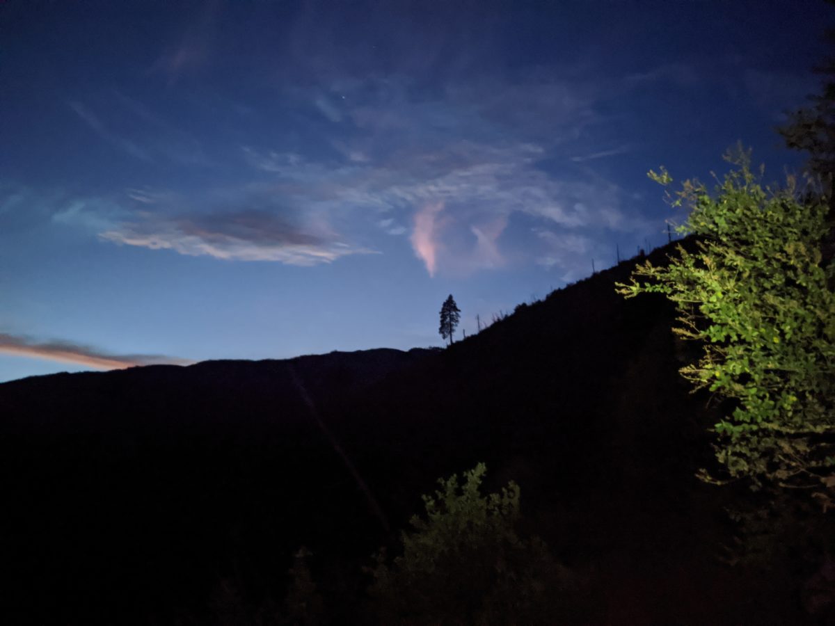
Sun through the haze at about 6pm
Day 7
After packing up camp and storing our packs in the bear box, we, of course, returned to Drakesbad for breakfast. Who could resist that temptation? After all, HeiZenBerg had started the previous morning with chocolate chip pancakes! What would they have this time?
French toast, it turns out, along with plenty of coffee, eggs that were brought out already cold, sausage, potatoes, butter, etc. I went ahead and got a root beer with breakfast too.
During breakfast, Pants and HeiZenBerg had a bit of a spat, each interpreting the other as being in a bad mood. This would lead to some awkwardness between them for the next few days, and in particular, their not talking to each other. Of course, I was not implicated in any of this and could and did freely talk with both. Often about the other and how to resolve the disruption.
Jeff and I left for the campground first and were basically ready to go by the time Adrienne got back, so we walked out together. I chased him up the one steep hill of the day, climbing out of the smoke settling in the valley. The haze was just as bad as the previous day. We stopped together to collect water after crossing the big creek on a log. I left first, but he passed me later when I stopped to soak my shirt in a stream.
At Lower Twin Lake, I stopped for lunch, sharing a lakeside with Chipmunk and Blueberry (the other two occupants of the campground the previous night). I could see HeiZenBerg doing something similar on the other side of the lake. After I finished lunch and the other two had left, I went for a quick swim in the lake to cool off. The sun was really racing through the haze and it was my last chance before a long dry stretch.
I passed Pants lunching on the other side of the river but hardly stopped to chat. I had a good 12 miles left to do and no reason to stop again until it was done.
Or so I thought. In fact, I stopped again within a mile as I entered the burned zone. It was like an apocalyptic wasteland with all the dead trees creaking in the smoky wind and the haze blocking the view beyond a thousand yards. There’s a picture of the scene below, but you wouldn’t be too far off of you’re imagining the first Silent Hill. But more importantly, the lack of tree cover meant high probability of sunburn, so I sat down on a log and covered my legs in sunscreen.
Then I got back up, and set off at top speed through the wasteland, slowing only when a snag blocked the path. I stopped once for a snack about 2 hours in when I found the only shady spot with a sitting log. But the trail was painfully flat and boring, so aside from that, I practically ran through it all.
Once outside the park boundary, the trail canted downhill and dove back into the trees. But it wasn’t any more interesting because it went right through a tree farm, also notoriously boring environments.
Finally, somewhere around 5:30, I reached the site where HeiZenBerg had set up camp right next to Hat Creek. After I had finished my nightly ritual, about an hour after arrival, Pants came wandering up too and set up her tent in the middle of a game trail above our site. I went up to talk to her before going to bed.
The next morning, I would be the first one out of camp in a perfect reversal of Williams Cabin Site’s departure scenario. It was only a few miles down to Old Station and I had a lot to look forward to there. But I’ll save all that for the next post. Over and out!