Categories
PCT OR Section G

Oct. 18: Goin’ Up Around the Bend

I got up with the sun or just before it, and the wind and rain (or condensation dripping from trees, which is functionally the same thing) were still getting busy. I packed up some of my things in it, but then put on my packa, put my water bag and air mat and electronics bag in its big pocket, and went down to the lodge again.

There was a sort of small stage outside one side entrance well under the eaves of the lodge, so my plan was to roll up the mat there where it could stay 90% dry. But instead of doing that right away, I laid all my stuff out on the stage and went into the lodge.

It turned out the side entrance opened on a hallway mainly intended for employee use, lined with employee offices and utility rooms.

Further into the lodge, I found the main lobby. After exploring it a bit, I talked to the clerk, who directed me upstairs to the restaurant where free coffee was offered. This was the space I had been in the previous night.

But once I saw how empty the restaurant was (at 7am on a nasty day), I decided to try to get some real breakfast. I had no reservation and I looked as gross as a hiker always looks–worse, maybe, given the amount of mud I’d encountered two days prior–but they could seat me right away.

I had an enormous three course breakfast featuring salad, meats, potatoes, and a pastry. It ran me 60 dollars. I hoped it would give me the motivation I would need to get me through a miserable day’s hike.

Then I spent some time in the hotel bathroom. Money isn’t the only cost of an enormous breakfast. Plus, the clerk said it was the best place to fill my water bag.

Finally, I went back out to pack up my air mat, then up the hill to pack up my tent. Finally, once again totally soaked, I could start my hike.

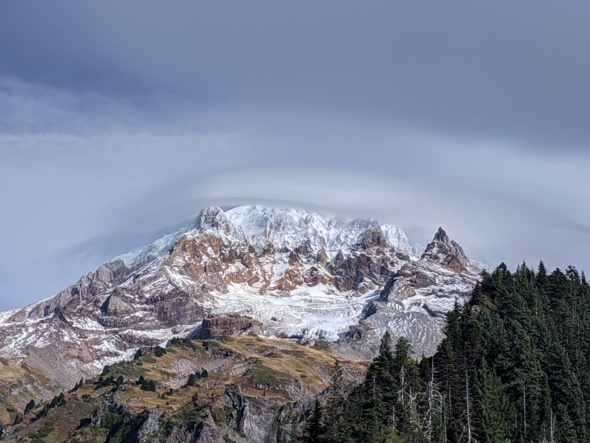
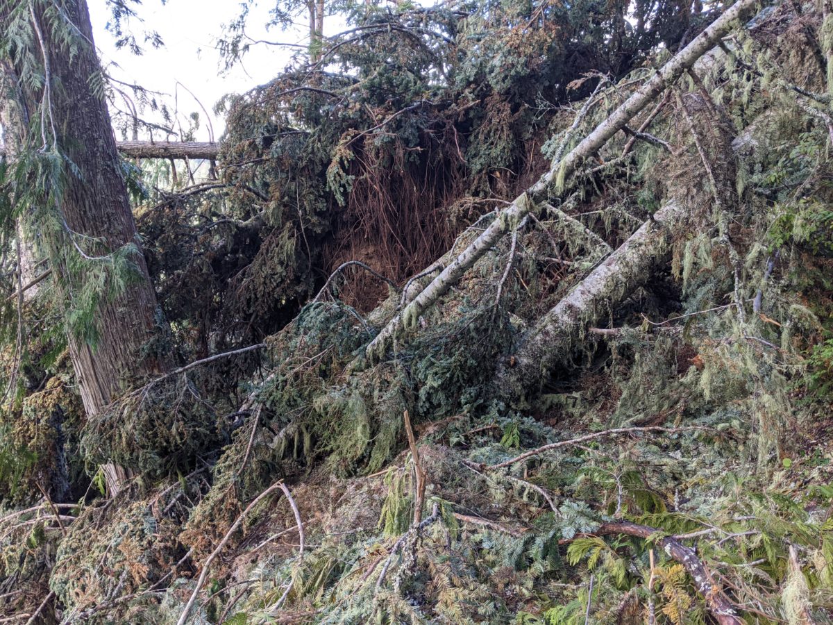
It was only another ten miles and most of it was downhill, but it was cold and foggy and there weren’t many views to be had. Also, there were still plenty of deadfalls to be avoided.

After I crossed the road at Barlow Pass, I started seeing more day hikers. More and more in spite of the weather. It gave me hope of getting a ride from any of this number who would return to the trailhead parking lot.

So when I got to the trailhead, I crossed the rode and stood in front of a semi parked on the shoulder where anyone leaving the lot and going my way could pull right off beside me.

No luck. This was probably the longest wait for a hitch I’ve had to date. Despite being bundled up and in rain gear, the cold fog soaked through and my temperature continously dropped. I danced in place to try to stay warm, but another hour there would have put me in hypothermia territory. And it’s not like there was no traffic. There were dozens of cars per minute. It’s just that no one there wanted to help me get somewhere warm and dry.

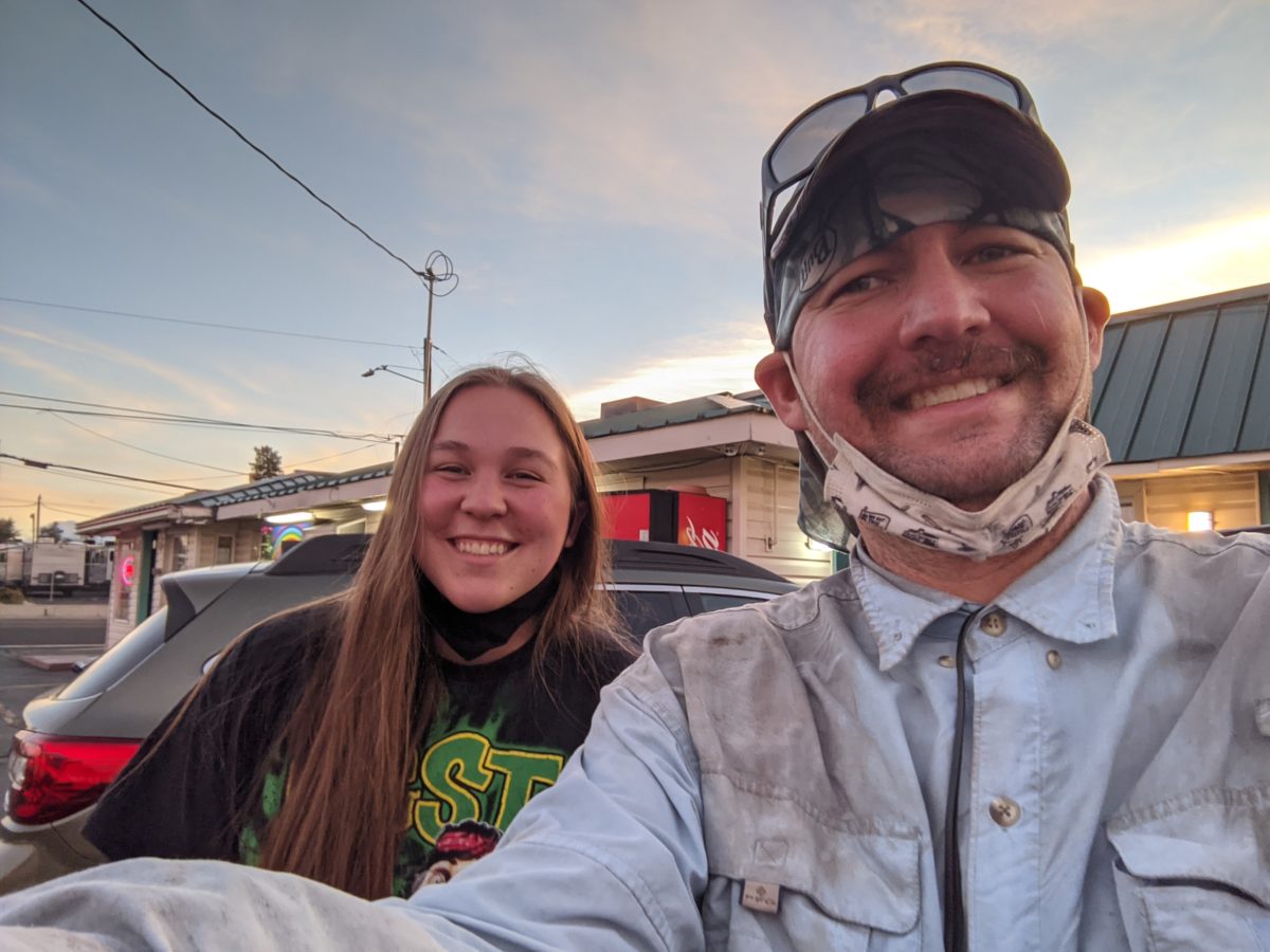
Until a hero comes along! Another unicorn, in fact. 21-year-old single female Shea and her pupper Stevie. They were headed to Bend for a day of rock climbing with a friend and was willing to take me with. This was nearly a two hour trip, and she let me run the heat aimed directly at me the whole way.

The beauty of the desert plateau we drove into was incredible, as was the river at Warm Springs State Park we stopped near for a dog walk break.

Along the way, I reserved a couple of nights at a motel and Bend called Rainbow Motel that was incredibly cheap and well-situated relative to the places I needed to go. As soon as she dropped me there and I got my room key, I cranked the heater in the room up to 11 and left it there.

And then I took off my wet clothes, took a hot shower, changed into my long johns, ordered a pizza from Domino’s for delivery, and spent the rest of the evening in bed just enjoying being warm and dry.

Total distance: 10 miles

Categories
PCT OR Section G

Oct. 17: A Fast, Motivated Climb

I slept in this morning for obvious reasons–my late bedtime and the continuing rain. When I finally emerged from my tent where I had been slowly and casually packing up, another hiker came down the trail, having survived the same mess the previous day but stopping even further back than me. I again apologized for being in the trail the log was blocking anyway.

It was after 11am by the time I started hiking again. After passing the one log that had stopped me the previous night, the trail was largely clear all the way down to Ramona Falls just a quarter mile away. There were many day hikers in the area. I went ahead and ate lunch right there near the falls before even truly getting started hiking.

I missed a turn where the side trail rejoined the PCT just above the falls and ended up walking nearly a mile north on the PCT by mistake. It wasn’t completely clear, but it was a sight better than the Timberline Trail. It was obvious Owl and Phoenix would have gotten to Timberline Lodge the previous day no problem. I passed a man collecting mushrooms in a bucket twice, confusing him a bit. He had the nature of the trail a bit confused in his mind and had contributed to my confusion when I passed him the first time.

Finally headed the right direction, I committed myself to top speed, hoping to complete the ten miles to Timberline Lodge by 6pm, when it was supposed to close. It was going to be tight, requiring maintenance of top speed uphill, running down hills where possible, and luck that the trail was mostly clear. And it was mostly uphill.

But it was a beautiful day and a beautiful bit of trail with only a dozen or so spots with trees blocking the trail. Even so, I was getting discouraged as 6pm got closer. I made it to the door at the lodge at just minutes before the deadline.

It turned out it wasn’t a deadline after all. Maybe it was the fact that it was a Saturday, but the Ram’s Head Bar on the second floor was wide open. So I got me a stout AND an incredible hot chocolate.

Annnnnd a root beer.

I watched the sun set from the windows of the nook. I saw some pictures on one guy’s phone of a pair of twins he’d seen earlier dressed in exactly the outfits the twins from Kubrick’s The Shining (which famously used exterior shots of Timberline Lodge as the exterior of its Overlook Hotel). The little girls involved in said photo shoot hopefully had absolutely no idea why they were being dressed in matching blue dresses and asked to stare unsmilingly into a camera.

While we’re on the subject of The Shining, I should mention that I saw a guy sitting at a desk near the entrance I used typing on a manual typewriter. I thought perhaps it was something the lodge put out for guests to mess around with, but I was wrong because by the time I had gotten my fill of the lodge’s strong cell service and went to leave, he had disappeared and so had the typewriter. But more on him in the next post.

The temperature had also plummeted and a fog was coming in. A wet night had been forecast for the mountain. All of the guests that had been hanging out on the patio had vanished. I stepped back inside to put on my pants, added my down puff, then went back out to pack up my pack and walk up the hill.

You see, although the Timberline Lodge will charge you $285 a night for a room, there is a free campsite for maybe half a dozen tents just up the hill beside the PCT, maybe a five minute walk away. Probably not where you would want to stay during the height of ski season, but it’s not exactly their mountain, so what could they do about it if you did?

Anyway, I needed to find said site. Luckily, I spotted the headlamp of a man headed up the hill. I asked him about it. He was already set up there and had stayed there on many occasions. I found a spot near his tent and tried to set up quickly as the wind blew in more fog that would thicken into rain. I cooked dinner in the vestibule under the closed flap of the rainfly and hoped the next day wouldn’t suck too badly. I knew it wasn’t going to be the most fun, but I had high hopes it would at least start and end well.

Total distance: 12 miles

Trail progress: 10 miles

The trail where I made camp the night before

Ramona Falls
Mt. Hood with a Fog Hat
Categories
PCT OR Section G

Oct. 16: The Longest Shortest Day

Thanks to the cold and the late night preceding, I only started packing up at sunrise. But it didn’t take too long, and I was out and hiking by 8. Phoenix and Owl did not catch me up.

After an hour and a number of encounters with weekenders, I had made it to the junction near the top of Bald Mountain. Based on the comments on Guthook, I thought that following the Timberline Trail here would be more interesting than the PCT. And it did turn out to be exactly that.

But there is a reason that “May your life be long and interesting” is considered a curse. And the Timberline Trail was that kind of interesting.

The first two miles or so were amazing, filled with views of the valley and then three easy crossings of the headwaters of the Muddy Fork. I could even see that the other side of the valley had a number of trees fallen on it, and expected it to get somewhat technical coming back up. But the PCT was supposed to have downed trees on it as well, and I had come through a few miles of tree falls the day before with only a few hours lost, so I grit my teeth and dove in.

It turns out I had severely underestimated the difficulty of the problem before me. And I’m using problem in the sense that climbers use it here. Because for the next nine hours, I did hardly any hiking at all. It was a lot more like caving, and even when I could momentarily find the trail, it lasted only a dozen feet at most before I had to resort to climbing, crawling, beam walking, backtracking, detouring, sliding, hanging, falling, and diverting yet again.

As the sun disappeared and a thick fog set in, the jumble got so thick and impenetrable that I had no choice but to descend hundreds of feet down the hill from the trail and scramble and slide across the crumbling hill. Eventually, covered in mud, blood, and cuts the scabs of which would still be around a month later, I hit a wall of thorny plants and had crawl straight up a waterfall to find the trail again.

Soon, I found myself at the mouth of the valley again, about two miles from where I had entered the fray nine hours before. It was pouring rain at this point, but I didn’t want to get out my pack cover/rain jacket because it would have been shredded by the obstacle course. So I and my pack were as much mud and water as fabric by this point.

After a somewhat easier quarter mile down into the next valley, I hit another tree that was going to force me way off the trail and said to myself “I just cannot do one more tree tonight.” I set up my tent right in the middle of the trail in front of that tree and got in out of the rain as quickly as possible. I changed into the dry clothes from deep in my pack and crawled into my sleeping bag before even starting to cook.

I was just about to finish cooking when someone else came past my tent and back again. Turns out I wasn’t the only one dumb enough to push through on that particular section of trail that day. But clearly this guy was more tenacious than me and pushed on into the night. I apologized for setting up on the trail, even though it was impossible to stay on the trail in that spot anyway.

I can tell you, after the most difficult day of hiking to date, it wasn’t hard to sleep that night.

Total distance: 7 miles? Maybe less?

Trail progress: 7 miles

Average pace: Almost 2 hours per mile!

Average pace on the difficult part: 4.5 hours per mile!

This is just a tiny taste of the scope of the mess. I was too busy working to take pictures or even to drink or eat for the most part.
Categories
PCT OR Section G

Oct. 15: The Owl and the Phoenix /The Obstacle Course Begins

Got a fairly early start. Left out around sunrise.

After a few miles, I arrived at the Eagle Creek junction and someone was there. Phoenix introduced herself and soon Owl appeared also. I wasn’t completely surprised to see them because Phoenix had posted their intention to do the section on Facebook, but I had thought they were farther ahead.

Owl directed my attention to a ramshackle outhouse before leaving. I definitely took advantage.

I took lunch beside Wahtum Lake, beset by a chill wind.

At some point later, I passed them cooking lunch, which for Owl looks a lot like Snape making potions. I let them know I intended to make it to Lolo Pass.

Soon after that, I entered a section with a lot of downed trees. Frequently, they were such that they couldn’t be surmounted or crawled under, so the only route was to go way off trail up the ridge. In this area was a lot of a thorn covered tree I didn’t see much of anywhere before just off the trail, so those also had to be avoided. Fortunately, these trees only came in ones and twos.

The deadfalls started getting more frequent once the area around the trail leveled off, which meant I ended up spending more time near the trail than on it for the next few miles.

The obstacle course was finished by the time I began to descend toward the pass. The sun disappeared around this time as well. But I made it to the pass only about three hours delayed from when I had expected to arrive. By the time I had my tent set up in the nice campsite there, there was truck riding around the pass. It turned out to be a tow truck driver called there by some mystery men I hadn’t seen to pick up a mystery car I hadn’t seen and having GPS issues thanks to the lack of cell service.

Phoenix and Owl never arrived.

A bit of historical trivia: Lolo Pass was the pass used by Lewis and Clark to reach the west coast.

Total distance: 21 miles

Categories
PCT OR Section G

Oct. 14: Cascade Locks and the Climb out of the Columbia Gorge

Following a long morning of gathering and packing right up to the time I was supposed to check out by, I set out into the tiny town of Cascade Locks to buy some snacks for breakfast and some Emergen-C for my daily vitamin D supplement.

The grocery store didn’t have any vitamin D in any form (but it did have pickle chips, yum!), the convenience store across from it didn’t have any, and the other convenience store was closed while glass was being installed and wouldn’t do curbside delivery, but probably didn’t have any either. That was every store within five miles, so after eating the food I had bought, I set out for the trail without the supplement.

The trail picks up under a bridge above the Bridge of the Gods and immediately starts climbing up the side of the gorge. I was climbing out with a full pack and not really feeling motivated or particularly speedy. Then another hiker coming out for a long weekend trip came up behind me. We started chatting and I sped up to keep his pace to the top of the gorge and along the plateau beyond. He stopped at the first tent site, a little nook on the edge of the hill in the trees, but I kept going. I stopped in a clearing to do my nightly text in case the trees were thick at my final destination, then continued down to a trail junction with a bunch of downed trees in the saddle near it overlooking the remnants of a fire. It was supposed to be a campsite. So I camped. The last light of dusk was disappearing when I started, so I got set up by headlamp light. I remember it being a pretty cold night, but not below freezing.

Total distance: 17 miles

A different sort of cornhole?
The toll plaza and PCT marker at Bridge of the Gods
When the snag forces you to crawl under