I got out of camp at 7:30 and stopped only an hour in because I liked the creek I was at. I had about 16 miles to do, but none of it was particularly interesting. Just the connective tissue of the CDT getting from one nice place to another. I made the same sorts of stops on the same sort of schedule I had been making for days. I had lunch in an established campsite near a creek and some cows, and sent a message with my arrival time at the road. There were lots of blowdowns, then I came out into the open ranch on dirt roads with all the cows. It was uphill all morning and downhill for the last few miles.
I came to the road around 5:30, and mom and Gail arrived about 12 minutes later, having been driving around for an hour unsure of where the trail crossing was. No cell service interrupted their ability to Google Maps. But I didn’t have to wait long in the end so it didn’t matter.
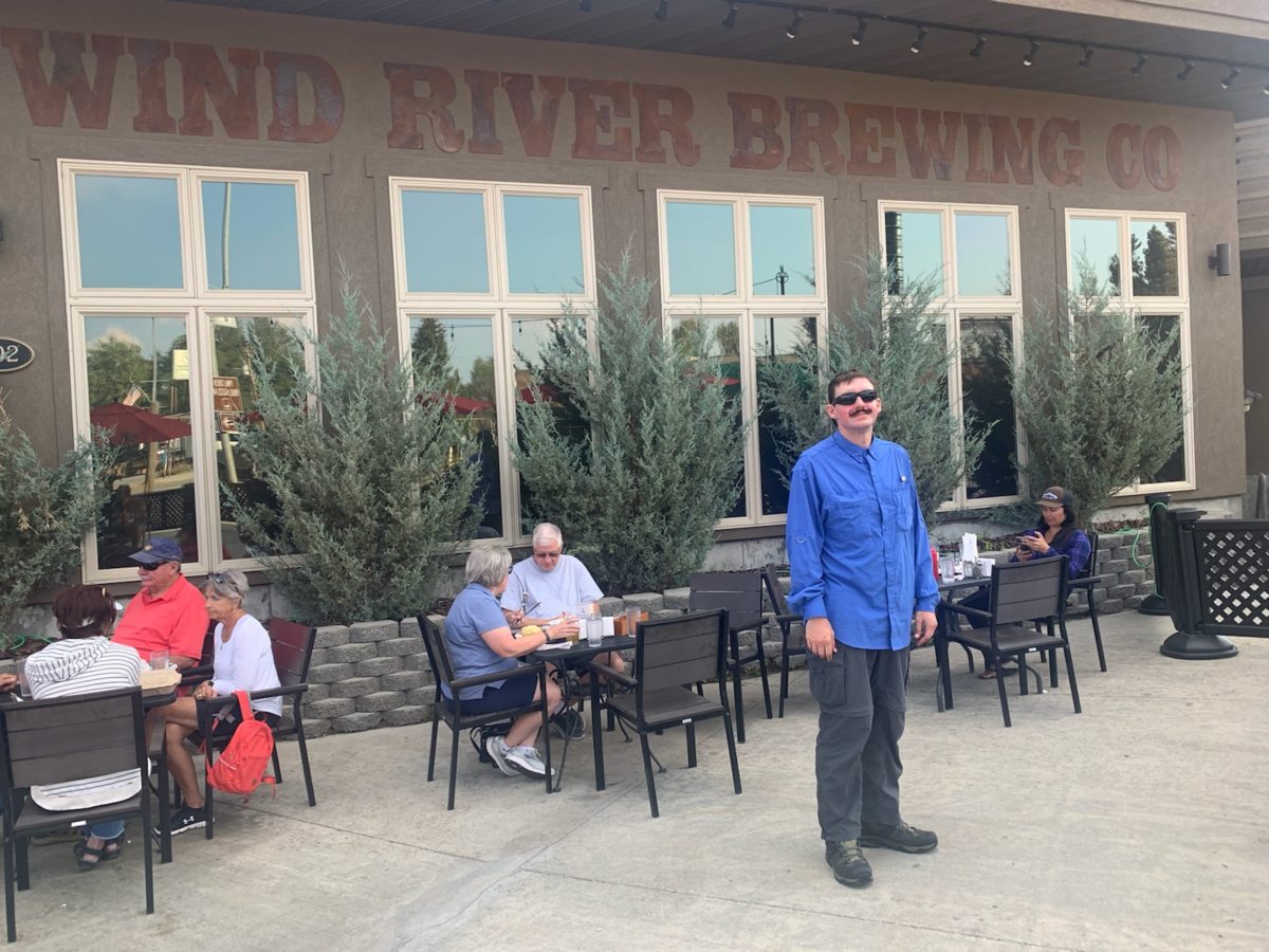
We went to the Holiday Inn Express so I could shower and change, and an hour later we went out to the Gannett Grill for pizza, salad, and (for me) beer. The pizza was okay but the salad was pretty good.
Back at the hotel, mama and I took advantage of the hot tub and pool for the little while I had before I needed to return to the bathroom, where I spent another hour. The ongoing issue continued off the trail with even more frequency, but a solution would be found soon.
Anyway, on the whole, I was just tired all day and didn’t see much of interest.
I started packing at 5:30 and hiked out before 7. It wasn’t a particularly windy morning, but my good choice of campsite also protected my stuff from a frosting that everything else in the valley received. Nothing in my campsite had the slightest frost.
After descending to the trail beside the creek, I followed it down into the ever thickening forest at the lower elevations. At some point, there was no space for the trail to run beside the creek anymore, and it turned up the hill and into the middle of the forest. Soon the struggle began.
What I mean is that the next 3 or 4 miles had so many blowdowns, it took me five hours before I was reasonably out of the thick of it.
When the blowdowns first got so thick as to hide the trail, I just kept climbing higher, keeping close to a rock face far up the hill where fewer trees grew and therefore fewer trees fell. Eventually, I had to descend straight down a ravine back to where the trail was. There were a couple of snack breaks in here, as even when I could follow the trail again, I still had to leave it often to work my way around large piles of blowdowns. I used up all my water in the couple of hours I spent here.
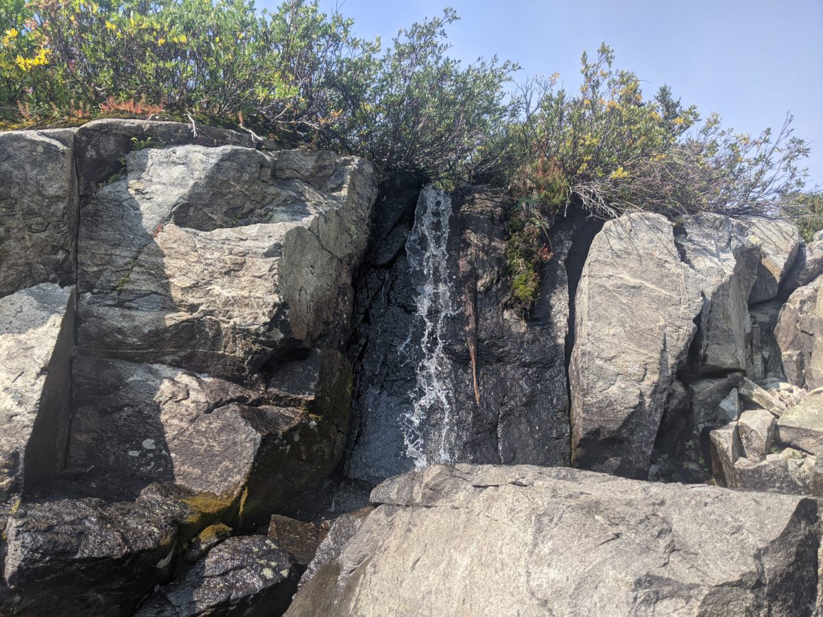
When I finally rejoined the CDT, I immediately arrived at a creek where I had to take a long break to filter some water. When I left again, I made the mistake of trying to generally follow the trail. This was not even close to possible, and I ended up just climbing over the rocky tops of every minor hill that stood adjacent to the trail until forced to descend into the narrow, muddy, and grassy meadows between them. The descent was inevitably a slow careful picking over more piles of blowdowns. When I found an open area with some sunshine and a respite from the blowdowns, I stopped for lunch for an hour, then descended into the mess again.
Eventually, I found a clear piece of trail up the first part of the biggest mandatory climb of the day. It carried me with some speed straight up to an overlook of Little Sandy Lake, then was immediately lost in another even bigger pile of blowdowns, the most technical maze yet. There was no going around this mess. The only way out was directly over the top of it, then much zigging and zagging around what was left near the top of the hill before regaining the trail.
The descent on the other side let up somewhat on the punishment. Most of the blowdowns could be avoided by ducking under or going around. It was 3pm or so, when I met some nobos climbing the hills with their dogs, who had apparently walked all the way from New Mexico and didn’t seem much worse for the wear. They told me the blowdowns cleared up after a mile or so. I told them to just go down to the lake and walk the shore around rather than to try to follow the official trail like I had.
Once I left the wilderness area, things got much better. Chainsaws were allowed here, which meant most of the blowdowns had been cut. There were some blocked sections I had to go around still intermittently after passing Sweetwater Trailhead, but the whole section was clearly just a pointless bit of connecting trail built to get the trail off the road it had once followed, so I just decided to take the road down to the campground.
There was a huge group of young amateur backpackers in the campground just hanging out in the green space near some SUVs. Teens or college kids, I think, and there weren’t enough vehicles there for all of them, so I guess they had been dropped off there. Anyway, they were playing Frisbee when I arrived, and when I finally identified a few campsite where I could cook dinner at a picnic table, they had gathered into a circle for some sort of briefing then hiked out to a nearby hike-in tent site.
The campground was a godsend. There was a brilliant creek right there to provide water for dinner. There was a huge trash dumpster next to the privy so I could free up space in my bear can and save some weight. And the convenience of a picnic table for cooking and eating can’t be overstated. There were also fire rings in every campsite, and the ones I passed hiking out were surrounded with immense piles of freshly cut firewood.
After working my way across the creek to the CDT on a log jam, I had nothing but easy hiking the rest of the evening. Even though it was rolling hills with some steady climbing at times, there were no more blowdowns, so I could do in two hours the kind of distance that took five hours in the middle of the day.
I could clearly watch the sun set, and once the light started fading, I started seeking a campsite. It was not an easy task, nor was it fun given the low light and my sore feet. If there was land that was level enough, it was usually covered with boulders or sagebrush or more blowdowns, or located directly under some already broken and precariously perched widowmakers. Finally, later than I wanted to stop, I found a rocky hilltop with a clear, flat, sandy spot just large enough for a tent in between the rock slabs. For various reasons, it still took another hour to get to bed and yet another to get to sleep. A long day and my latest night on the trail yet.
When I first woke up at 3:30am, the inside of the tent was covered with condensation despite my campsite being far above the creek and valley floor. I got out my towel and dried the inner ceiling and the outside of my sleeping bag, then slept through the 4am alarm to make up for it, pulling the hood off my bag up over my head and making it hard to hear.
I woke next just after 6am, before the alarm reprise. There was a wind blowing now, and it had already carried away every last bit of dampness from the inside of the tent. I hurried to pack as quickly as possible to lose as little extra time as I could. I climbed down the hill at 7, but I hadn’t made breakfast because I was out of water. I stopped where the creek was close to the trail and there was a tree providing good wind protection to collect and filter water and make breakfast. So it was nearly 8 before I was hiking in earnest.
I missed a turn at Shadow Lake, and lost more time climbing up through the woods back to the trail. This was kind of fun though, and I’m glad I got to see the creek coming down through that forest.
I lost more time to a loose bowel issue, and I was looking to do so again when Cliff and Lost caught up to me. I won’t get into it, but this issue cost me more than an hour throughout the morning, and I wondered if it had something to do with the alterations to my breakfast drink (use of a new protein powder in particular). I hoped it would not recur the next morning because it was very costly in terms of time.
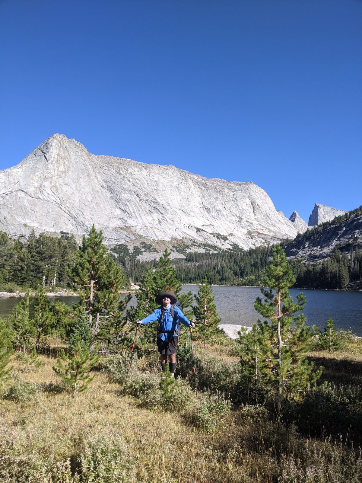
Next up was the climb over Texas Pass, which wasn’t that bad. There was a trail the whole way up. It read was steep, but I have seen steeper. It took less than an hour bottom to top. It was definitely no Knapsack Col. I stopped for my first snack break on a boulder at the top of the pass.
When I got around Lonesome Lake at the bottom of the other side, I caught up to Cliff and Lost most finishing a meal. They said they intended to finish the entire alternate that day. I was pretty doubtful I could, especially with the multiple unintended diversions. Really the overall difficulty of the section should have been a reason as well. I climbed Jackass Pass right behind them, passed them on the way down to Arrowhead Lake, then stopped for lunch on a sandy beach on its shore. I didn’t catch up to them again.
After picking my way across the rocks and slowly down a steep hill with a winding trail, then up and over a nasty rocky hill that was only sometimes a proper trail, I came to the swiftly flowing North Creek, where an overnight hiker lady from Utah was already filtering water, and I needed to do the same. I was here alternately watching the hikers pass through, the trout in the creek, and the water slowly leave my dirty reservoir for an entire hour.
Just down the hill from here was Big Sandy Lake, the biggest and most accessible lake in the area. Plenty of people here, but most were coming in or going out of the wilderness along the Big Sandy River to the west. I headed around the east end of the lake then left the alternate for an alternate-alternate going up around Clear Lake then up a flat granite water slide for a mile to Deep Lake, in my opinion the most beautiful lake I had passed all day. There were plenty of people hiking this route too, and I traded pictures with one group at Clear Lake. I stopped for dinner on the shore of Deep Lake, then headed out over the little saddle back to the main alternate about 6:30.
The trail on the other side dropped down to the edge of Temple Lake/Rapid Creek. I didn’t want to lose so much elevation just so I could gain it again climbing over the pass at the south end of the lake, so I left the trail to try to stay high. I had to drop down several times when I got cliffed out on the high route, and had to do some difficult (with a pack on) bouldering in a couple of places. I don’t think I was the only one to try it, as I found a lone pink Croc among the trees way up there far from the trail.
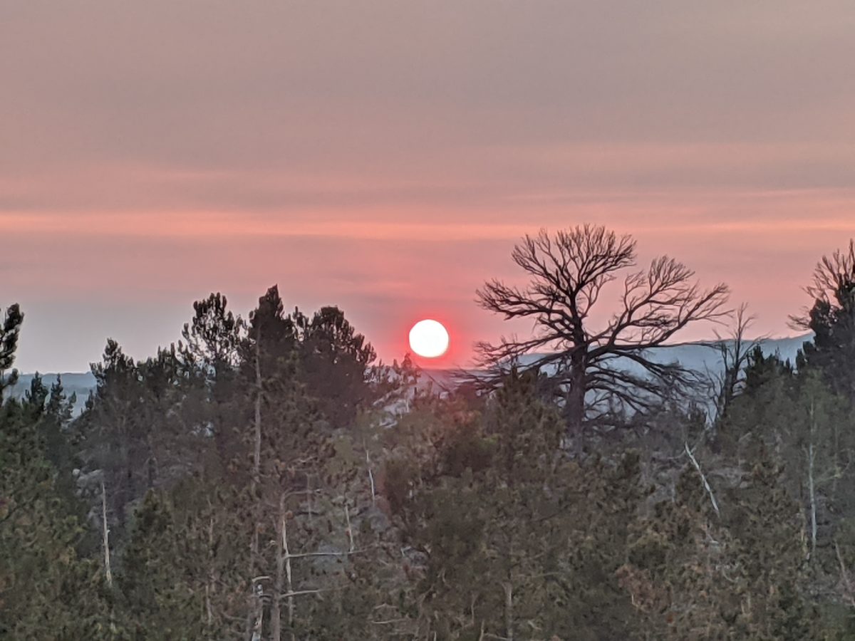
Anyway, after a while, I came to a trail proper that slipped gently up to the “official” trail, which climbed steeply up the side of the rock slide to the pass. I could have saved a lot of time by just going down to the lake and catching that trail at its base, but I had a lot of fun trying to navigate the high route. I came over the top of the last, steepest, and most technical pass of the day about 8pm, just in time to get some incredible views with the sunset colors.
There was something of a trail coming down the other side, though it kind of disappeared near the bottom. I found my own way across the outlet of the “Frozen Lake” at the top of the Little Sandy River and out onto the plateau beyond. This was far above the trail indicated on the map, so I descended toward the river and crossed the marked trail without ever seeing it. I thought maybe I had just missed it in the twilight, but soon figured out that it was only the vaguest suggestion of a trail even when I was right on it. Just spots where the grass was slightly less trampled or the bushes didn’t quite connect.
It was pretty dark by this time, far past my usual encamping time, and I was to the point where I was just looking for a flat and level spot far from water to make camp. I thought I found such a spot, and stopped to get put on my headlamp, but it turned out to be too rocky and too steeply sloped. Eventually, I spotted a big boulder straight up the hill, and went to look behind it, thinking it might hide some level ground and give it some wind protection. It was mostly as sloped as everywhere else around, but there was a tiny nook near the edge where the bushes met the boulder that was nearly level and just big enough for my tent. Not only protected from the wind but a lot of privacy too. I made camp.
Not many miles to show for such a long day, but very little of the trail going forward would be nearly as difficult. Luckily, there was room in the schedule for a somewhat shorter day, as long as the next day went well.
I let the 4am alarm and its backup ring out, but I was awake, uncomfortable, sleepy, but knew I needed to get started. So I eventually got myself going, first packing purely by moonlight through the tent and eventually getting my headlamp out. I was able to turn it off as soon as I started hiking just after 6.
Just down the hill, on the approach to Rambaud Lake, I scared up another early morning porcupine but it vamoosed before I could get a picture. The rest of the day, I caught no rare sightings. Just fish, cows, chipmunks, grouse, Gray jays, and other smaller birds.
I saw some lights of people packing on the other side of the lake. I started to go over there wondering if it might be Cliff and Lost, but it was three tents and people I didn’t recognize. I backed off before accosting them and stopped to put up my coat and headlamp.
Later, I passed that same guy who I had seen the night before climbing Knapsack and who apparently had hiked out to Pinedale just minutes ahead of me judging by his experiences stopped to take his coat off. We crossed the next creek together, me picking my way across the shallows taking advantage of the waterproofing of my new boots and him just wading straight in and saying it wasn’t that cold.
An hour or so later, I stopped at the shore of Lower Pipestone Lake to start filtering some water and take a morning break. A single tent stood by the trail a hundred yards ahead. A loud lady got out of the tent and looked toward me. I waved, but I don’t think she saw because she proceeded to take her shorts down and squat in clear view of me, then wander around noisily taking sunrise pictures of the tent before going back inside.
The old guy caught up to me there and stopped to wring out his socks. I was already leaving when he arrived. I left him there but I’m sure he passed me at my next stop. He’s a much faster hiker than me on average. I doubt the people in the tent ever knew we were there.
I started feeling really miserable in my gut a few miles later, an uncomfortable sensation that eventually turned into genuine GI distress and an emergency stop. This helped, but left me still feeling quite bad as I walked on toward a lunch stop. I hardly wanted to move during lunch I felt so bad, and I just kept hoping that eating would make me feel better. I still felt a little off as I forced myself to pack up and leave because there were still miles to do.
But I still felt a little bit weaker than normal for the next couple of hours. When I stopped for another break and ate and drank some more, I finally started feeling a little closer to normal. Cliff Richards and Lost Keys caught up to me at this point, but I passed them on the next hill. I got ahead of them on the long high plateau I crossed all afternoon, but they passed me again without seeing me while I stopped to eat dinner.
After dinner, I finally felt back up to my usual strength and powered after them, nearly catching them when they took a break on the other side of a creek crossing. I took a long way around the valley to cross a lot of smaller streams by rock hopping and got to where they had been just after they left. I saw them again just ahead of me at the turnoff for the Cirque of the Towers alternate, but they were outhiking me and I lost sight of them. I expected to get ahead of them again in the morning but getting up earlier.
For an hour, I hiked up the valley toward Texas Pass, but at 7:30, I climbed a tall hill overlooking the valley and made camp on the levelest place I could find that wasn’t covered with elk pellets or cow manure. It was right on the edge and had a great view of the valley, the creek flowing through it, and the spires above it. Best of all, it wasn’t crowded with other tents and hikers like I expected the area just below Texas Pass must have been. I was in the tent just after 8, ready for another early bedtime, looking forward to another early morning and beautiful weather for my tour of the Cirque.
I had planned to do a late bout of sewing before leaving camp, so I started getting up at 6 when there was enough light to sew by, only to discover that my needle had disappeared. I had stuck it in a pocket with a small pencil in my repair kit because it had a tendency to poke through the side when attached to the thread spool, but now it wasn’t there. It wasn’t anywhere. I got a late start for nothing, and my things will have to go unsewn for another week.
I didn’t make it out of camp until 8:30, and I didn’t make it back to the CDT until 9. But I did a decent job hiking for the first few hours. Almost right off the bat, though, Andrew (Secret Squirrel) passed me and went flying up the hill in his ultralight pack. The last time I saw him he was just reaching the top of Lester Pass as I was approaching the bottom. It’s incredible that he wasn’t already way ahead of me. I think he must hike fast but take a lot of zeroes. I might see him again.
Soon I arrived at Pole Creek, knee-deep and very wide at the trail. I scrambled through rocks and bushes upstream for a while looking for a rock hop, but it was a waste of time. I went back to the trail and took off my boots.
On the other side, I found a bag of food someone had left behind. Summer sausage, uncured Canadian bacon, cheddar jack sticks, and a ball of mozzarella. I ate half the mozzarella and packed the rest out. Whether I eat it or not, I couldn’t just leave it there beside the trail to rot. That’s as bad as littering myself.
I stopped for lunch and water collection just after that, and though I was there for basically an hour and a half, I felt a lot better hiking out than when I arrived. Also, I stripped a twist tie I didn’t realize I had for the wire and used it to hold my gaiter together in lieu of sewing.
It was 3pm and I’d only done 5.5 miles of the CDT. I would have liked to hike a lot faster, but the trail was just steep climbs followed by steep descents all afternoon, with frequent detours to avoid blowdowns. By 5pm, I had only done another 4 miles. It looked like it was just going to have to be one of those “I’ll do better tomorrow” days. I stopped for supper.
When it was time to start eating, Cliff Richards and Lost Keys rolled up. They had spent two days in Pinedale just before I’d gone in, hitching to and from the Green River Lakes trailhead. They had then gone over Knapsack Col as well. And then they had camped at Island Lake and spent all morning swimming in it, not hiking out until 10am. Since I had taken two effective zeroes in Pinedale as well and a poor day of progress, that put us in roughly the same place, vowing to go further the next day. I pulled out the meat and cheese I found and they wanted to carry the cheese. I let them have it to lighten my load, even though it was pretty good mozzarella. If I see them again, I’ll see if they can give me a needle in return.
They went on, then I went on after supper. I climbed over Hat Pass, one more long climb for the day. Soon I felt some straps tapping the backs of my legs and took off my pack to find I had left the lower compartment open after taking out the meat and cheese. As everything there was further stuffed into the packing cube that was too wide to fall out, I hadn’t lost anything, but I surely would have before I bought that. Halfway down the other side, I turned aside to cross a wet meadow and make camp in a bowl ringed with trees on the other side. It was 8 when I got into the tent. With the great weather, I knew I had no excuse not to get up with the first alarm in the morning, and the trail ahead seemed a lot less hilly. Bigger miles would come.
I got up to get my watch when the 4am alarm went off. Then I slept lightly until the 5am alarm. I didn’t have much to do to get ready to hike, and we had everything packed and in the car by 5:45.
Our first stop was the famous Wrangler Cafe, a breakfast diner with a menu so immense it was impossible to decide. One thing was for sure, though. There would be hash browns. And toast. Those came with or in almost everything. I decided on a “Greek breakfast” which was basically a ham, egg, and cheese sandwich, but with piles of scattered hash browns where the bread would be (and rye toast on the side). I added a pancake and we all added biscuits, equally famous.
The hash browns were incredible, the biscuits were alright, and the pancake was perfect, but I was too full to finish it. I spread jelly on the toast and took it with me.
Our destination was Green River Lakes for a small group hike around the lake. Most of the way was a pretty well-maintained dirt road, but it did slow us down a bit so that the trip was 1.5 hours in total. With some preparation and packing for a day hike (and the unfortunate loss of most of my Gatorade into the day pack), we set out together around the lake.
The setting was much the same as it had been the first time except warmer and drier. The snow was gone from the peaks. However, the hike was much slower because now it was a moving photo shoot, and every vista needed a picture taken by every party member of every other combination of party members at every camera orientation and zoom level. The first tenth of a mile took fifteen minutes.
Things picked up about halfway through. The hiking itself was about the same speed, but there weren’t as many views or as many pictures. Even so, it was already looking like we wouldn’t make it back to the car by noon nor get me back to my trail by 2. I took to hiking way ahead of the other two to find a shady spot to get some blogging done. That way, even though I would have to start hiking late and therefore make it to camp late, at least I could just go right to sleep as soon as I was set up and only be a few hours behind on blogging.
Because I was always walking ahead and then stopping to blog and wait for the rest to catch up, I scared off a pair of moose before anyone else could see. So after that I took to staying put even after the others caught up, letting them get way ahead and get first dibs on the animal sightings, then catching up, passing them, and repeating the cycle.
We finally made it back to the campground about 1pm. I had been hoping to be finished by noon, but the last few miles were really hard on my mom. Gail seemed to do quite well though. 5 or 6 miles is a long first wilderness hike. Anyway, my mom stopped at the boat launch parking lot, Gail brought the keys to the trailhead, and I drove back to pick her up to save her the last quarter mile. She said her legs were wobbly and she was feeling sick to her stomach. It was probably a result of not drinking enough before starting or just generally not being accustomed to exertion at 8000 feet above sea level.
With a bit of speeding, we were back in Pinedale a bit after 2, and as soon as I had cell service, I had phoned the Mexican place the forest service ranger girl had recommended to have me a burrito ready. So, we stopped to pick that up, then swung by Ridley’s for some Lamisil (days of hiking in wet socks made a great environment for fungal growth) and a Gatorade to drink with my burrito. Then, we were finally headed back out to the trailhead, where, after eating the burrito, pictures, and some shenanigans, I was ready to hike out by 3:30.
The hike up to Seneca Lake was much the same as the one down but in reverse. My pack was heavier and it trended uphill, so I went slower. I took a break at Photographer’s Point this time, which seemed like a prettier view on that clear afternoon. I saw two grouse going up compared to only one going down, but just as many chipmunks.
Around 7:30, I arrived back at the very same campsite from two nights before and pitched my tent in the very same place. It’s nice when you already know where to go and don’t have to think. A cold wind picked up as the sun set, so I cooked in the vestibule while snuggled in my new tent, then got to sleep at a much more reasonable hour than the previous night. Not even the squirrels were yelling through my tent walls. Just the wind in the trees.
Trail miles: 0 (not one of those 13 or 14 miles hiked counts!)
Distance to Lander: ~81 miles
I kept trying to get these huge clouds of flies to show up in the photo