Categories
CDT CO Section 3

Day 150: Silverthorne

Ted and I got out of camp around 7:40 with only a few day hikers passing us by as we packed up. We both agreed it was the best night of sleep we had in a long time, what with the temperature not even dropping below 40 the whole night at that low elevation.

The day’s hike would be short, of course, but it would not be a gimme. The first 9 miles or so were all uphill, a climb of 2000 feet.

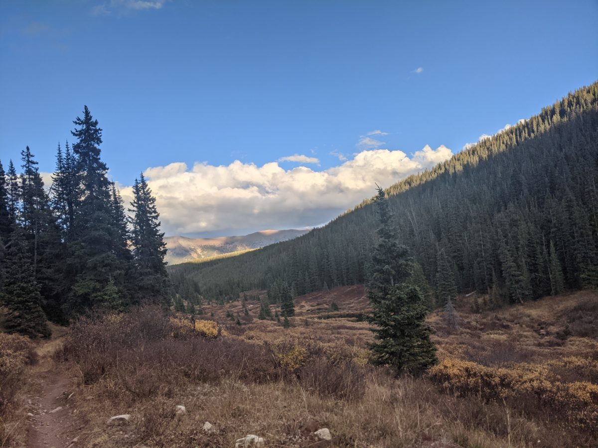
I had to interrupt the climb at one point and wander off into the woods, but Ted was nice enough to wait. There were some steep climbs after leaving the trees and we arrived onto a ridge with a view of the entirety of Breckenridge. We kept that view in sight for the next mile or two as we traversed and then climbed the east side of the ridge until we finally reached the high point for the day.

On top of the ridge, above 12000 feet, we took a break in the sun. I ate an entire bag of dried apricots while Ted had his usual lunch.

We started encountering others who had come up the west side of the ridge for the view as we descended. One pair included a very inquisitive guy who seemed kind of a hippy and kept asking questions about the trail that we had no clue how to answer. They also had a dog, Bo, who jumped on us a lot and really wanted the food he smelled in our packs.

We also met a mountain biker climbing the hill from Copper Mountain with a German Shepherd he couldn’t keep up with. It didn’t seem like the most fun section of trail for mountain biking. It was relentlessly steep and occasionally filled with enormous boulders.

Coming down to Copper Mountain, I was in distress and desperately needed a toilet. We came to a parking lot that had one but it was locked. On the other side of the street was a construction site. Luckily, they had left a Porta potty way away from everyone. While he waited, Ted did some research on the stores in the areas of Frisco and Silverthorne. Then we walked to the bus stop in the middle of Copper Mountain. We had to wait there about 20 minutes for the hourly bus.

We needed three busses to get to the hotel, each leaving from right next to where we got off the last, and around 45 minutes in total. And then I went into the hotel, waited for the clerk to be free, tried to check in, found out the clerk didn’t have my reservation, and then found out from Ted that he had just noticed this was the wrong hotel and we wanted the one up the hill.

Finally, a bit after 4, we got checked in, did a little shopping in the hotel store, and carried our stuff up to room 538 (the Nate Silver suite). I got my shower first, then took all our clothes (except for what we were wearing) down to the guest laundry to get a load going.

The wash cycle took forever, so by the time our going out clothes were clean and dry, it was past 7 and we really needed to get going if we wanted to get supper before the restaurant closed. We left the second load (what we were wearing) washing and walked up to the Dillon Dam Brewery.

Why this restaurant in particular? Mainly because they had a 12oz New York Strip on the menu and it had been too long since I had a good steak. But this restaurant had the speediest service I have ever witnessed at a sit-down restaurant. Every order came within 5 minutes of ordering. Beers for both of us. A huge plate of meaty poutine to share. Stakes with mashed potatoes and asparagus for both of us. A cheesecake and a root beer for me for dessert. Yes, I ate that much. I left feeling a bit uncomfortable. Ted left with a box containing half of his entree and confusion as to why he couldn’t eat more in town.

We walked back to the hotel, put the clothes in the dryer, went up, and got ready for bed. I went back down myself later to fetch the clothes from the dryer. Ted seemed nearly asleep already for his part. I took a bit longer, but it wasn’t hard. Hiker midnight was well past and I could hardly keep my eyes open. I turned on a 24 hour stream of lo-fi beats to relax/study to (you know, the kind on YouTube where Shizuku is always writing her novel but never finishing) and drifted off.

Trail miles: 13.7

Categories
CDT CO Section 3

Day 149: Gold Hill

I woke at 6 with a decent amount of condensation on the ceiling. I had plenty to do in the morning and got started right away. Ted got going at 7 and we hiked out together at 8:20.

We had 15 miles to the highway. There were three climbs along the way. After two miles, we started the first, and by the time we were halfway up and consistently in the sun, we were ready to remove our coats. It shaped up to be a hot one. I took the opportunity to make a drink and accidentally spilled half a liter in the process. The net result was I drank less water during the hike and had less weight to carry.

The first climb was the longest and steepest, but even so, it didn’t even rate compared to the previous morning. On the other side of the hill, we took a break on a well-placed bench overlooking the Dillon Reservoir area.

There was one other hiker playing leapfrog with us on the Colorado Trail, but mostly we just had a ton of mountain bikers to deal with. We frequently had to step off the trail to let them pass in one direction or another, especially coming over the last hill.

We came down off the ridge overlooking Breckenridge and passed through an expensive subdivision to the highway about 2pm, having completed our intended easy 15 miles for the day. We crossed the busy highway and waited for the free bus into town. We took it to the last stop, the main bus station, and walked from there to the first restaurant that looked good. I was extremely hungry and had myself an incredible Reuben sandwich with fries, plus a green chile soup and a salad accompanied by a couple of local beers. Ted had a burger he rated as the best he’d had so far, and he eats a burger in every town.

After lunch/dinner, we split up. I set off for cookies and Ted went to the grocery store. I figured he would still be there when I got back with his cookie so decided not to fix a meeting place. Grocery shopping takes longer than getting cookies, so the grocery store is the obvious Schelling point, no?

I ended up going to an ice cream place instead of the cookie place. It was closer for one, it was a hot day for another, and Ted had expressed an especial affinity for over cream for a third. I ate a scoop of Mint Oreo on a sugar cone and then grabbed two chocolate chip cookie ice cream sandwiches from the freezer case.

When I got to the grocery store, Ted was not there. I went ahead and bought some more breakfast mix and set off for the next most obvious Schelling point: the bus station next door. Ted found me there and I gave him his slightly-melty-by-now ice cream sandwich. Then we waited for another free bus uptown.

It left ten minutes later and we got off at an industrial park at the north end of town, home of Broken Compass Brewing. They had 11 beers on tap and in the course of two flights we tried them all. A little after sunset, we put on our headlamps and set off up the bike path, a bit less than two miles to the Gold Hill Trailhead. We took the trail uphill for a bit over a mile until we spotted some flat clearings in the trees beside the trail. We set up there immediately and went straight to bed with no fanfare or further feeding.

Trail miles: 16.6

Distance to Frisco: 13.7 miles

Categories
CDT CO Section 3

Day 148: Middle Fork of the Swan

I first snapped awake around 4am at the sound of two consecutive explosions. Like propane canisters popping right next to me or distant blasting. Or maybe more likely gunfire echoing hollowly down the canyon.

I got back to sleep again somehow. I slowly started waking up and packing around 6. By 7:15, I was nearly packed and Ted was still asleep. I woke him up. I walked out at 7:30 sure he would catch up to me soon.

I finished climbing the road up to the old mine. We had been seeing evidence of mining operations all down the valley, but nothing as decrepit as this. Just before reaching it, I was passed by a jogger who ran right up to the steep face of the ridge at a loose rock scramble on the corner, paused for a drink, then began climbing it at unbelievable speed, like young Bane escaping the oubliette in Dark Knight Rising.

I walked up to the collapsed mine building, happy to finally be in the sun. After nothing but cloudy mornings for most of a week, a clear day was a blessing. I removed my coat and snow pants, put on my sun hat, and slathered on the sunscreen. While I was doing all this, Ted caught up to me.

We had a nasty climb ahead of us. To begin, we climbed straight up a pile of rocks sized perfectly for such climbing. There were only a few sketchy spots further up, but nothing incredibly exposed. Walking diagonally up the grass toward the lowest part of the ridge, we eventually arrived at a faint trail that was probably actually the official CDT. It was mostly easy, but right before the top of the ridge, there was the section labeled “Dangerous Traverse” on Guthook. A steep, sandy backslope that was completely exposed. It wasn’t really possible to skip it by climbing up. That was just as sandy and sprinkled with loose rocks ready to fall when you try to step on them or use them to pull up.

Right at the middle of the traverse, the trail, such as it was, was completely missing. I avoided it by climbing up onto the protruding rocks above it: an outcropping of shale, half of which was ready to fall at the lightest touch. In fact, my trekking pole loosely brushed one such rock sending it freaking straight into the side of my knee to perform a very painful and bruise-inducing collision. But it didn’t jar me loose, and I managed to safely crawl to the other end where it stop being exposed.

Once gaining the top, we still weren’t at the top of the correct ridge we wanted to travel. There was a road now, at least, but it steeply zagged up another long climb. As we approached, the insane jogger descended and went off the road right into the rock slide where he had come up. In the fifteen seconds it took us to reach the spot where he’d gone over the side, he had disappeared. He must do this route a lot. Probably one of them ultramarathoners.

Once we reached the top of that next climb (with several photo and breath stops along the way), we came to a junction and took what appeared to be a shortcut road still climbing the hill. At the top of another climb, I called for a snack break, but we then learned that road wouldn’t connect, so we took another steep and even less traveled by road through the snow to finally gain the top of the ridge. In a bit over 2 hours, we had climbed from 11461 feet of elevation up to 13061. 1600 feet up!

So what did we do next? Climbed over Santa Fe Peak. This was just the first of many peaks we climbed as we moved along the ridge throughout the day. There was Geneva Peak right after (another snack break). Followed by a snow field below the summit of Landslide Peak. Then we made a steep descent to a road that led us over a steep hump and down into Webster Pass. There were a lot of dirtbikers here and a guy in a big 4WD SUV that rolled down his window to give us props, but my yogi game was off so I didn’t even try to get anything else.

Next was Handcart Peak, which we only partially climbed before following the trail on a traverse along the side. This brought us to Radical Hill (which I guess is named because it is vaguely shaped like part of a square root symbol) and a road down and around it where we were constantly passed by off-roaders. One RZR was being driven by a little girl while two old men got to just enjoy the scenery. A climb back up the ridgeline put us directly in the path of a sharp cold wind. We decided to stop for lunch as soon as we could get out of the wind.

That didn’t work out. We climbed down a bit from the trail in the next pass, which was ruled by dirtbikers practicing their hill climbing to where a big pool of water was constantly maintained by snowmelt. There were plenty of places to sit but none sheltered from the wind, so we just put on our jackets and ate lunch. Clouds chose that exact time to start blocking the sun on a regular basis. I wanted a time machine to send them back to when I was walking across the New Mexico desert. In the shade, the wind could cut right through my jacket.

I took it off after lunch in preparation for two more climbs. The clouds cooperated by letting me have the sun while I crammed it into my pack.

The next climb was on the road, steeply up to the corner where the road left the ridge, then across the snow on the way to Whale Peak. The first part of this climb was around and over a steep rock pile, echoing the sort of work we’d done the previous day. The rest of the climb up Whale Peak was just an easy cruise in the snow.

The last climb of the day was Glacier Peak, a mile away over the ridge. Ted led the way to the trail but some animal led left prints in the snow along the trail up the hill. It was a steep climb but not technical, and we reached the top around 4pm. We stopped to don jackets again since the cold wind was still blowing and there would be no more big climbs to warm us up. From here we had 7 more miles to the river, almost all downhill.

We followed an old road undergoing restoration to a more natural state down to the saddle before Georgia Pass. The trail followed the road up to the trail crossing then down again along a parallel track. We just walked across the road and hit the track a hundred feet away cutting off the pointless climb.

We didn’t know it yet, but we were now on the Colorado Trail. It worked its way back along the side of the ridge we had just descended to one of the lower ridges radiating northward from Glacier Peak. After being above treeline all day, we were thrust back into the forest quite abruptly. We descended this ridge, eventually taking a long series of switchbacks into Missouri Gulch as the light faded.

Ted got a bit stumbly and slow toward the end of the descent, but I could still make out the trail obstacles just fine. And more importantly, I didn’t want to stop and remove my pack to get out my headlamp until we were done. At the very last twinklings of twilight in the trees, nearly 8pm, we came upon a creek and a small footbridge. Since Ted had his headlamp at hand, I asked him to put it on and look around us for camping. There was nothing good visible, but then I saw another side trail and went down it to find a nice little cleared campsite near the stream.

I started with filtering water and exploring the area while Ted set up his tent. He hung his bear bag in the woods while I set up my tent, piggybacking off of one of his stakes. He was done for the night and I hadn’t even started dinner.

I sat on a log beside his tent and made supper. While it cooked, I crawled into my tent and put on a few more layers of clothing. By the time I was done, maybe a liter of water had finished filtering, but I packed up the filter and took it to bed with me. It was not going to be as cold a night as the last two, but it would still be pretty cold.

Trail miles: 19.5

Distance to Frisco: 30.3 miles

Categories
CDT CO Section 3

Day 147: Warden Gulch

It turned out to be a terrible place to sleep. Despite removing the big stone, there was still a huge lump in the middle of my back making it difficult to get comfortable, and with the overnight temperatures dropping into the low twenties or below, I felt a little bit chilly all night as well (though never shivering cold–just too cold to sleep). On top of that, it was a Saturday morning on a popular trail for day hikes, with the first tourists bellowing their baritone conversations down the trail beginning at 4:50am leading up to a continuous stream of boisterous chatter on my front porch, so to speak, by 6am.

I decided I could do something about exactly one of those problems, and started my morning by boiling several liters of water and putting it back in my water bag, to be promptly stuffed under my jacket. Thus elevated to a comfortable temperature, I slowly went about getting myself ready for the day. Ted was on roughly the same page. We finished packing up about the same time–around 6:30–and joined the throngs thronging the high peaks.

About the time we came up onto the ridge that rose up to Grays’ north face, I was getting fed up with slipping and sliding on the compacted snow. I ordered a stop to put on my microspikes (for the first time ever!) and Ted took the opportunity to get out his poles. He had no traction devices with him. This arrangement made, we started making great time, passing a number of people on the way up.

Once on the face, we left the main trail at a switchback, joining the Torreys connector trail. This was a much less frequented trail, only a few footprints trampling down the snow. And those footprints led us astray. We had to climb straight up the slope to rejoin the actual trail later. We met a couple of Indian guys coming down. They had literally gotten cold feet before even making the saddle due to low-top shoes leaking snow and no gaiters. Basically, similar shoes to what Ted was wearing. In short, they were wimps.

We dropped our packs when we reached the trail junction with the ridge and stuffed some snacks in our pockets to do the climb up to Torreys unburdened. Though there was a hellacious cold wind at the junction and in the saddle between peaks, halfway up Torreys the wind disappeared. Even without pack weight, it was a pretty slow climb just with how easy it was to get winded at that elevation.

The whole morning the peaks had been shrouded in clouds, only occasionally and briefly clearing up only to be consumed by another cloud moments later. So it was when we both summitted our first fourteener. But it wasn’t windy or particularly cold, so we sat down and waited. Within 15 minutes, the cloud bank disappeared and we received several precious minutes of unobstructed panoramic views–with the exception of the cloud that refused to release Grays Peak from its embrace.

Our days already made, we retraced our steps back down to our packs for a water break. A lovely girl handed me a delicious piece of chicken and cube of cheese from her morning meal here. I’ll count it as magic!

With the wind having died down even here, I removed and stowed my jacket for the next climb. We shouldered our packs and lugged them up the much snowier climb to the summit of Grays Peak. And just before we reached it, the mountain removed its own foggy mantle, granting yet another gorgeous panorama–except, of course, for the summit of Torreys, which had regained a cloud. I was a bit disappointed since the other visitors on the summit with us had brought beers to celebrate. Oh well.

Ted and I started down the south ridge of the peak as soon as we had finished our own celebrations. I led the way, taking advantage of my traction to create tracks in the snow. We stopped a few hundred feet down to look at the views and, in my case, to celebrate finally being far enough from the tourists to make some yellow snow without being unmannerly.

It was at this point Ted informed me that this was the wrong ridge. We wanted the northeast ridge. We climbed back up the way we had come and then cut across near the top to the much steeper, rockier descent onto the knife edge ridge connecting Grays to Mt. Edwards and beyond.

This infamous stretch of trail, only a couple of miles to the summit, is a lot of work. Not only is it a lot of picking your way over and around rock piles and scrambling up the steep ridge, it was also covered with a fairly fresh layer of snow in places. But not enough places to warrant the spikes, which I stopped at the bottom of the initial descent to remove.

The sun finally came out during this interminable stretch as the clouds got higher and smaller. At some points on the climb, I removed my jacket, removed my snow pants, swapped my balaclava for my sombrero, and put sunscreen on my legs.

The trail got vastly easier after attaining the summit of Edwards, where we stopped for lunch. (I had Palak Paneer wrapped in Spinach and Herb Tortillas thanks to Slowcahontas.) No longer a sequence of steep rock scrambles or loose scree fields, the ridge spread out a bit into somewhat wider snowy rollers. Although I had led on the majority of the knife edge, we started swapping lead frequently as we joyfully bounded through the snow over a series of smaller peaks with clear trails and footprints to follow. We came upon another hiker for the first time since leaving Grays here, climbing up to Edwards from the much easier section of trail we were heading into.

It had taken us about 3 hours to do the 1.4 miles from Grays to Edwards, but it now took us only an hour or so to do the 1.1 miles down to the pass. A pass, by the way, with a truck parked in it as we approached. We were surprised to a vehicle way up on the 13000 foot ridge with us, but we would get used to that eventually. In the meantime, we were happy to see the road in front of it, which we knew led to water and good camping. It was still early afternoon, but we had put in enough work for the day. We needed some celebration.

At the bottom of the slope, we crossed the Peru Creek on a small bridge and joined Peru Creek Road for an easy 3 mile jaunt further into the valley. It was a relatively heavily trafficked road and a popular area. In fact, when we reached the turnoff for the Chihuahua Gulch Trailhead, we saw the biggest crowd of people I’ve seen on the trail this year. Even though the lot was on public land and could only be accessed by fording the creek (or walking over it on a fallen of like us), there appeared to be a wedding ceremony wrapping up. Parked on the road all around the lot were a couple of dozen Jeeps (and a couple of Subarus sticking out like sore thumbs). The only wedding I’ve ever seen that could only be reached by four-wheel drive.

The CDT skirted this madness and followed a steep road winding back up the hill toward the ridge. An hour or so later, we reached a nice stream crossing the trail next to a perfect little campsite. There was a cold wind falling down from the ridge, but there was also an enormous fire ring. We set up tents, and while I added several cold weather layers, Ted started gathering firewood for our celebration of doing our first two fourteeners and one of the trail’s most infamous sections with sunshine to spare. We got a roaring fire going and hung out next to it until 8:30. Socks were dried, gloves were warmed, supper was eaten.

It was still quite a chilly night in the tent once we put out the fire, but it was a good day overall, even if the mileage doesn’t show it.

Trail miles: 11.3 (but actually a wee bit more than that!)

Distance to Frisco: 49. 7 miles

Categories
CDT CO Section 3

Day 146: Stevens Gulch

I woke with my 6am alarm but that wasn’t nearly enough sleep. I managed to sleep in until 8 and then the day hikers started rolling by on the very popular trail. I was packed and careening down the hill by 9:30. By 10:30, I was at the trailhead. It was nothing but a paved lot (the black gravel of asphalt but none of the tar) with two Porta-potties and a cell tower at the other end (AT&T, worse than useless to me).

Oh and one other thing that made it like no other trailhead I’ve seen. Across from the tower behind a concrete barricade lining a strip of leveled land marked by piles of that same gravel as if the DOT had wanted to build a road and never got around to it was a pole with a power box connected to a WORKING POWER OUTLET.

Of course, I knew it would be there. The Guthook comments promised it existed. They didn’t get across how much of an oddity it would be stuck to a piece of plywood on a pole behind a barricade, but I had been counting on its presence nonetheless. I had planned my whole day around sitting in a parking lot next the the Interstate highway putting enough electricity into my headlamp batteries to be able to safely continue hiking after dark.

And that’s what I did. Of course, it wasn’t all just waiting. I filtered 2 liters of water from the creek (pretending I could still trust my filter after it had been out in the cold for so long the previous night), wrote a blog post, made and ate lunch, called home, etc. But I was there for nearly 6 hours, and there was a lot of time in between that for waiting.

I spent some of that time chatting with people. An old lady about where to see the Colorado state fish, the Greenback Cutthroat Trout. A fisherman about the same thing. (I wouldn’t actually get to see one unfortunately.) A man who had come to do maintenance on the cell tower generator about hiking and work in the time of COVID-19. A Forest Service guy who came to clean up litter and agreed to take my trash too. But best of all, my call home was interrupted by a woman who wanted to give me a ton of trail magic. I talked to her for an hour, and in that time, she gave me an extra two day’s worth of food, enough to save me having to go into Breckenridge. Some cookies. A ton of chewy bars (on which I was running low). Little tubs of peanut butter. Indian food MREs. Precooked Basmati rice. Breakfast mix ingredients. She tried to even give me a Sawyer Mini water filter, but I didn’t know if I could trust someone else’s water filter either.

She was a former PCT thru-hiker who had had to quit hiking due to leg injuries and was just out scoping out some trails. She goes by the trail name Slowcahontas. And by herself she probably just added at least fifteen miles to where I’ll be in a week.

Our conversation was interrupted by a young lady who had lost her keys. And I took that interruption as an excuse to get hiking… but first Slowcahontas had to show me her new toy: an electronic hand warmer / mobile USB battery. Then, I finally gave my regrets and packed up to get hiking. It was 4pm.

I went under the Interstate (just east of the Eisenhower and Johnson Memorial Tunnels if you were wondering) and found a short road that ran over a beautiful bridge built by the CDTA to get me over Clear Creek and onto a paved bike path. I was just walking down that bike path for the next four miles. Even though it ran parallel to the creek, I rarely could see the creek (and when I could, no trout in sight).

A quick note about the weather: it hailed/rained briefly while I was in the parking lot eating lunch. Then it was clear for a couple of hours until right when I left, sand-caked rain gear on. For the entire next three hours, it was raining off and on. Usually lightly sprinkling. Sometimes heavier. Always at least misty.

At the end of the bike path section, I met a familiar face. A hiker was packing up after a snack right next to a bank of portapotties and trash cans. It was Ted, with whom I had shared the shelter atop Parkview Mountain. I had assumed he was way ahead of me by dint of being a faster hiker, but apparently he has a weakness for towns and had taken consecutive zeroes in Winter Park (which I had skipped) to get a day behind me. I learned all these as we caught up, chatting all the way up the road to the Grays Peak trailhead and beyond.

Quick summary: this was his first long trail. The longest trip he’d done before was five days. He didn’t even plan to do this much of it. He started on July 11 telling people he was going to do part of Montana, thus giving himself an out if he hated it, but ended up liking it all enough that he had just kept going. And even though he didn’t take zeroes very often, he had ended up way behind the bubble with me because he liked to stop in every single town along the way (although I guess I’m still slower on the whole since I started at Canada earlier).

Despite being faster on that long climb up to the trailhead, he stopped and waited for me when I needed to catch my breath. He stopped and had a snack with me at the trailhead even though he had eaten far more recently. And then he kept my pace climbing up into the snowy glacier-carved valley below Grays Peak where we made camp side by side.

A series of misfortunes occurred during the tent set-up process. The flattish ground we found near the trail was pocked with tufts of grass and rocks once the snow was cleared away. Not ideal but doable. I set up my tent, looking tiny in comparison to Ted’s comically large Gossamer Gear Two. (When he switched from car camping to backpacking, he wasn’t quite ready for the tiny home lifestyle.) I started pumping up my air mattress, but the pump sack had a blowout after three pumps and I had to finish inflating by direct oral contact. I stood up from this, stepping directly on my sunglasses which I had put on the ground cloth to get them off my head so I could put my hood on right. I snapped off half of my custom JB Weld nose piece. Luckily, the frame and lenses were undamaged. When I finally climbed into my tent to change and warm up, I discovered there was a rock sticking straight up right in the middle of my back. I spent the next ten minutes fighting to wrestle that rock out of the ground using my trowel as a lever. I broke the tip off of it while prying with it. It was really quite a large rock buried quite deep with another adjacent rock holding it down. But I did get it free.

I cooked some Indian curry in my vestibule and mixed it with the Basmati rice. It snowed a little and the ground was very cold under the mattress. It was just below freezing around the time we were setting up according to Ted’s thermometer, but it seemed likely to drop into the low 20s overnight. I put on a extra layer, and even so, I needed my sleeping bag over my head while I was cooking not to shiver at all. That’s just how things are this time of the year above 12000 feet. Even with all those extra clothes and that thick down sleeping bag, it was going to be a chilly night.

Trail miles: 10.6

Distance to Frisco: 60.9 miles

Categories
CDT CO Section 3

Day 145: Herman Gulch

As can be expected from having gone to bed so late, I got up late as well. My tent was absolutely covered in a layer of frost, but things had warmed up enough by the time I was ready to pack it up, I could just brush off the remainder. It took a little extra time to mop up the water inside my tent and on my mattress. The narrow strip of level unmaintained trail on a hillside I had squeezed my tent into had led to a lopsided setup that left one side somewhat unprotected from weather. I carried that extra water out in my damp towel.

I loaded up and hiked back to the trailhead parking lot. Here I learned that what I had thought was an information office was actually a warming hut for backcountry skiers. It had probably been open the night before but I had not bothered to check because it was dark inside. The bathrooms inside were pit toilets with no water supply. I would have to make do with the water I had managed to filter the night before and had turned into breakfast for the first several miles of the day. On the other hand, there were trash cans in the bathrooms, so I wouldn’t have to carry that up the hill.

Climbing a hill on the other side of the pass is what I had to do next. The weather was beautiful and sunny and I had some great views from the ridge once I got above the low clouds streaming through the pass. It was a couple of miles of climbing before I reached the ridge top, at which point the rest of the day would be just rolling hills along the ridge.

At first, I could look down and see the highway, then later the highway went off down a different canyon leaving a view of some sort of plant or mine. In the other direction, just a desolate bowl in the middle of the Vasquez Wilderness. I met a few hikers on the Divide, all going the other direction.

Around 2 or 2:30, I came down the side of Stanley Mountain into the gulch between it and Vasquez Peak. The trail ran along the face of the latter, coming low and close to a trailhead. At the junction ease was a stream, so I took lunch while filtering a liter of water to make some orange vitamin drink. I hiked back up to the shoulder of Vasquez Peak and onto the Divide ridge again, and as soon as I was out in the sun, I was sweltering. I had already taken off my jacket at lunch, but now I had to stop and take off my snow pants too.

Within an hour of hiking on the ridge, cold winds were carrying low clouds right over the lip, chilling me to the bone. I had to stop again, sitting down on the windy hillside to put back on my pants and jacket. I probably should have put on my Packa also, but it seemed like an unnecessary inconvenience at that point since it was not supposed to rain.

The ridge walk continued ever more enveloped in fog as the night fell. Just after 7, with the sun almost gone, I came onto the back side of a peak that was wind protected enough to be free of the clouds spilling over either of its shoulders and got one final sequence of sunset views right up to the southern edge of the Vasquez Wilderness. Then it was back into the fog and driving wind, climbing up over rocky peaks by headlamp with only a few feet of visibility. Luckily, the trail was clear enough to follow even with this handicap.

It got harder to follow as the snow on the trail got thicker. At first, the addition of snow made the trail easier to follow since the snow was only in the trail bed. Then there started to be an even coating all around the ridge top. It piled up in places where the trail climbed over boulders and up high stairs.

Running low on energy, I took one last break on a random slope that happened to be wind-protected. I got a good look at my pack. Frost was building up on the outside of it, mainly on the windward parts. I began to wish I had put on my Packa earlier. There was frost on my pants and the fingertips of my gloves too, though that wasn’t much of a problem. It fell right off when brushed. A thick layer of ice was building up on my poles though.

My headlamp blinked off six times, two groups of three flashes. The low battery signal. I was still 4 miles from a weather-safe place to camp, and there was no way to keep hiking without the light. It wouldn’t just die all of a sudden though. It would keep running in the lowest brightness setting and run the batteries out completely, fading as they went. I hoped it would last me a few more hours.

I crossed a road that descended into the valley, a shortcut low route to Silverthorne that cut off some of the best mountains on the trail. I crossed it and stayed on the ridge. Though there was snow all over more, it was briefly much easier to follow the trail, as a mountain bike had passed this way earlier and I could just stay in the tracks.

When the trail got rockier and started climbing up to over 13000 feet again, the tire tracks disappeared. I had to start carefully analyzing the shape of the snow and rocks ahead to stay on the trail. It was still possible because, even in the thickest snow blanket, there was a slight depression in the snow following the trail path.

When I started coming down off that last high point, I didn’t even trust it at first. I knew there were supposed to be some switchbacks to kick off the descent into Herman Gulch, but there had been plenty of sharp turns in the trail along the ridge, and plenty of longer descents. It took several minutes of descent and a couple of those turns before I believed it. I was so happy. It was late. I was pretty tired. My feet were aching.

But I didn’t want to stop until I was down in the trees on the Herman Gulch Trail. And the trail had to torture me a little by making me go back uphill coming down into the gulch. Finally, I reached the wide day hiker trail heading down canyon. I kept leaving the trail to head into the woods below searching for a single flat spot wide enough for a tent, but it’s pretty hard to do with five foot visibility radius. Wander and hope. I was another third of a mile back down the trail when I finally found a barely suitable spot not far from the trail. Not ideal since that meant day hikers noisily passing my tent in the morning, but I did not want to walk a single step further.

I started water heating to boil for supper immediately upon unpacking. I wanted it to be ready to eat by the time my tent was set up and I was inside. And indeed it was. I boiled more water for dessert in the vestibule from the comfort of my sleeping bag. After all was settled and I could sleep, it was almost half past midnight.

Trail miles: 17.3

Distance to Frisco: 71.5 miles

Categories
CDT CO Section 3

Day 144: Berthoud Pass

It was actually neither raining nor snowing when I woke, but I did sleep in to compensate for my late night the night before. There was a ton of frost stuck to the outside of my tent and hoarfrost off the guy ropes. I didn’t really feel eager to get up while the wind was shaking my tent around, but it did eventually calm and the sun briefly came out of the clouds to help melt the tent frost. It was a little after 10 when I started out.

I reached the top of James Peak around 11:30, right when another cloud had enveloped it. Fifteen minutes later, when I was already 500 feet down and half a mile away, it briefly cleared up. I just missed the view.

I saw a number of other people out hiking on the way down. A girl with skis headed up despite the lack of any snow to ski on. A couple of day hiker guys just running excitedly up to the peak and back. It had been lightly snowing, but when I got into the trees, the snow picked up and the thunder and lightning rolled through. When I came to a road, an SUV was leaving and a backpacker was hiking up the valley in the same direction.

I eventually came to a large campsite around 1:30. 3.5 hours of hiking to get a mere 5 miles, but who wants to take a break in the middle of a storm. The snow, rain, and thunder had entirely stopped by this point, so I took lunch. I also took advantage of the sun briefly coming out to remove all my extra layers.

I left again at 3, crossed the creek at the bottom of the valley, and started climbing again. At first, I was just zig-zagging my way up a wooded hill to a ridge. Then, I came into the open and could clearly see the tops of the mountains ahead. I came level around the side of a ridge working my way into the canyon of Bill Moore Lake.

I took a fifteen minute snack break at the outlet of that lake, took a bag of water for later. I also put my jacket and snow pants back on. Even though the sun had another two hours before it set, I had no need for sunglasses and put my headlamp on.

At 5, I began the climb up Breckenridge Peak. This one was a fun zig-zag back and forth across a rock slide, but the trail builders had done a decent job arranging the rocks into stairs and flat sections for the most part. It wasn’t smooth going by any means, but far easier than actually walking across a natural scree field would be. As I climbed, clouds washed over me and then passed away, revealing the peaks and valley again. It was only a two mile stretch, but it took the entire remaining sunlight to reach the summit.

From there, it was a relatively easy climb to the summit of Mount Flora, less than a mile and not particularly steep. However, it was dark and it had been a while since I had eaten, so I stopped a quarter mile from the summit for another quick break.

I reached the summit of my second thirteener a little before 9 and began descending the other side for the 3.3 mile drop into Berthoud Pass. It was more built trail into scree field for the first part, but after a mile or so turned into dirt track. Further on, for the last 0.8 miles, it joined an easy, gently graded, switchbacking dirt road.

A little after 10, I found myself wandering across the parking lot at Berthoud Pass again, desperately seeking a privy. It seemed the only bathrooms in the area must be inside the closed information center, so I wandered back into the woods below the road I came in on to dig a hole then make camp. I started filtering the water I had brought while I pitched my tent and made my bed and had enough water to make dinner by the time I was ready to do that. I went back in my camp shoes to bring in the filter and unfiltered water at the same time as I got the filtered water I needed for dessert.

It was well after midnight by the time I went to sleep. Sometime in the wee hours came the soft sounds of falling snow dusting the fly of my tent.

Trail miles: 14.0

Distance to Frisco: 88.9 miles

Categories
CDT CO Section 3

Day 143: James Peak

I was much less cozy and I didn’t sleep well, but it was a nice morning, so I got on the trail by 8 feeling a bit sleepy.

I had forgotten to make my breakfast mix, so I stopped just an hour in to do that. I had reached the low point for the day. It would be nearly all climbing from there.

After a long difficult climb for just under two miles, I stopped in a sunny spot and gathered some more water to filter. I was headed up onto the ridge and didn’t expect to pass any water sources for a while. I also had good internet service and some important messages to send. Also, I needed to check the weather. A cloud was blocking the sun suddenly and letting the cold wind up the hill freeze me.

It said there would be thunderstorms in the 4 and 5 o’clock hours. I didn’t want to still be on the ridge at that time. So I tossed out what was left to filter and got going immediately.

I saw clouds thundering and raining out over the valley, but nothing on me. Then there were some clouds lightly and hardly noticeably sprinkling on me. Around this time, I stepped on a rock wrong and face-planted. But I’ve fallen under weight enough times now that I was able to let my body ragdoll and spread out the impact and didn’t even get a single cut on my knees or bruise on my hands.

The rain started to pick up, so I stopped to put on my coat and Packa. I should have put on my gloves too because my fingertips were soon in great pain as the wind got stronger and cooler and the rain became hail. I was now in a full-on thunder hailstorm with lightning not far away and I was on an exposed ridge.

It turned out I was looking at the weather report for Grand Lake even though I was now much closer to Winter Park and the weather system had to pass me to get to either of those places. Thus, the 4pm storm was passing me before 2pm.

The hail let up as I made the final descent into Rollins Pass, but it started up again, complete with more thunder, as soon as I got to the road. The trail was following the ridge back up, but I had no desire to be up there if the next storm was even worse. I took the road following the old railroad grade down the side of the ridge. It was only barely descending and was littered even to this day with old railroad hardware, but more importantly it was soaking wet and puddled from the melting hail. And the ongoing drizzle.

Just before the road reached the trail back up to Rogers Pass near the deteriorating old trestle, there was a blocked side road into an area where people frequently camped. I had been going almost four hours without a snack or a break, and this seemed like a perfect place to rectify that. I pitched my tent under a Douglas fir where it had kept the ground free of hail and pushed my pack in front of me as I crawled inside. I spent 2 hours in there, not just eating lunch but also putting on all my cold weather layers (except the hat) and making a repair to my Packa. When I was done, the rain had let up.

I hiked out again at 6 in full winter gear and headlamp and soon reached the Rogers Pass Trail, which climbed back up to the ridge I had left at nearly as gentle grade as the road had come down. I ascended into the cloudbank hugging the top of the ridge as the sun set. When it finally got so dark I needed the headlamp, I couldn’t see more than a dozen feet in front of me through the fog.

The trail was easy enough to follow, though. I turned off onto the Ute Trail just below the top of the ridge, and for the next hour, I walked just below the ridgeline with a towering cliff of rocks to my left and nothing dropping away below me on the left. The ridge and the trail got steadily steeper as they got closer to the steep northern face of James Peak. The mist also got thicker and more rain-like.

I had estimated I could make it to the top of the peak by 9pm, but when I started the intensely steep climb toward the top of the ridge and the start of the side trail to the peak, I found myself losing a lot of steam. Even with the continuous cold misty wind, I was getting overheated in my many layers. I stopped to get some more energy and cool off. While I took that short break, that rain falling through the fog turned into bits of snow or tiny hail. It looked like this last bit of climbing, less than a mile, was going to be miserable.

To make matters worse, the trail seemed to disappear as I continued. I was basically guessing and hoping I didn’t miss the turn. Visibility was way down.

Then a low rock wall loomed out of the mist. Someone had built a wind-protected campsite right in the middle of the ridge. I stepped inside to check it out, and a mouse immediately emerged to check out the light. It scurried back down its burrow when I stepped toward it. It was almost 9pm already and the weather promised only to get worse, so I gave in and pitched my tent in the midst of the three-sided wind barrier.

I climbed fully dressed into my sleeping bag before cooking supper in the vestibule. The mouse didn’t come to bother me while cooking like the overly bold one at the similar campsite outside of Tehachapi. When I packed everything up to sleep around 10:30, anything not under my tent was covered with a thin layer of hail-snow. Sleep just after 11.

Trail miles: 13.5

Distance to Frisco: 102.9 miles

Categories
CDT CO Section 3

Day 142: Hamilton Creek

I think this morning I was the most comfortable I had ever been sleeping on the trail. The shape of the ground below my tent was the perfect shape for me to get cozy, perhaps, so amen my alarms went off or people passed me on the trail, I dozed back off again with ease. I didn’t start getting ready to go until 8, and hiked out a bit after 9.

I had good reason to want to reach the privy at Arapaho Campground at the southern end of Granby Lake before stopping. It turned out that campground and privy were closed despite my desperation at that moment, but I was saved by a portapotty at the trailhead just past it.

I passed two more campgrounds in quick succession as I continued down the dirt road the trail had become. The second was open and full of people, so i stopped to dump my trash in the dumpster. I continued down the road to Monarch Lake Trailhead where the crowds really were. Most groups had cute dogs too. Halfway around the lake, I turned off onto the trail that climbed out of the canyon and none of the day hikers followed. I stopped a few hundred feet up the trail on top of a giant boulder for lunch.

After lunch, I climbed for the next two hours, and finally reached the end of the climb just in time for another snack break. I emptied my water bag to make a new drink and continued across this new plateau for an hour and change. I passed a group of three backpackers headed the other way, but they were the only people I saw all day since I left Monarch Lake.

I had the whole Junco Lake trailhead to myself. Since there were water, picnic tables, and trash cans there, it seemed the perfect spot for dinner, and the perfect time for it as well. I had to filter enough water to cook with first (not really, I guess, I could have just boiled it longer–but I filtered it anyway) and then I let the rest continue filtering while I cooked and ate so I’d have enough for dessert and some change. After all that, there was still water in the dirty bag, so I just dumped it and hiked out.

I left in headlamp mode because the sun was setting. There was very little in the way of climbing to do for the next two hours. I was looking for a particular established campsite, but I ended up wandering around in the woods for twenty minutes when I got near trying to find it. The last mile was a zone of destruction left after the historic wind event from last September with a trail chainsawed through it, so the formerly fancy campsite now had blowdowns laid straight across the fire ring and the benches around it and all around it too. I found the one remaining spot suitable for my tent among the deadfall and set up. I also grabbed some water from the nearby creek to filter while I slept. During dinner, I had found my toiletry bag tucked deep into the wrong pocket, so I got to brush my teeth this night.

All in all, not a particularly interesting day, but not too tiring. It allowed me to save up plenty of energy for the next day’s challenges.

Trail miles: 16.3

Distance to Frisco: 116.4 miles

Categories
CDT CO Section 3 Off-trail

Days 140 and 141: Lakewood and Lake Granby

Sorry for the day off folks. I didn’t have enough posts queued up for this long stretch, but things will be back to normal (daily) now.

Day 140: Lakewood

I took a zero at Six and Dangerpants’ new condo. Six made bacon and eggs for breakfast. Amazing. I tried to do some blogging while a Die Hard series marathon ran on AMC. In the middle of Die Hard 2, Dangerpants took me to the grocery store to do my resupply shopping. I got enough for the next section and enough more to ship ahead. When we got back, there was still a lot of Die Hard 2 to go. They sure can stretch a movie with commercials.

We had decided to do and booked an escape room, so we left well before the end of Die Hard with a Vengeance to do that. Six’s car got rear-ended by a pickup truck starting a three car pileup as we turned into the venue. They decided to skip the police report and we ended up starting the escape room just shortly after our planned start time. As rooms go, I’d say it was below average compared to all the ones I’ve done, though it did have some interesting ideas I’ve not seen. We did solve it, but it took 3 hints and maybe a half minute overtime.

From there we went to Walmart to get boxes and because I had miscalculated the number of tortillas I needed during my earlier trip. Then we went to Edgewater Market for dinner and drinks. I had some Venezuelan pocket sandwiches and Crispy Boi and Old Fashioned Happy Meal from Roger’s (“the originator of the Happy Meal, often imitated, likely duplicated”). We sat in the rooftop bar until 9 because the weather was so nice (and it had an outdoor heating system). Then we went back to the apartment and watched a movie until midnight while I got a decent chunk more blogging done.

Day 141: Lake Granby

I slept in pretty late after that late night. Six made banana pancakes while I did the last of the blog uploads and edits. I got in one last shower and cleaned myself up before doing my final packing and preparations for the trip back to Grand Lake.

The traffic was a bit thicker in the outbound direction even though it was Sunday noon and people should have been returning to the city from their weekend trips. We stopped for a brief photo shoot on Berthoud Pass then arrived in Grand Lake around 1:30. After wandering through the town looking at lunch options, we settled on a return to Sagebrush. We shared some mozzarella sticks, then I went with a chili and a chicken cobb salad since I had already sampled the barbecue. Six and Dangerpants tried different types of barbecue. Six and I had some last beer to part by, then we drove down to the trailhead for pictures and hugs all around. I hiked out just before 4pm.

The trail ran south along the east shore of the lake, immediately entering the national park again, before turning up into the woods slightly. Not climbing away from the lake or creeks, really, but splitting into a trail for bikes and a trail for horses. The CDT followed the latter, and here there were many blowdowns.

After a couple of miles, the trails rejoined and the blowdowns stopped being an issue. I stopped at 6pm for a snack break. Prunes and apricots dipped in Biscoff spread, candy. Less than an hour later, I left the national park for good just as Arapaho Creek was starting to spread out into Granby Lake. I stopped an hour and a half later after struggling to find any suitable sites anywhere along the climb up to the ridge along the east side of the lake. There was a major wind event last year, so there was deadfall everywhere, and yet plenty of snags still standing anywhere there might have been a clear spot. I didn’t see anything at all until I reached the top and started to descend. I saw a slopey but relatively clear spot among some shorter pines.

Once I was in my tent, I discovered my toiletry bag was apparently gone, not in its proper place, most likely left behind in town. So I slept without brushing my teeth for the first time in years.

Trail miles: 8.4

Distance to Frisco: 132.7 miles