Categories
CDT CO Section 2

Day 139: Lakewood

I woke up before the 5am alarm, put on my long underwear, and got on the trail by 6.

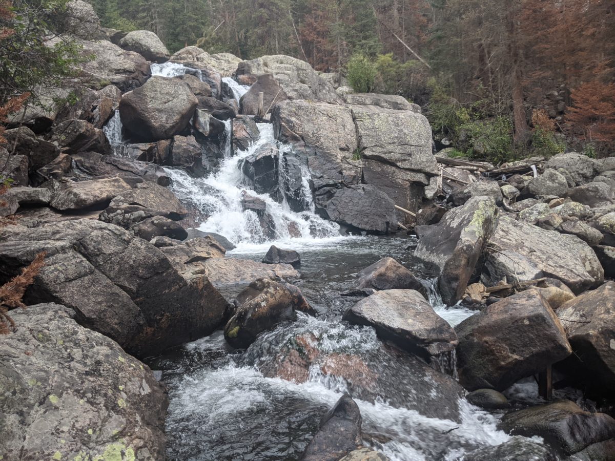
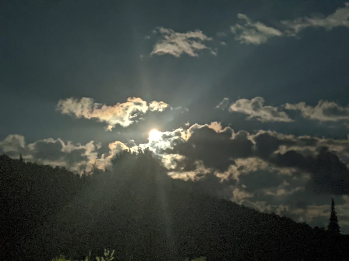
It was all climbing at first, up into a higher canyon Hallett Creek flows from, then up the wall of that canyon on a series of switchbacks to the top of Flattop Mountain. I was thankful for the extra layers because even with the intense climbing, I was never overheating. I was in the shade all morning, the sun only lighting the tops of the mountains behind me and never reaching into the canyons until well into the 9 o’clock hour. Around 8:30, I was far enough up the canyon wall to finally get into the sun, so I took a 45 minute break to snack, eat, drink, remove layers, and prepare for the sun.

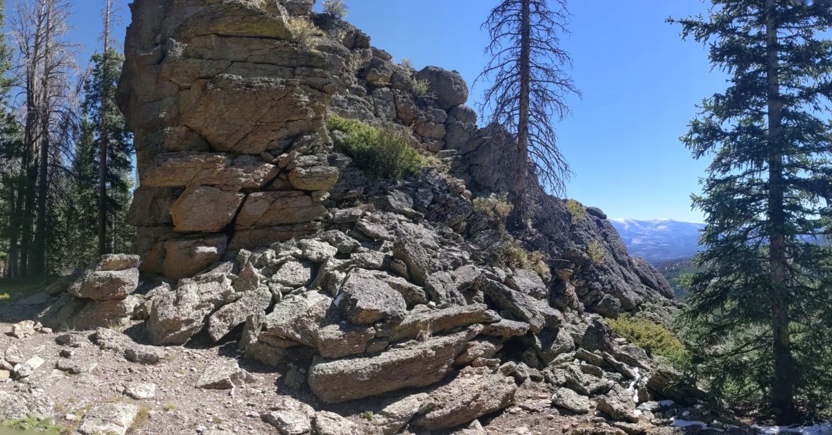
A few minutes after I started hiking again, I was on the mountaintop plateau. By 10am, I reached the trail that had been closed until this month and was now limited to backpackers only. A few minutes later, I was at highest point I would reach for the day, around 12250 feet. It was all downhill from there. And so I was coming down fast.

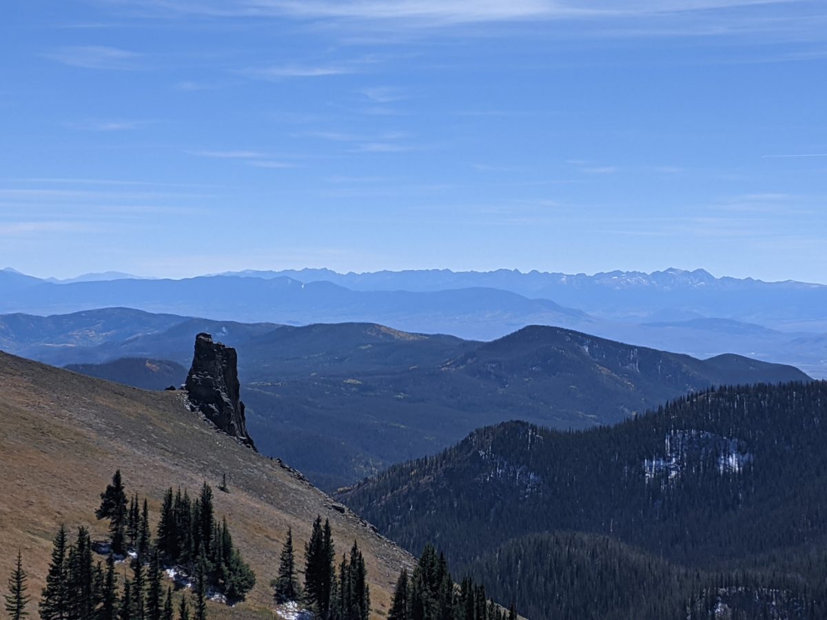
I entered the Tonahutu Creek canyon behind a nice elk bull. Who knows why he came there. The whole canyon was completely burned out by fire earlier this year. I took one break at noon near the top of the descent and cruised two miles in no time to the bend in the creek, where I saw the only other backpackers I met on the trail, a father and son headed up to the next campsite with plans to go fishing in the Haynach Lakes the next day. After 5 minutes, I headed on, thinking about what time it would be when I reached the next trail junction.

I was hurrying to reach town before the post office closed so I could pick up my winter clothes. But at this point I thought I should pause to check out the actual hours. I learned that it closed at 4pm instead of 5 like most places, which meant I had a little over two hours to finish the 5 miles I had left to hike, and that assumed I got a hitch as soon as I got to the highway. If I walked into town, it would be 6 miles.

Welp. I canceled my plans to take a break and filter some more water and picked up the pace. I did the last 4 miles down the creek at breakneck blistering pace. (Honestly, I don’t get why people talk about “breakneck speed.” I could see a breakleg pace, like if you’re riding a fixed wheel bicycle with your feet strapped to the pedals down a steep hill, but no matter what you’re doing, your head and torso should be going the same speed, so how are you going to break your neck? I could see someone arguing that something stopping one but not the other when you’re going sufficiently fast could result in a broken neck from the inertia, but then it’s not the high speed that broke your neck but rather the high second time derivative thereof. We really ought to be referring to breakneck jerk, no?)

I reached the highway at 3pm on the dot, 3 hours since my last snack break, but I kept the pace down the highway. I walked the last mile to the post office and got my package at 3:30. Goal achieved, I felt like a runner at the end of a marathon. I was lightheaded and weak. Everything went out of me. I ate a snack bar and drank the last of my water, then strolled slowly and effortfully down the tourist street of an unappealing Colorado town.

Imagine South Park, but slightly more expensive and upscale and maybe even more tacky. You’re probably picturing Grand Lake. I was glad I wouldn’t be in that hellhole very long.

At the far end of the street, I took a seat at the window bar at the Sagebrush BBQ & Grill. It was got 4pm, and my ride arrived at 5. Just enough time to get down two full glasses of watery, two beers, a half rack of ribs with fries and beans. It was very busy and full of locals, and service was hard to come by, yet the food and drinks came as fast as you could order and were very good. I felt better immediately.

Then, Six showed up at the door with unexpectedly long hair, and it was time to catch up on a two hour car ride into the city. Lakewood, a suburb of Denver, is the real Colorado. It’s everything you imagine when you think “Colorado”: a vast plain of indistinguishable houses with mountains on the horizon, great craft beer, weed dispensaries, homophobic bakeries, homicidal white guys, mass shootings… it’s basically the American ideal. Good to be in the real Colorado finally.

After a shower and with the laundry laundering, me and Six and Dangerpants spent the next several hours catching up over Indian takeout, root beer, and other beer. I slept in a real warm bed in my own room.

Categories
CDT CO Section 2

Day 138: Pine Marten Camp, RMNP

It was another cold morning, but I slept really well. I woke to my 6am alarm, but rolled over and slept until 7. After wiping the frosty condensation off the ceiling, I started packing up and getting ready then. The sun finally hit my tent at 8 right when I had all the inside stuff taken care of. I hit the trail at 9, refreshed and in good motion.

At first, the trail was like what I had been doing the previous night, with snow and blowdowns, a couple of which I had to crawl under. But bits like that were separated by nice open meadows with good views.

I stopped an hour later for a snack because I felt really empty, and I was about to start the final climb to Bowen Pass. It was steep, but not too bad. On the final thousand feet or so, the switchbacks were filled with snow, so I just shortcutted them and climbed straight up to the pass on a steep rocky line that might have been the old trail or a game trail.

I reached the top of the pass by 11, and stopped to take a few minutes to think logistics while the goats on the slopes casually looked on. I turned off airplane mode and started looking at information about permits for Rocky Mountain National Park because I would be entering it before I even reached the highway just 7 miles down the hill. I tried calling them but got no answer. It looked like I had to pick up a permit in person anyway. The wilderness permit office closed at 3:30, so my goal was set. Get to the highway and hitch 5 miles to the visitor center where the office was before 3:30.

There were a handful of blowdowns on the east side of the pass, but nothing annoying. There were also an increasing number of day hikers as I got closer to the park. There were plenty of tourists and cars at the trailhead. I walked out to the highway and stuck out my thumb. At first, cars were slowing because I was next to the crosswalk, but I only wanted them to stop if they were offering a ride, so I fixed it by moving a few feet. It was just before 2 when I arrived, and I was only passed by a few dozen cars by the time I got a ride from an older outdoorsy couple in a minivan about 20 minutes later. Pretty easy hitch.

They could only take me as far as the entry gate to the park. I don’t know why, since their day pass and earlier reservation should have gotten them back in, but they wouldn’t go through. It was fine though. The visitor center was only a half mile further on, so I just walked.

When I arrived, all the rangers were gathered together at some tables in front of the restrooms instead of in the office. One asked me what I needed and I pointed toward the wilderness office. It turned out the one asking was the one who worked in that office, and she said she’d meet me there. I guess that explains why they didn’t answer the phone. They just don’t even go in the office until someone shows up needing help.

It was easy enough to get a permit, though easily the most expensive permit I’ve yet bought. Thirty bucks for a single night! I got a site on the southern half of the loop around 7.5 miles from the southern trailhead, so I would tackle the 26 mile loop counterclockwise. There was a 1.5 mile connector trail straight from the visitor center, so I could leave straight from there and start the loop immediately.

But I wouldn’t start immediately. I had been in such a hurry to make sure I got a permit, I had skipped lunch, so I left my phone charging in the office while I went to a picnic table among the trees across the parking lot to take care of that. I also emptied my trash and filled up my water. The former was especially important since there is a lot of bear activity in RMNP, especially the part I read entering, so I needed the extra room in my bear can to store as much of my food as possible.

I got my phone back with 35% more battery than it had before and started hiking again about 3:30, planning to reach my campsite by 9. At first, the trail was kind of gross. Dirt and rock chewed up by heavy horse traffic through a burned out forest. Eventually, I joined a wider dirt road with a good number of day hikers leaving the way I was entering. I scared off (or not) at least half a dozen snakes of various sizes in the first mile on this road. None stuck around to have their pictures taken. They weren’t keen on having their enjoyment of the bright sunny afternoon disturbed by tall, heavy-booted, stompy intruders.

There were not so many snakes as that road got narrower and more rugged and eventually dead-ended to a proper foot track. That bright sunny afternoon didn’t last either. As I started climbing up the North Inlet canyon in earnest, on actual rock staircases in places, dark clouds came in and blanketed the sky, smothering the sun completely and cooling things down…but not too much.

In fact, I was mostly comfortable even sitting right at the foot of the Cascade Falls to cook dinner around 5:45. It was starting to get chilly by the time I packed up and left again at 6:30, having traded sunglasses and hat for a headlamp, ready for the night-hiking.

The climb continued. It was another 1000 feet up to the elevation the junction to my campsite was at, and most of that happened right at the beginning of this last 4 mile stretch. As night fell, I started to see tiny fluttery drops of water come down, small enough to be snow if they didn’t fail so fast, but too few and far between to call rain. I was worried if would start raining, even as I looked on enviously at the roaring campfire visible in the Porcupine Camp. My campsite did not permit campfires, nor would I want to spend the time one would require when arriving so late, but I wouldn’t have minded a few minutes beside one at that moment. My rain fears abated as did the clouds. The stars came out.

I turned off onto the side trail to my campsite, crossed the upper North Inlet Falls ravine on a high bridge, and cruised into my campsite a half mile later. I set up my tent while my Garmin fetched a weather report. 0% chance of rain for every hour all night. Nice. I filled every last bit of space in my bear can with snacks, carried it with my stove and Nalgene way back up the trail to a random spot nowhere near my campsite, then hit the sack.

Just before 10:30, a steady light rain started. I made sure everything still with me was pulled in under the fly and let all that reportedly impossible rain on the tent sing me to sleep.

Trail miles: 18.6 (18.7 actually hiked, but some very different miles)

Distance to Grand Lake: 18 miles

Categories
CDT CO Section 2

Day 137: Ruby Mountain

I didn’t sleep well again. It was warm and toasty in the shelter even as the wind roared around the building and made the radio antenna creak back and forth outside, and even the mice stayed put in their holes. But I woke up after less than four hours of sleep. And two hours of uncomfortable dozing later, my roommate awoke, ready to get going.

I was blocking the door, and I figured he would need to pee, as I did, so I got up too and folded up my mattress. I went, he went, I went back to take a picture of the sunrise sky, and then I started my water filtering again back inside. When Ted (as I learned his name was) got going a bit after 7, I moved my mattress to the other side and crawled back inside. After hopping online to stream a TV show, I started feeling sleepy enough to sleep half the day away, but obviously I couldn’t do that. So I started packing in earnest and left to descend the mountain about 9:40.

I kept all my warm underwear and jacket on until I had descended far enough, a mile or so, to be out of the cold wind and starting to overheat. I stopped only an hour into my day to remove layers and put on sunscreen.

It was a mostly easy hike as far as the road. Then there was an intense climb up to a ridgeline. Not far along that, I entered a recent burn zone, and the trail was littered with blowdowns for about a mile. Down the front side of the mountain, the blowdowns were cleaned up, and I reached a nice stream, still in the burn zone, and took a long lunch in which I filtered an entire bag of water.

After working my way around to Trout Creek and climbing up beside it for a while, I stopped to chat with Cheer and Snickers, who were doing the Colorado section nobo. They told me there was a lot of snow and blowdowns coming up. They made out like it would be really bad and shouldn’t be done in the dark. But it wasn’t.

There was nothing of note in the next two miles before I stopped for supper. And then it was still another mile of clear sailing after that when I started getting the annoying blowdowns that couldn’t be circumvented or stepped over. It was dark, but they weren’t that bad. I crawled under two obstacles and stepped over one with a minor knee scrape. There were maybe two more that required some athletics to get over it under and a couple more that required clever detours. And all this was spread out over a couple of miles. Not enough to seriously slow me down.

By the time it was 9:40 at night, twelve hours since I started, I was at a wide open meadow 2 miles shy of Bowen Pass, which I had wanted to get over today, but I guess I took too long at lunch and chatting. Either way, I didn’t want to maintain the late hiking schedule of the previous night, and it seemed like a nice place to stop that would have a lot of sun on the morning to help me get an earlier start. It was cold, sure, but not windy, and it was not going to be as cold a morning as it had been earlier in the week. Sleep by 11 this time.

Trail miles: 14.4

Distance to Grand Lake: 34.9 if I get a RMNP permit.

Categories
CDT CO Section 2

Day 136: Parkview Mountain Lookout

I did not want to get out of my sleeping bag when I woke. It was too cold. There was some condensation inside and patches of snow on the rainfly. Everywhere around the tent outside was a thin layer of snow. I stayed in my sleeping bag watching videos until the sun got high enough to hit my tent. Then, I packed up without changing out of my warm clothes. I changed out of them just before hiking out, stopping to take advantage of having my shirt off to sew a button back on it. All in all, I didn’t start hiking until 11am.

Right off the bat, I was climbing. It took an hour to do the first mile and a quarter up to the ridge. Then things opened up and the views started. It was a clear temperate day and the whole early part of the afternoon was walking along the exposed ridgeline with excellent views. I could even see part of the trail I had skipped the previous evening (I posted this view on yesterday’s post.) Eventually, the trail did dive back into the trees, descending to Troublesome Pass and around Haystack Mountain to the best water source I saw all day.

By this time it was already 6PM, so I stopped to put on long johns and a headlamp, ate a snack, grabbed some water, and planned to hike late to make up for getting up late. It was only 4.5 miles to my destination, but it was also over 2500 feet UP.

The first 2 miles from the stream were a reasonably steep but not painfully so climb up to a ridge, about 1250 feet. There were some annoying blowdowns in the forested part, but once I got above treeline, it was no problem. There were switchbacks and everything.

Then I walked along the ridge for a mile and a third. Slight ups and downs, but nothing steep. I got a break here to just enjoy the moon rising. There was a cool wind but it wasn’t that intense yet.

The last mile up to the top, though, was a monster. Almost 1200 feet of climb to the top of Parkview Mountain in that mile. I’m pretty sure that mile is the length of the trail’s projection into a horizontal plane because it took two straight hours of nonstop climbing to get up.

Parts of it there were no trail for. There were some posts marking a route, but they were far enough apart I couldn’t see them in the dark. So I was just finding my own way up to the ridge avoiding the snow patches. I always had a bit of guidance from someone whose shoe prints I’d been following all day that had taken a similar route, but they were avoiding the snow also.

Even once I gained the ridge, along which the trail simply climbed straight toward the peak and for which the way up was least steep, it was still incredibly steep. I stopped to take frequent leg and breath recovery breaks, but I still felt like I was making good time despite the intensity of the climb.

The cold wind picked up as I got higher. It was never so strong that I needed to lean into it, but it was cold and continuous enough to chill my fingertips. The extra layers and demanding workout kept the rest of me warm enough that the wind was actually a welcome rapid cooling system when I stopped.

It was before 11 when I arrived at the shelter at the peak, and I was disappointed to find a pair of trekking poles outside the door. I had hoped my advance guard had been further ahead than this so that I would not have to do what followed.

I turned my headlamp brightness down to the lowest setting and pushed. The door squeaked open, and a body in a sleeping bag leaped into a sitting position like someone in a bad movie waking from a nightmare. I apologized and went to hanging my water to filter and making my bed as quietly as possible. It was still after midnight by the time I had cooked and eaten dinner and stowed the water filter for sleep. And less than four hours later, I woke up, tossing and turning and sleeping only fitfully from then on.

Trail miles: 15.2

Distance to Grand Lake: 49.4 miles

Categories
CDT CO Section 2

Day 135: Cross Creek near Hyannis Peak

I didn’t really feel like getting up this morning. It was cold, the inner tent was beaded with condensation. I heard the alarm, but slept in until 7. And then I watched some videos and didn’t start packing until 8.

I had pulled everything under the flap before sleeping the previous night when I heard the rain start, but I was surprised to see an inch of snow stuck to everything when I emerged from my tent. Everything except my tent and the area around it because I had pitched my tent under a fir tree (which I don’t usually do because the sap on the ground sticks to everything). I had also forgotten to pull my Packa under the flap and it was soaking wet. I spread it out in the open area next to the road for the sun to dry. This turned out to be a mistake.

I decided, since there were plenty of trees between my campsite and the road, to dig a cathole not far from my tent. Everything goes well. I’m wiping. A truck goes by. No problem. I’m in the trees. But then the truck slows down, pulls off the road, stops. So they’re gonna see me, obviously. I rush to get my shorts back up as an old man gets out of the truck.

What’s going on? He’s talking to someone. The phone? Probably not. No service here. Someone else in the truck. I finally understand some of what he’s saying.

“Maybe a walker left it.”

I finally notice that he’s picked up my Packa.

Decent enough now, I call out. “That’s mine.”

Surprised he looks around until he locates me in the woods.

“I thought someone left it.”

“Leave it right there. I put it out to dry in the sun.”

“I was going to hang it up.”

He drops it and drives off, and I go back to lay it out properly again. Nonetheless, it’s still wet when I go back to pack it up. Unfortunately, there just wasn’t much sun. The sky was smothered in clouds for the entire morning and into the mid-afternoon. It had cleared up when I took my lunch at 2:30, but the damage was already done. The sun didn’t get to the ground to warm it, so it couldn’t warm the air. Snow stayed on the north sides of mountains all day and icicles stayed on the trees. And I wore my down jacket the whole time I was hiking, despite the fact that the first five miles were all uphill and I got a bit toasty in those rare moments the sun came out and the wind stopped blowing.

I guess it was nice to have relatively clear skies when I came up onto the top of the open ridge and got to see the incredible views.

Near the end of the high ridge, I missed a turn onto a proper foot trail and kept going down the road. I ended up going more than mile, mostly downhill, on the wrong side of the ridge. The only way to get back to the trail was climb the hill again. But there was one upside to this mistake. I decided to take a shortcut to cut off a half mile by going around the back side of the ridge, which briefly put me on a bare steep slope with the most incredible view of the day. Then I worked my way diagonally down through the woods until I hit the trail.

It was getting late and the light was fading at this point, and since I was now on the north side of the slope I was surrounded by snow, even in the trail. Which meant it was rapidly getting colder. Also I now had quite a few blowdowns to contend with, which meant I couldn’t just always keep my hands in my pockets to maintain feeling in my fingers. Eventually, it got cold and dark enough that I stopped to put on my long underwear and headlamp. That did make hiking a lot more comfortable.

I went on another mile or so into the valley before finally coming to a rushing creek with some falls that made it easy to catch some water. That’s the Cross Creek in the title. Just beyond this, the trail turned to climb straight up to another ridge. It looked like it would be miles to a good campsite, but there seemed to be a pretty good one under some trees right next to the junction. It was too early to sleep, but I hadn’t had dinner and it was definitely cold enough to warrant cooking in the vestibule, so I stopped to make camp.

After trading my boots for an extra pair of socks, I climbed into my toasty sleeping bag and started the water boiling just outside my inner tent flap. After cooking and eating, I started boiling the water from the creek. I didn’t want to risk ruining my filter by hanging it up with water running through it in temperatures cold enough to freeze, so boiling all the water seemed the better option.

Got to sleep well before eleven. Short day, but pack’s heavy, weather’s cold, and I did do those two bonus miles on accident…

Trail miles: 14.0

Distance to Grand Lake: 64.5 miles

Categories
CDT CO Section 2

Day 134: County Road 35 near North Ryder Peak

I woke up at 6 and it was quite chilly on my end of the trailer. I wanted to do some blog work, but I kept getting distracted by the internet, videos I wanted to catch up on and people I wanted to talk to. I got up on several occasions to do various things like swap out batteries that were charging, microwave some breakfast (immediately before I got a text letting me know there was breakfast with the family inside–I declined both because I had just eaten and because I felt it would distract me further from the work that needed doing), put on a jacket, etc. I got everything written and uploaded around 11. It took a lot less time to rearrange and properly pack my gear and change into hiking clothes. Finally, around noon, I went inside the house to bring in the trash from the trailer, fill up my water bag, and announce my departure to Sara, who was working at the table. (The eldest son, Cooper, was back where he’d been the whole time I had been in the house the previous afternoon–on the couch playing Fortnite on the living room TV. No one else was around.)

Anyway, a few minutes later, I was up at the road hitching a ride and got one very quickly. He was an elk hunter returning from three days in the wilderness. He had a lot of information on how hunting elk with a bow worked and an accent of some sort… maybe French Canadian? He probably had a name too but I didn’t get it. He left me at the north edge of town.

My first stop was Boomerang, the outdoors gear consignment shop. I was looking for some cheap warm gloves, but they had nothing in my size that wasn’t at insane retail price. No scarves either.

I was also looking for a pocket knife as I’d mislaid mine somewhere (could still be somewhere in my pack for all I know–a downside of wearing my long johns when in town because they have no pockets). Luckily, it happened in a town with a dozen outdoors stores, but the ones in that area didn’t have any small enough. The last one I tried, BAP again, said try Ski Haus at the other end of town. So I planned to go there after lunch. And I went where the guy there recommended. Back Door Grill, just down the block. “Best burgers in town”

They were pretty busy yet the food still came pretty quickly. They did have some wild burger options. Good curly fries. Nice salad. Only downside was they had that ultra sweet tomatoey ketchup like Hunts. Nothing vinegary to put on the fries.

So I finished up an hour or so later and took the free bus back to the Safeway area. I confirmed I hadn’t left my knife where I had stopped to pack up the food (the last place I remembered using it) and then went into Ski Haus to buy a new one. They had one that was smaller and lighter than mine and had basically everything I needed, so I got it and left.

Noting that a Lyft back up to the pass would cost a hundred bucks if I could even get one, I took the free bus to its southernmost stop and stood on a street corner trying to hitch. It was a busy intersection, so I figured prospects were good. I got a guy going the wrong way calling out his window letting me know he’d take me after he finished some errand in town after about 20 minutes. Ten minutes later, a couple of guys waved me over to their truck before pulling over. They were headed the wrong direction though. Finally, ten minutes later, I got an offer that worked.

Ryan is a New Zealander whose been in the states for six years and absolutely loves the outdoors. His main hobby is trail running, and he was just kind of touring the area looking for cool places to visit. He was headed up to Wyoming next and then apparently out to the California coast for the winter. I guess he had a job he could do from anywhere. He took me not only up to the pass, but the extra 9 miles up CO 14 to where the trail finally leaves the highway and follows the scenic dirt county road 35 for a while. And that’s where he left me.

It was already 5pm at this point, but I didn’t need to go too far to get back into the national forest. I walked for almost two hours (without bothering to pull out my trekking poles) with the only interesting occurrence being a guy flying a small drone over the road to get aerial photos. The drone surprised me when I could see but not hear it because it sounded like a huge swarm of killer bees at first.

I stopped to make dinner on the side of the road when I saw a nice rock. A few of the scattered rainclouds decided to get me wet while I was doing this. One was so insistent that I actually had to get out my rain gear. I hiked out wearing it even though it never rained again once the sun was gone and the full moon was rising. It was good protection against the chill wind rushing through the open areas. But when twilight had fully ended, the wind and clouds disappeared and it got a little warm.

I pulled off into a place it seemed had been used as a campsite before at 8:45 because it had some clear spots among the trees, and I wanted that good wind protection. Sleep long before 11.

Trail miles: 15.9 (actually hiked 5.4)

Distance to Grand Lake: 78.5 miles